Weather Service issues river flood warnings for parts of the Potomac and Conococheague
The National Weather Service has issued multi-day river flood warnings for the Potomac River and Conococheague Creek.
The flood warning for the Potomac River at Shepherdstown, W.Va., is through Friday afternoon, said meteorologist Kyle Pallozzi.
That could affect Washington, Berkeley and Jefferson counties, according to the online flood warning at the weather service's website. More specifically, affected areas include Hancock and, in West Virginia, Shepherdstown, Harpers Ferry and Paw Paw. Minor flooding is forecasted in those areas.
The flood warning for the Conococheague Creek at Fairview in Washington County is through 9 p.m. Thursday, according to Pallozzi and the weather service's online flood warning.
The Washington County Highway Department announced Wednesday morning that Cresspond Road, which is near the Conococheague Creek, and Pecktonville Road at Licking Creek were closed due to high water.
Around 3 p.m. Wednesday, the county added Independence Road, Wishard Road and Kemps Mill Road, from the Mill to Snug Harbor Lane, to the road closure list.
Drivers are urged to turn around when they encounter flooded roads and not to try to drive through, according to the weather service's flood warning.
"Most flood deaths occur in vehicles," the warning states.
The Potomac River, at Shepherdstown, was at 10.68 feet as of 5:15 a.m. Wednesday, according to the weather service's latest online observation.
When the flood stage in that area is at 15 feet, River Road is flooded in low spots between Shepherdstown and Harpers Ferry, the warning notes. "Significant parts" of the Chesapeake & Ohio Canal National Historical Park's towpath also flood between McMahons Mill and Dam No. 4.
When the river hits 16 feet, water goes over the Potomac's banks near the mouth of the Opequon River in Berkeley County, the warning states.
More weather news: Powerful storm system slams central and eastern US, spawning multiple tornadoes: Updates
Flood watch on Wednesday
The weather service also issued a flood watch through 4 p.m. Wednesday for Washington County and West Virginia's Eastern Panhandle.
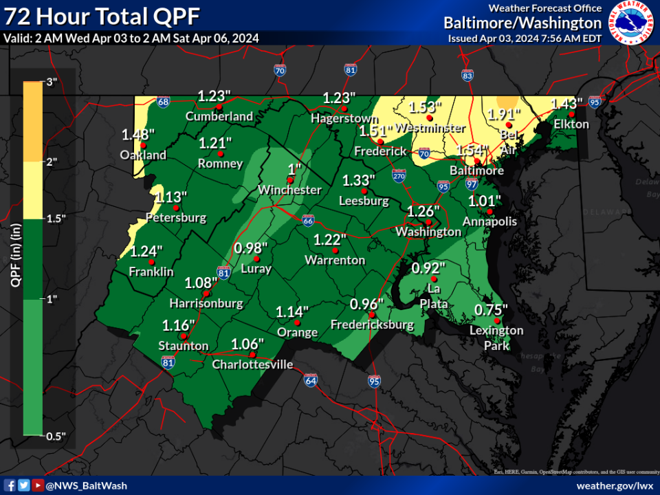
The forecast calls for "multiple rounds of showers and thunderstorms" Wednesday afternoon, the watch states. That could bring another 1 to 2 inches of rain and up to 3 inches in some areas.
Eclipse watching events: Best places to watch the solar eclipse in the Hagerstown/Washington County area
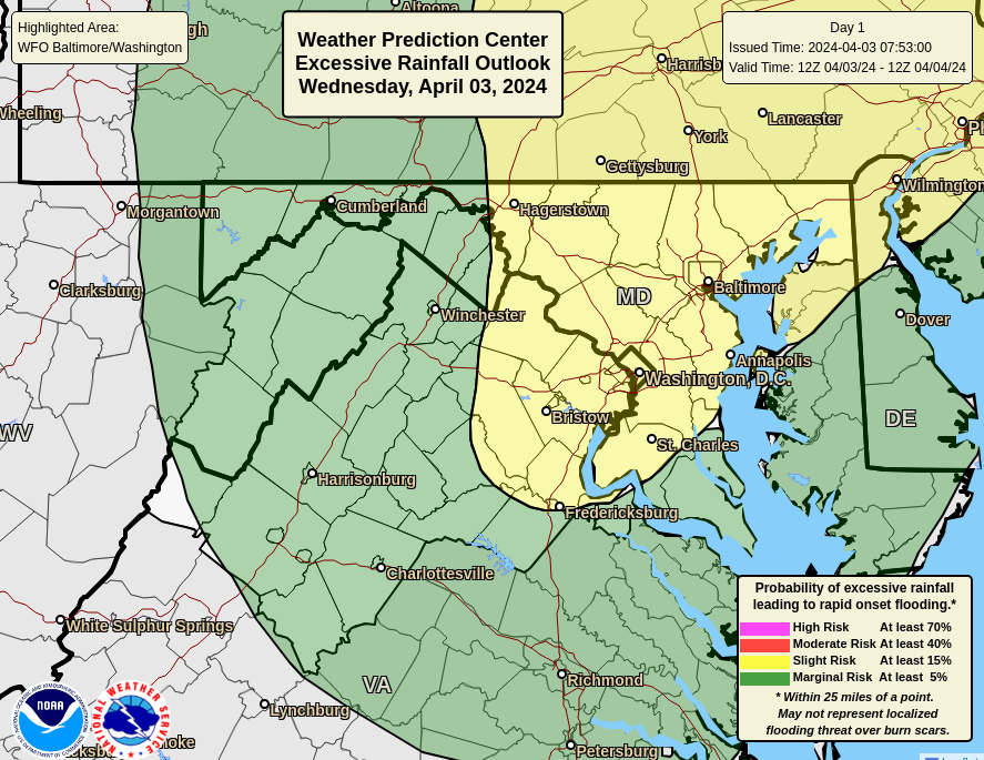
There could be flooding of small streams and creeks, and flash flooding is possible, the watch states.
There is a chance of rain continuing through Friday, with the possibility of another thunderstorm on Thursday in the area, according to forecasts.
This article originally appeared on The Herald-Mail: NWS issues multi-day river flood warnings in Washington County area

