Where did winter storm dump the most rain across SLO County this weekend?
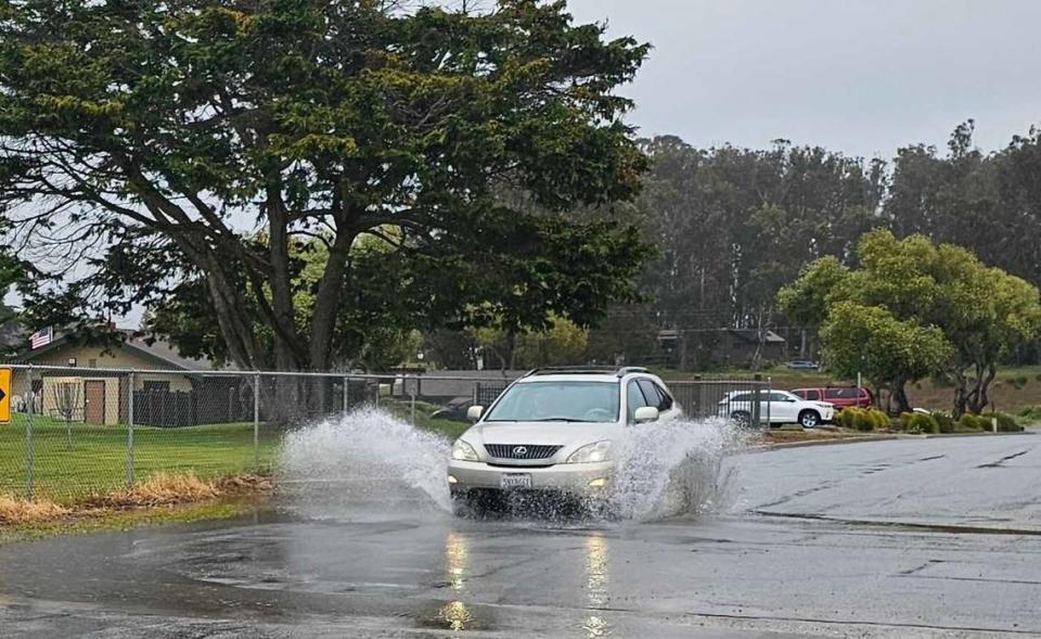
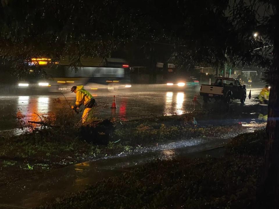
San Luis Obispo County got even more rain as a powerful winter storm touched down across the Central Coast this weekend — bringing with it numerous warnings of thunderstorms and weak tornadoes and even sending a piece of Highway 1 crumbling into the ocean.
County locations received anywhere from 0.54 inches to more than an 4 inches of rain in the 48-hour period ending at 11 a.m. on Sunday, according to the San Luis Obispo County Department of Public Works.
Rocky Butte, a location in the mountains northeast of Cambria that often leads the county in rainfall, received the most during the heavy storm with 4.13 inches.
The San Luis Obispo area received around 1.86 inches, North County got between 0.9 and 1.21 inches and the South County topped out at around 2.1 inches.
Here’s a look at all the totals from across the county, according to Public Works:
Arroyo Grande: 1.86 inches
Atascadero: 0.99 inches
Camp San Luis Obispo: 2.37 inches
Canet near Morro Bay: 1.41 inches
Creston: 0.95 inches
Davis Peak (near Montaña de Oro): 1.15 inches
Hog Canyon (north of Paso Robles): 0.90 inches
Highway 46 West: 1.39 inches
Lopez Dam: 2.08 inches
Los Berros: 2.32 inches
Los Osos: 1.99 inches
Morro Toro (Highway 41): 2.37 inches
Nipomo East: 1.56 inches
Nipomo South: 0.94 inches
Oceano: 1.25 inches
Rocky Butte: 4.13 inches
Salinas Dam: 2.85 inches
San Simeon: 1.73 inches
Santa Margarita: 2.09 inches
San Luis Obispo (Broad Street and Industrial Way): 1.86 inches
SLO Reservoir: 1.88 inches
Shandon: 0.54 inches
South Portal (Cuesta Grade): 2.21 inches
Templeton: 1.21 inches
Upper Lopez: 1.54 inches

National Weather Service warns of thunderstorms, tornadoes
The National Weather Service issued a special weather statement Saturday warning about thunderstorms and possible waterspouts that could even come ashore as weak tornadoes during the storm.
The system was expected to produce wind gusts up to 50 mph, pea-size hail, brief heavy downpours and cloud-to-ground lightning, the Weather Service said.
“Some rotation is being detected offshore, with a slight chance of these storms spinning up a brief tornado over the statement area,” the Weather Service added.
The advisory was for western San Luis Obispo and Santa Barbara counties — from Point Conception to Cambria — and was in effect until 4:15 p.m. Saturday.
The Weather service warned that the hail could cause minor damage to outdoor objects is possible and gusty winds could knock down tree limbs and blow around unsecured objects.
Meanwhile, the National Weather Service issued a flood watch and a high surf advisory for San Luis Obispo County on Saturday morning.
The flood watch was sent out for the entirety of SLO County and would be in effect until Sunday at 6 p.m.
The agency also issued a high surf advisory for all SLO County beaches until 6 a.m. Sunday.
Overnight downpour soaks SLO County. Here’s how much rain fell in your area
Waves were expected to reach 8 to 12 feet with some as high as 15 feet, with the largest waves hitting west- and northwest-facing beaches.
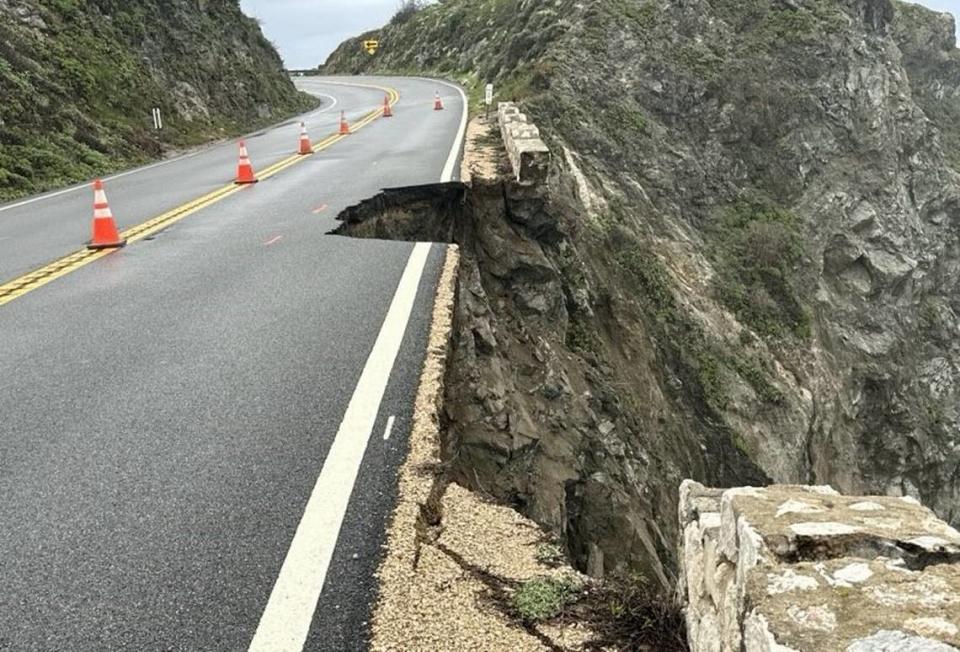
Highway 1 reopens after minor mudslide closure, new closure begins
Late Friday night, Caltrans extended the closure of Highway 1 in Big Sur as far south as Ragged Point due to a new mudslide at Alder Creek.
By Saturday morning, crews had cleared the road and reopened access as far north as Limekiln State Park at the southern end of the ongoing 12-mile closure around Paul’s Slide and the Dolan Point Slide, which have prevented full access to the scenic coastline for more than a year.
UPDATE: The closure of Highway 1 has returned to a perimeter of Lime Creek to the north and Limekiln to the south following our work this morning to clear a slide at Alder Creek which occurred last night.
Road info: https://t.co/86BJHWuSgc@CaltransHQ https://t.co/e4s6rMx70Y— Caltrans District 5 (@CaltransD5) March 30, 2024
But the drama wasn’t over for the scene highway.
Later Saturday night, a piece of Highway 1 north of the existing Paul’s Slide and Dolan Point Slide closure crumbled away amid the onslaught of heavy rain, according to Caltrans.
Highway 1 was closed at Palo Colorado due to a slip-out near Rocky Creek on Saturday night, Caltrans said.
“The southbound lanes have been lost and northbound lanes potentially impacted,” Caltrans said.
The agency was expected to assess conditions of the road on Sunday.
The current closure now extends south to Limekiln, the agency said.
What’s ahead in SLO County’s forecast
As the storm passes, the National Weather Service predicted a light chance of rain and clear skies going into the first week of April.
The risk of flooding and hail will be low, while temperatures were expected to range from a low of 46 to a high of 73, according to the agency’s forecast discussion. .
Cool temperatures will continue through Monday, the agency said, before a warming trend heats things up later in the week.
Another round of “cool and unsettled weather” could return next weekend, however.

