Pop-up storms with marginal severe weather risk
Columbus and Central Ohio Weather
QUICK WEATHER FORECAST:
Today: Pop-up t-storms, high 84
Tonight: Mostly clear, low 62
Sunday: Late PM t-storms, high 86 (69)
Monday Scattered t-storms, high 77 (59)
Tuesday: Spotty showers, high 75 (55)
Wednesday: Showers & cooler, high 70 49)
FORECAST DISCUSSION:
Memorial Day weekend will be filled with plenty of chances for showers and thunderstorms. Each day will carry some level of risk for severe weather. The biggest chance for the strongest storms will be late Sunday night into early Monday morning.
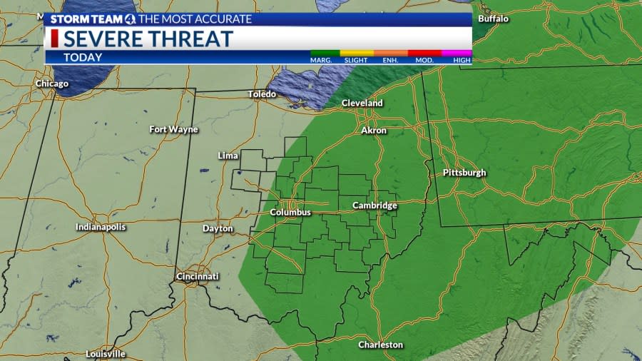
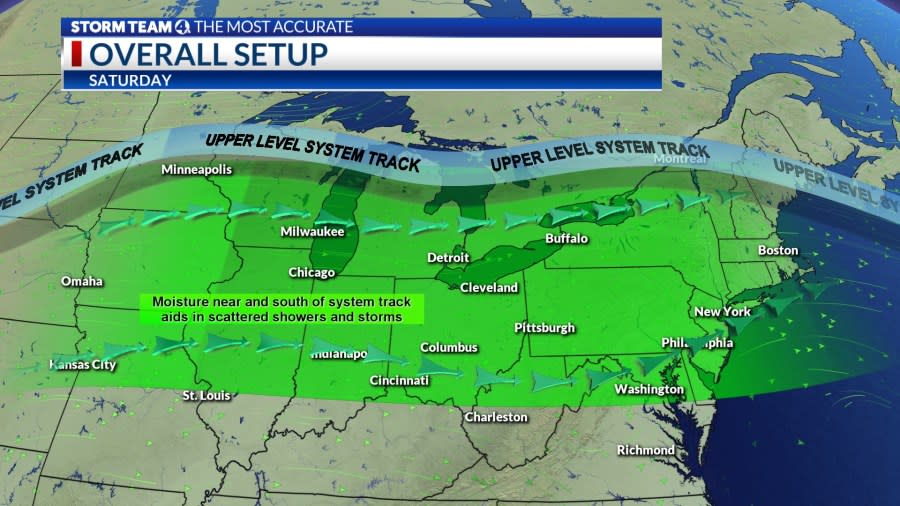
Starting with Saturday, skies will start of partly cloudy. As the afternoon goes on there will be better chances for pop-up showers and thunderstorms. The best chances for storms will start in the mid afternoon and most of them will be east of Columbus. There will be a marginal risk for severe weather. Highs will be in the low to mid 80s.
Tonight skies will be mostly clear. Winds will be light coming from the north. Lows will fall to the low 60s. Overall a quiet night weather wise is expected.
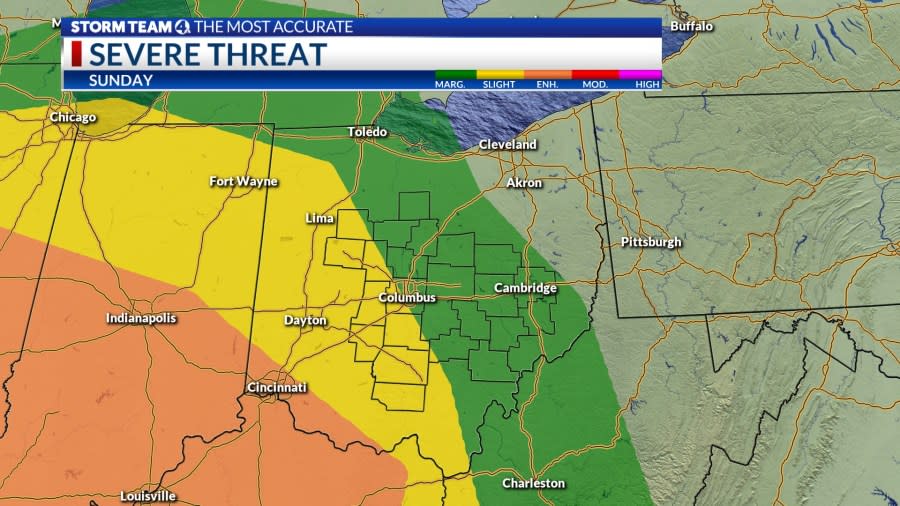
Sunday will start off calm and partly cloudy. As the day goes on could will build up. There will be a two primary rounds of storms. The first will move through by the late afternoon. The second will arrive late Sunday night into early Memorial Day Monday. This will carry a slight risk for severe weather mainly west and south of Columbus. Highs will be int he mid 80s, lows will be in the upper 60s.
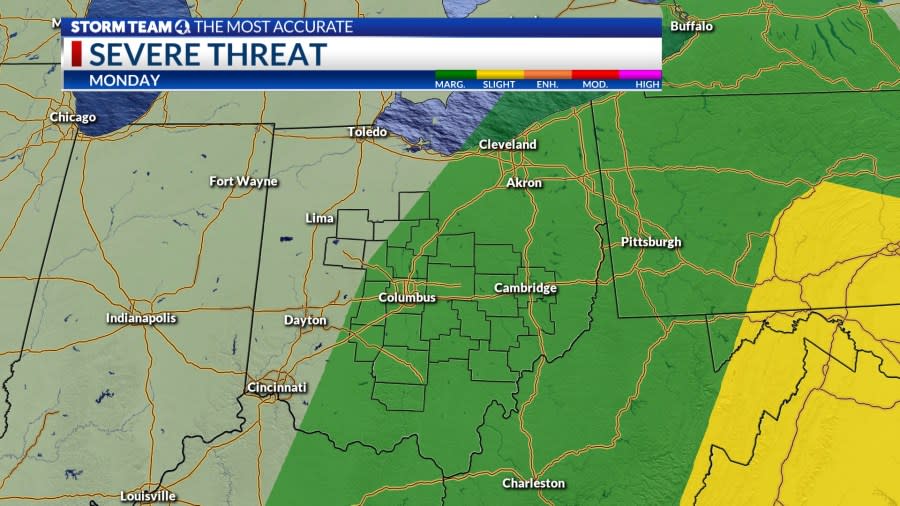
Scattered showers and storm chances continue into the day Monday. Highs will only reach the upper 70s. A marginal risk for severe weather continues into the Memorial Day holiday. Spotty rain chances continue though the middle of the week.
Copyright 2024 Nexstar Media, Inc. All rights reserved. This material may not be published, broadcast, rewritten, or redistributed.
For the latest news, weather, sports, and streaming video, head to NBC4 WCMH-TV.

