Photos: Sunny, warm end to winter causes record snowmelt in Oregon Cascades

PORTLAND, Ore. (KOIN) — Oregon’s recent round of warm, sunny days led to record levels of snowmelt in the state’s northern and central Cascades.
Oregon State Climatologist Larry O’Neill told KOIN 6 that several snow monitoring stations in the region documented the fastest level of snowmelt ever recorded between March 13 and March 20, dating back to 1981. The weeklong melt brought Mount Hood’s snowpack from 103% to 97% of its seasonal average.
“The unusually warm weather lead to a significant meltoff event of our snowpack,” O’Neill said. “The meltoff was unusually strong.”
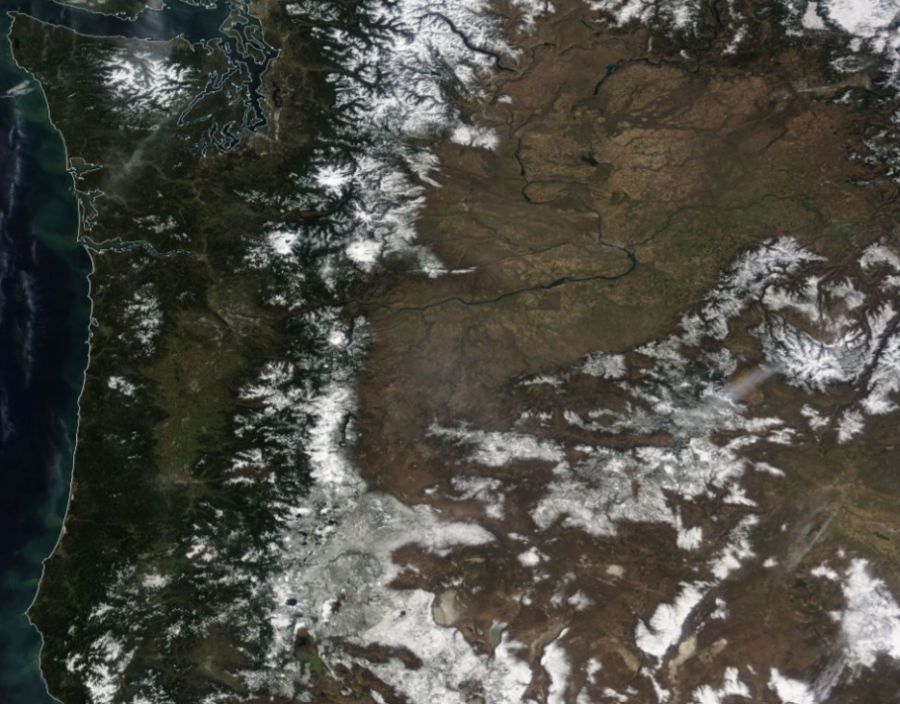
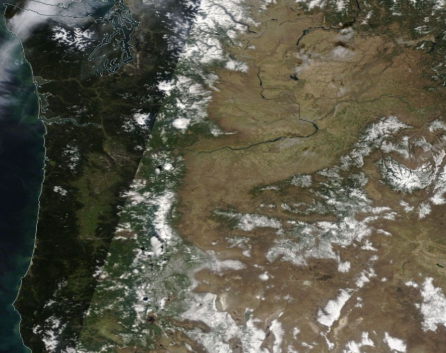
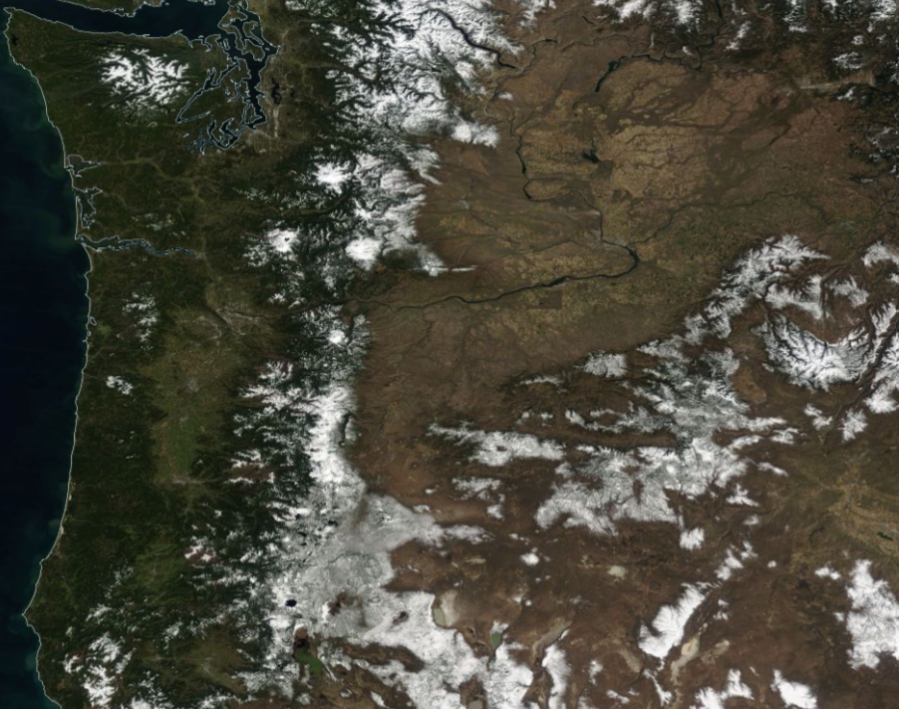
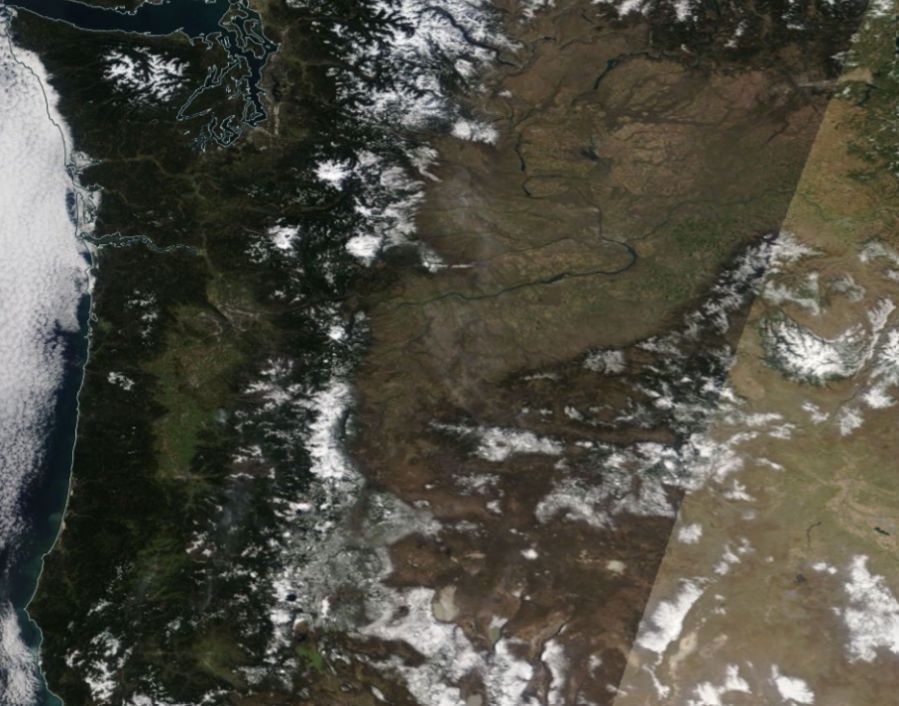
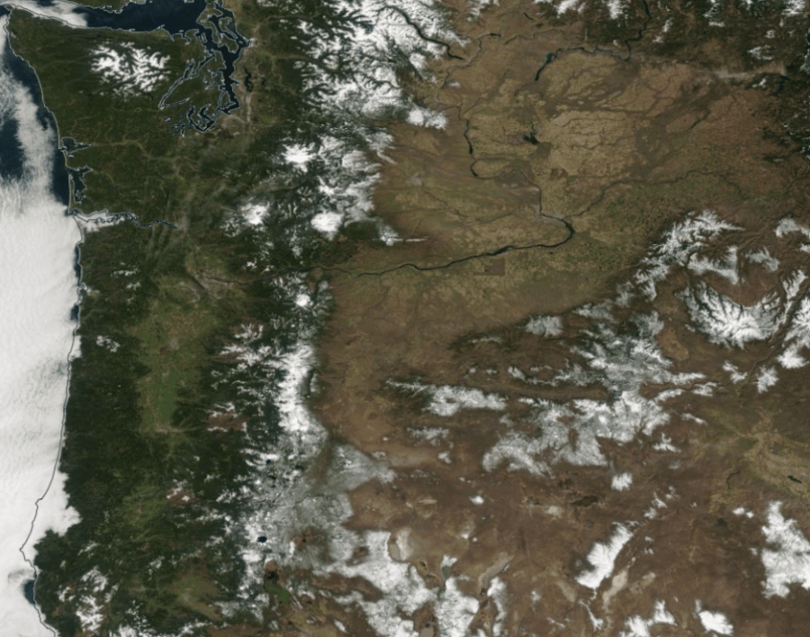
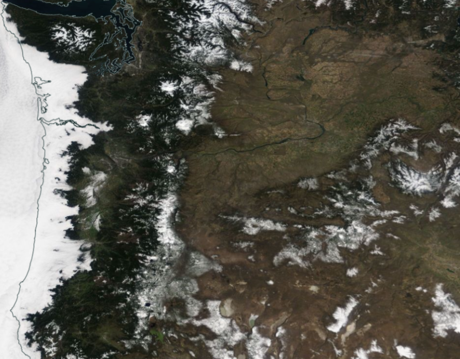
Pacific Northwest snowpack levels seen on March 14, 2024. Snowmelt seen across the Pacific Northwest between March 14 and March 19. (Satellite images courtesy of NASA) March 15, 2024. March 16, 2024. March 17, 2024. March 18, 2024. March 19, 2024.
Eight snow monitoring stations across the northern and central Cascades and the Blue Mountains set new records for snowmelt during the period. Another 16 stations observed the second or third largest snowpack reductions in recorded history.
“The snowpack loss was uncommon for this time of year, but since the snowpack was a bit above average going into the meltout, it fortunately still leaves us with about an average snowpack for this time of year,” O’Neill said.
Family with 2 children stranded overnight near Government Camp rescued
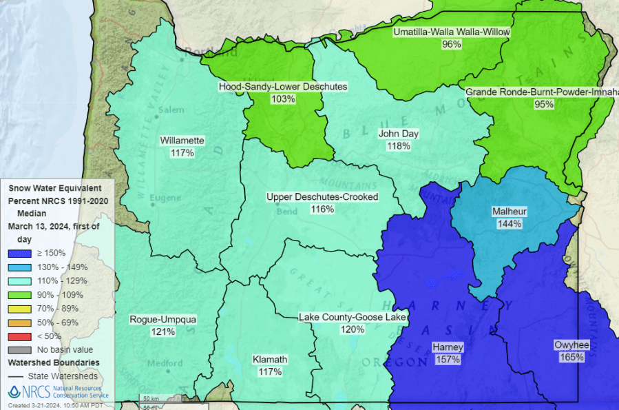
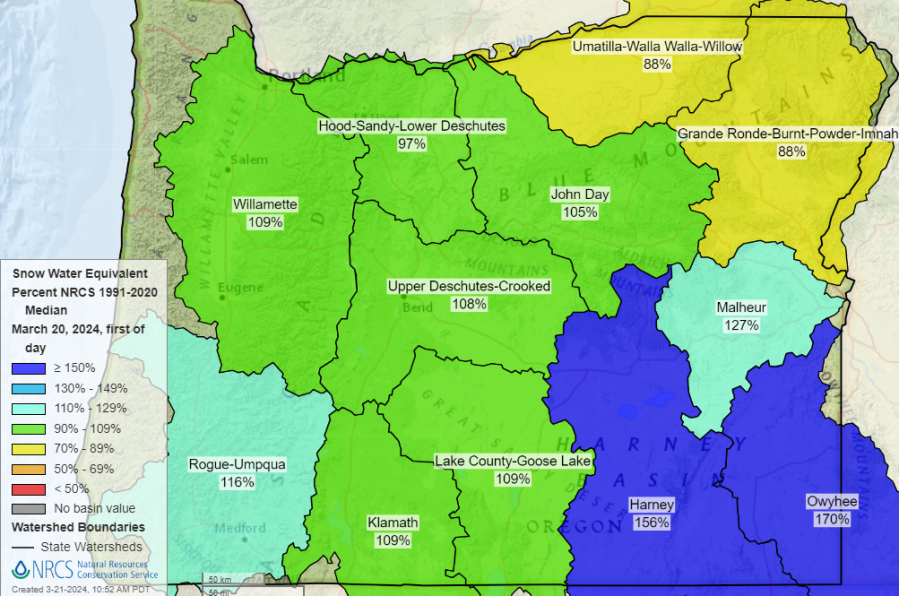
Oregon snowpack levels compared to the seasonal average on March 13, 2024. (USDA) Oregon snowpack levels compared to the seasonal average on March 20, 2024. (USDA)
The latest forecast shows that fresh snow is expected at elevations above 4,000 feet this week. While the snowfall isn’t expected to recoup the levels lost during the past week, O’Neill said that the region is still on pace for healthy snowpack levels heading into the spring and summer months.
“We are almost at the seasonal peak of our snowpack, and it appears we will be around normal,” he said. “Most reservoirs in Oregon are on schedule to fill later this spring, so water supply conditions are looking good heading into the summer.”
Vancouver resident wins ‘Jeopardy! Tournament of Champions’
Normal snowpack levels bolster summer water supplies, keeps rivers, creeks and streams cool for fish during the hotter months, and can reduce the impacts of wildfire season. KOIN 6 will continue to monitor the latest weather and drought conditions as they develop across the Pacific Northwest.
For the latest news, weather, sports, and streaming video, head to KOIN.com.

