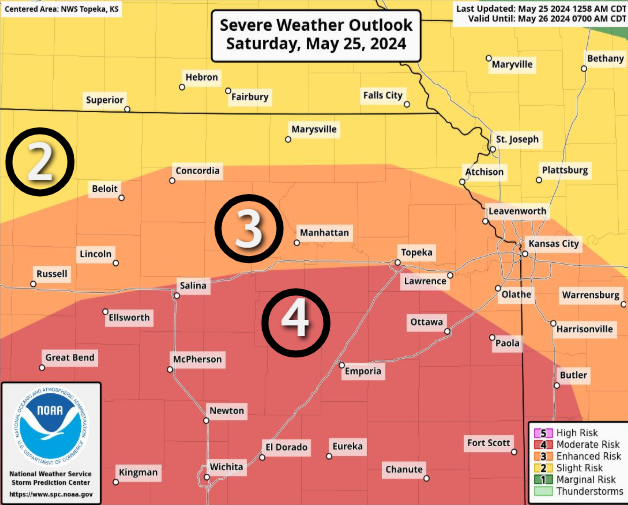
Large hail, high winds expected in northeast Kansas. A strong tornado can't be ruled out.
Residents should "expect very large hail and destructive wind potential" late Saturday in northeast Kansas, the National Weather Service says.
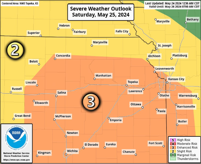
Forecasters say they can't rule out the potential for strong tornadoes to be a part of severe storms anticipated that evening for the eastern two-thirds of the state.
The storms will affect north-central, northeast and east-central Kansas “mostly after dark,” said Brandon Drake, meteorologist for the weather service’s Topeka office.
He noted that the storms will come during Memorial Day weekend, a time characterized by “a lot of camping” and other outdoor activities.
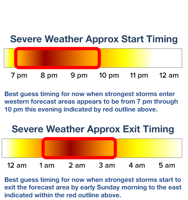
Drake said the storms should move from west to east, arriving around or after 8 p.m. in an area that includes Concordia and Abilene, around or after 10 p.m. in an area that includes Topeka, Emporia, Marysville and Concordia and around or after 11 p.m. in an area that includes Hiawatha and Kansas City, Kansas.
The website of the weather service’s Topeka office said forecasters' confidence is between "medium" and "high" that the area it serves in north-central, northeast and east-central Kansas will see severe weather.
Shawnee County Emergency Management asked on its Facebook site that residents prepare for the storms, particularly if they are going out.
”Pay detailed attention if you are camping or on the water (sleeping on a boat or staying in a marina area)” it said. “Know where your shelter is (investigate it now if you are camping) and move before the storm arrives.”
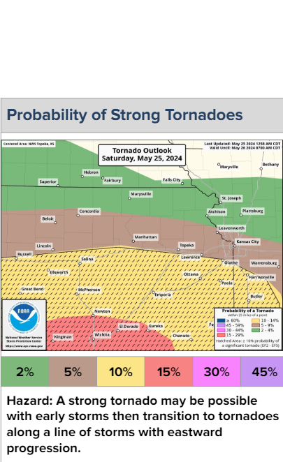
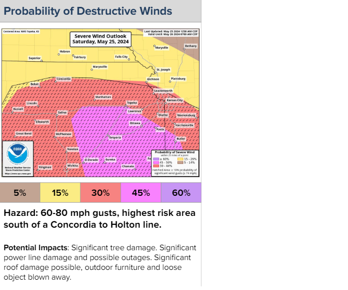
What are chances for high winds, large hail, tornadoes?
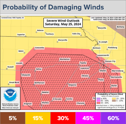
Topeka is on the border between an area where forecasters predict a 45% chance that winds of 60 to 80 mph will be present within 25 miles of any given point and an area where they predict a 30% chance that winds of 60 to 80 mph will be present within 25 miles of any point.
Winds of 60 mph should be “fairly common” with Saturday evening’s storms, Drake said.
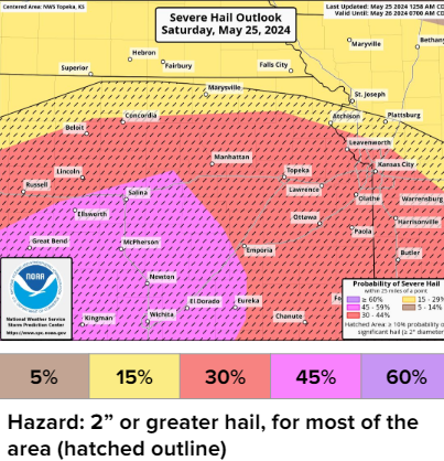
Forecasters predict a 30% chance that up to baseball-sized hail will fall within 25 miles of any given point in an area that includes Topeka.
The capital city is part of an area where forecasters predict a 5% chance that a tornado will touch down within 25 miles of any given point. However, that possibility is 10% for an area just south of Topeka, and 15% for an area to the southwest that includes Wichita and El Dorado.
Flash flooding will also be possible, particularly in northeast and east-central Kansas, Drake said.
He said the storms should weaken but produce higher rainfall totals as they move east.
May 25 brought deadly tornadoes in 1917, 1955
Saturday marks the anniversary of the deadliest tornado in Kansas history, which killed 80 people in 1955 while devastating Udall, 30 miles southwest of Wichita.
Saturday also marks the anniversary of a 1917 tornado that killed 23 people while racing through parts of Sedgwick, Harvey, Butler and Marion counties at an average speed of 65 mph.
Contact Tim Hrenchir at threnchir@gannett.com or 785-213-5934.
This article originally appeared on Topeka Capital-Journal: Hail, winds, potential tornado forecast late Saturday for NE Kansas

