Tornado watch issued for 20 counties across Florida
A strong cold front is moving through Florida today, bringing with it the potential for hail, tornadoes, strong winds and flooding rainfall.
Here's the latest on what's happening.
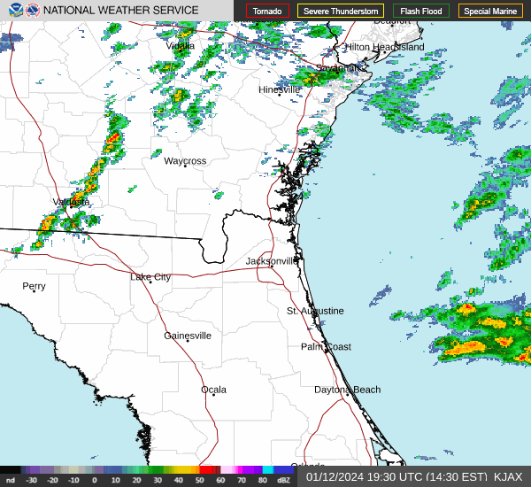
➤ Check the radar for current conditions
Strong winds, pea-sized hail possible
1:58 p.m.: Winds up to 55 mph and pea-sized hail are possible for Palm Coast, Ocala and Palatka until 2:45 p.m.
Special marine warning issued for parts of Florida coast
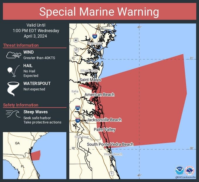
11:41 a.m.: Special marine warnings have been issued until 1 p.m. with winds greater than 40 kts is expected until 1 p.m. EDT. The warnings cover:
From Altamaha Sound, Georgia to St. Augustine, 20 to 60 nautical miles out (coast to 60 miles out for Fernandina Beach to St. Augustine
From Tarpon Springs to Suwannee River, coast to 60 nautical miles out
Tornado watch issued for 20 Florida counties
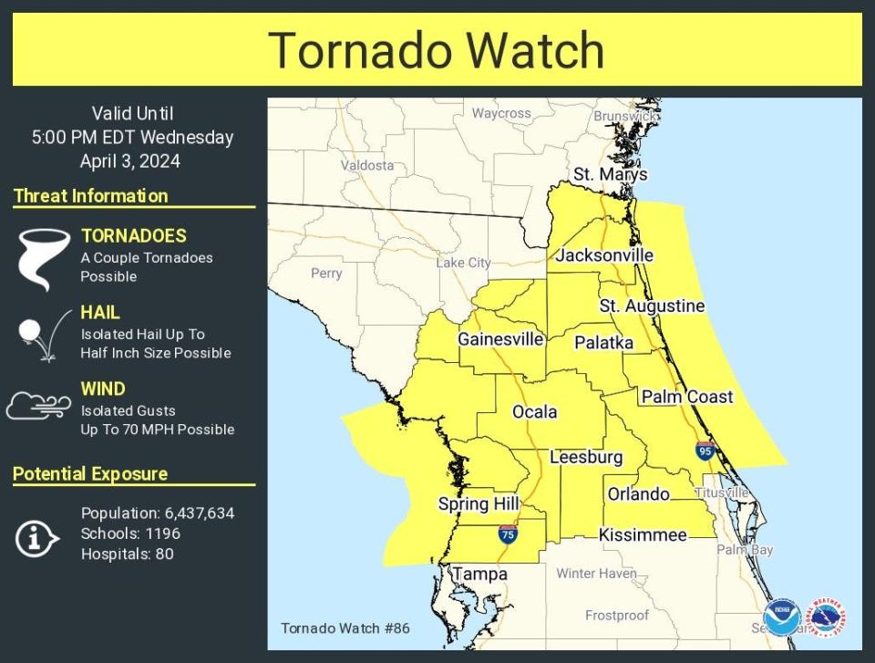
10:43 a.m.: A tornado watch has been issued until 5 p.m. for a large swath of Florida from Jacksonville, through Orlando and into Spring Hill on Florida's west coast.
Counties in the watch include:
Florida counties included in the tornado watch are:
Alachua
Bradford
Citrus
Clay
Duval
Flagler
Gilchrist
Hernando
Lake
Levy
Marion
Nassau
Orange
Pasco
Putnam
Seminole
St. Johns
Sumter
Union
Volusia
A couple of tornadoes are possible, along with isolated hail up to half-inch size.
Wind gusts up to 70 mph, also are possible.
60-mph winds, penny-sized hail, tornado all possible
10:14 a.m.: A severe thunderstorm warning has been issued until 11:15 a.m. for Lake City, Alachua and High Springs.
Winds up to 60 mph, penny-sized hail and a tornado are all possible.
Special weather statement warns of 50-mph winds
9:04 a.m.: A special weather statement warns of strong winds for Lake City, Live Oak and Watertown until 9:45 a.m.
Winds up to 50 mph are forecast.
Special weather statement issued for strong winds
7:49 a.m.: A special weather statement has been issued for Live Oak, Jasper in Florida and Statenville, Georgia, until 8:30 a.m. EDT. Winds up to 50 mph are possible.
Weather alerts issued in Florida
Weather radar and forecast for Jacksonville
Follow the National Weather Service Jacksonville on X, formerly known as Twitter
This article originally appeared on Treasure Coast Newspapers: Jacksonville weather forecast, radar: Tornado watch, hail, strong winds

