NWS confirms EF0 tornado near Des Moines was one of 5 on Friday
Iowa experienced yet another round of severe weather, battered by thunderstorms and high winds Friday morning.
Here are the latest updates (Jump to eastern Iowa radar | Des Moines radar | safety tips)
Tornado confirmed over Mississippi River near Le Claire, Iowa
— NWS Quad Cities (@NWSQuadCities) May 26, 2024
A brief tornado touched down over the Mississippi River on Friday, the National Weather Service confirmed. The tornado ran between Lock and Dam 14 and the Interstate 80 bridge near Le Claire. It was rated EF Unknown because there was no damage reported and the weather service couldn't determine wind speeds.
EF1 tornado confirmed near Wellman and Frytown, Iowa
A tornado that started near Wellman, Iowa on Friday tracked about 18 miles through Amish areas and Frytown. It was rated an EF1 and had peak wind speeds of about 110 mph.
Damage was reported to homes, outbuildings and trees in the area, according to the National Weather Service.
EF1 tornado confirmed near Riverside, Iowa
The National Weather Service confirmed an EF1 tornado with up to 100 mph winds touched down Friday morning near Riverside to Downey, which is just over 20 miles. The tornado damaged trees and outbuildings and did minor damage to a home, according to the NWS.
“All of the sudden, boom,” farmer Rick Brenneman told the Press-Citizen on Friday. “There were trees falling in my backyard, branches falling, whatever. It was chaos. Crazy.”
EF1 tornado confirmed near Delta, Iowa
The National Weather Service confirmed an EF1 tornado hit Keokuk County, just northwest of Delta, Iowa on Friday morning. The brief tornado caused significant damage to trees and outbuildings, the weather service reported.
Brief EF0 tornado confirmed in Johnston on Friday morning
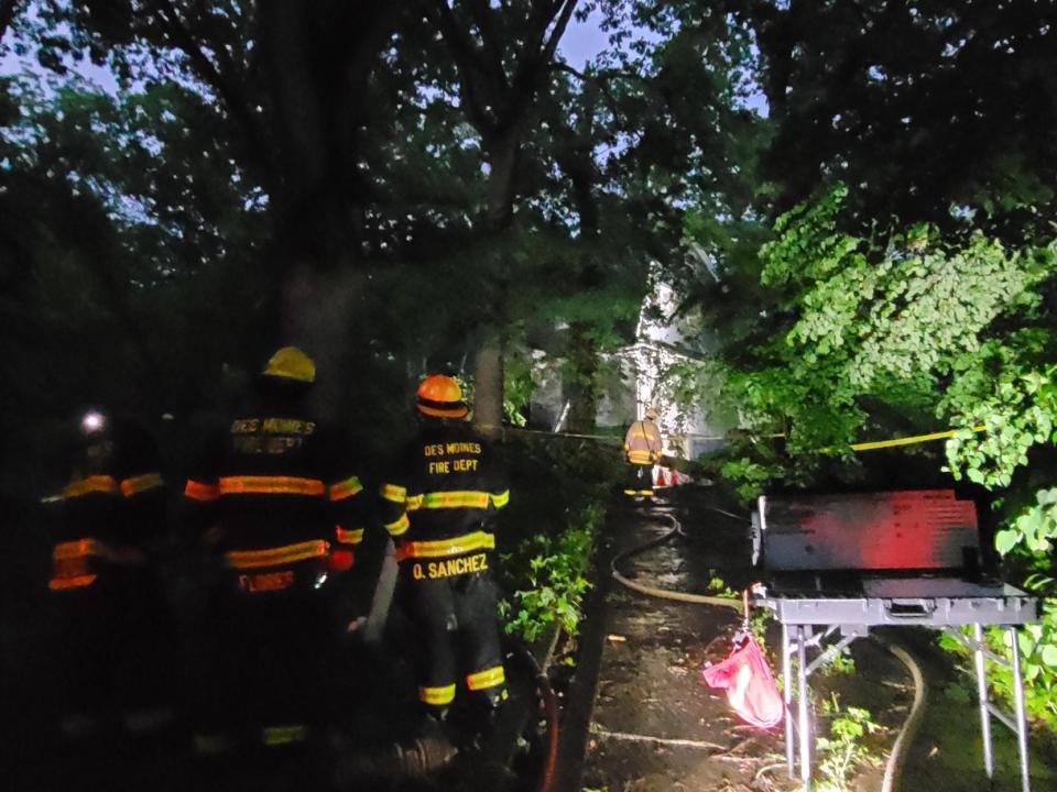
The National Weather Service confirmed an EF0 tornado hit Johnston early Friday morning. The tornado tracked from the south to eastern portion of the city from 4:53 to 4:57 a.m.
It's the second tornado to hit Johnston this week. An EF2 tornado started in Johnston on Tuesday before continuing 41 miles through Polk and Story counties before ending near Zearing. It touched down near Johnston High School, causing "extensive" damage that canceled classes for Wednesday.
12 p.m.: Power returning for many Iowans, about 14,000 still without electricity
More than 14,000 MidAmerican Energy customers remain without power after storms rolled through the state. At one point the utility reported more than 47,000 outages. Top outages include:
8,400 Des Moines customers
1,900 Fort Dodge area customers
2,300 Quad Cities area customers, mostly in Illinois
In the Des Moines area, some power outages could remain through Saturday.
Alliant Energy reported about 175 customers without power across the state. That's down from 10,000 earlier Friday morning.
Most customers in Ames have had power restored.
Iowa's Rural Electric Cooperatives have about 270 customers still without power. That's down from about 3,300 customers earlier.
10:40 a.m.: More storms possible Friday and Sunday in Iowa
Another wave of storms are possible on Friday, especially in southeastern Iowa.
Saturday should be a clear day for most of the state before more storms, including possibly severe storms, are possible Saturday evening into Sunday.
More: Will Iowa see more severe weather Memorial Day weekend? Here's the best time to be outside
10 a.m.: Wind, hail damage reported across much of Iowa after Friday morning storms
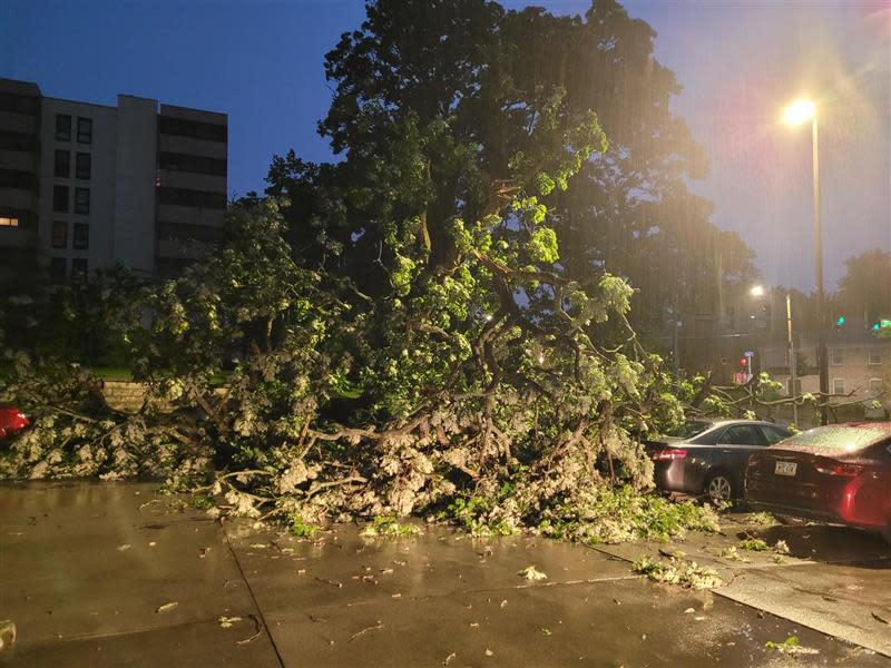
Damage from Friday's severe thunderstorms is widespread across Iowa, according to NWS. Main causes include wind damage and hail in some areas of the state.
While the damage reports are preliminary, there was damage to trees, power lines and farm property. There were reports of multiple semis tipped over on Iowa interstates.
Baseball size hail was reported to the NWS from the Humeston area. Hail an inch in diameter was reported in places likes Milford, Nevada and Readlyn.
NWS is still collecting data on whether or not any tornadoes touched down in the state. There haven't been any visual sightings reported or confirmations in central Iowa, according to weather service's Des Moines office.
8:30 a.m.: Central Iowa districts delaying , canceling classes after Friday storms
Several school districts are delaying classes in the Des Moines metro on Friday morning. In Des Moines, classes at six buildings are delayed due to power outages.
Des Moines Public Schools: Cowles Montessori will start with a two-hour delay. Canceled classes for five schools Friday due to power outages: Findley Elementary, Greenwood Elementary, Harding Middle School, Madison Elementary and Willard Elementary
Johnston Community School District: All classes are delayed two hours. Morning preschool and developmental kindergarten classes are canceled, but afternoon sessions will be held. KTC child care opens two hours late.
Johnson County updates: Area schools delayed as strong morning storms prompt small outages across Johnson County
8:30 a.m.: New tornado warning issued for Bellevue, Iowa
Tornado Warning including Bellevue IA, Stockton IL and Warren IL until 9:15 AM CDT pic.twitter.com/gMCB6wvZDV
— NWS Quad Cities (@NWSQuadCities) May 24, 2024
Bellevue, located on the Iowa-Illinois border is under a tornado warning until 9:15 a.m. for a radar-indicated tornado threat.
8:02 a.m.: Tornado warning issued for Quad Cities area
Tornado Warning including Moline IL, Bettendorf IA and Clinton IA until 8:45 AM CDT pic.twitter.com/5SStP6BWTG
— NWS Quad Cities (@NWSQuadCities) May 24, 2024
A tornado warning was issued for cities around the Quad Cities including Bettendorf and Clinton in Iowa and Moline in Illinois. It stretches as far north as Maquoketa in Iowa and Green Island in Illinois. Threats include a possible tornado and pea-sized hail. The warning covers more than 176,000 people and lasts until 8:45 a.m.
8 a.m.: Flood watch issues for 30 Iowa counties after another round of storms
Over 30 central counties in Iowa are under flood watch. Affected areas span from Cass County to Marion, up to Palo Alto. It stretches up to Floyd Count. Towns within the warning include Mason City, Fort Dodge, Ames, Des Moines Atlantic and Marshalltown.
7:55 a.m.: Tornado warning issued in Jackson County, Iowa
Tornado Warning including Bellevue IA, La Motte IA and Saint Donatus IA until 8:30 AM CDT pic.twitter.com/VR2JLXrAqi
— NWS Quad Cities (@NWSQuadCities) May 24, 2024
A tornado warning has been issued for Bellevue and areas on the Iowa-Illinois border. The warning continues until 8:30 a.m.
7:45 a.m.: Tree, power line damage reported after storms in Colfax, Iowa
A weather-related incident occurred around Colfax, Iowa, on Friday morning, causing significant tree and power line damage.
Jasper County emergency management posted on social media warning residents to avoid the area to allow essential traffic to respond to the incident.
7:40 a.m.: Tornado warning issued near Clarence, Iowa
Tornado Warning including Clarence IA, Lowden IA and Wheatland IA until 8:30 AM CDT pic.twitter.com/JS1OvnHDtC
— NWS Quad Cities (@NWSQuadCities) May 24, 2024
A tornado warning is in effect until 8:30 for eastern Iowa. The warning is for a radar-indicated tornado and includes Clarence, Dixon, Lowden, Wheatland
7:15 a.m.: Tornado warning issued near Anamosa
Severe Thunderstorm Warning continues for Iowa City IA, Muscatine IA and Coralville IA until 7:45 AM CDT. This storm will contain wind gusts to 70 MPH! pic.twitter.com/ykvtmIesGQ
— NWS Quad Cities (@NWSQuadCities) May 24, 2024
A tornado warning was issued for areas around Anamosa around 7:15 a.m. Potential dangers include pea-sized hail and a possible tornado. The threat areas covers from Central City, down to Anamosa and as far north as Holy Cross. The warning is expected to last until 8 a.m.
7:00 a.m.: Tornado warning in eastern Iowa includes Solon, West Liberty and Muscatine
Tornado Warning including Muscatine IA, Anamosa IA and Mount Vernon IA until 7:45 AM CDT pic.twitter.com/6PSE7dgbdw
— NWS Quad Cities (@NWSQuadCities) May 24, 2024
Storms moving through Iowa City and into eastern Iowa are capable of producing straight-line winds and tornadoes, according to the National Weather Service. The warning said there was radar-indicated rotation. The warning is in effect until 7:45 a.m.
Eastern Iowa radar shows storms moving through Iowa

Weather
Embedded content: https://radar.weather.gov/ridge/standard/KDVN_loop.gif
Des Moines radar shows storms exiting the metro area

Weather
Embedded content: https://radar.weather.gov/ridge/standard/KDMX_loop.gif
Clean up options available
Branches, trash and other debris may have blown into your yard after serious storms rolled through the entire state of Iowa on Tuesday, as well as this morning. Cities in the metro are offering debris clean-up services to help their residents.
See where and when: Des Moines metro cities offering debris cleanup services after Tuesday's storm. What to know:
6:13 Tornado warning for Deep River, Guernsey
A tornado warning was issued for areas around Deep River and Guernsey just after 6 a.m. Possible threats include pea-sized hail and a tornado. The area covers 637 people and is predicted to last until 6:30 a.m.
6:07 Flood warnings in Iowa
Four northeastern counties in Iowa are under a flood watch after severe thunderstorms swept the state, according to NWS. Areas include:
Floyd County
Chickasaw
Fayette
Clayton
5:50 a.m.
A reported 33,795 MidAmerican customers across Iowa were without power as of 5:50 a.m. Des Moines was hit the hardest with over 23,000 customers losing power. More than 6,500 residents in Fort Dodge also lost power, along with 3,100 in Council Bluffs.
5:42 a.m.
A tornado warning was issued for Pella and towns as far northeast as Montezuma at around 5:39 a.m. Threats include pea-sized hail and a tornado. The warning covers New Sharon, Lacey and as far south as Harvey. The threat is predicted to last until 6:15 a.m. Friday and covered a population of just over 22,000 people.
Greenfield still fresh in memory as new tornado warnings issued in Iowa
The latest round of tornado warnings comes just days after Greenfield was hit.
5:40 a.m. Tree down in Des Moines
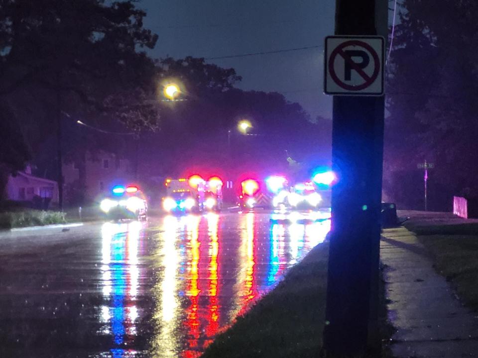
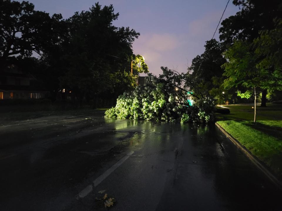
A large tree fell down on cars at an apartment complex on Grand Avenue at 31st Street in Des Moines. Area of Des Moines are also experience a power outage due to the severe thunderstorms covering the metro and much of Iowa.
5:34 a.m.
A tornado warning was issued for towns north of Newton around 5:20 a.m. Threats include pea-sized hail and a tornado. The warning is expected to last until 6 a.m. and covers as far west as Mitchellville and up toward Melbourne and Haverhill. The threat area covers an estimated population of over 24,000 people.
5:18 a.m.
Ames remains under a tornado warning as a wide swath of central Iowa once again experiences severe weather. The threat runs as far north as New Providence, including Roland, Zearing and Nevada. Pea-size hail and a tornado were possible until 5:30 a.m., according to the National Weather Services. The warning area covered more than 38,000 people.
5:03 a.m. Friday
An area just north of Des Moines went under a tornado warning around 5 a.m. The threat area spanned from Ames down to Huxley and as far west as Woodward. Quarter-size hail and a tornado were possible until 5:30 a.m., according to the National Weather Services.
Tornado Warning including Ames IA, Nevada IA and Roland IA until 5:45 AM CDT pic.twitter.com/6RST9seYbv
— NWS Des Moines (@NWSDesMoines) May 24, 2024
What should you do during a severe thunderstorm warning or tornado warning?
During a severe weather warning, it's time to take action and follow your plan.
NWS has tips for what to do at different locations:
Stay Weather Ready: Continue to follow local news or listen to a NOAA Weather Radio to stay updated about watches and warnings.
At Your House: Go to your secure location, like the basement or lowest floor level, if you hear a warning. Take your pets with you if time allows.
At Your Workplace or School: Stay away from windows. Do not go to large open rooms such as cafeterias, gymnasiums or auditoriums.
Outside: Go inside a sturdy building immediately. Sheds and storage facilities are not safe. Taking shelter under a tree can be deadly.
In a Vehicle: Being in a vehicle during severe weather is safer than being outside, but, drive to the closest secure shelter if there is sufficient time. Do not stop and park under a bridge or underpass.
This report will be updated.
Kate Kealey is a general assignment reporter for the Register. Reach her at kkealey@registermedia.com or follow her on Twitter at @Kkealey17.
This article originally appeared on Des Moines Register: NWS confirms EF0 tornado hit Des Moines metro Friday morning

