Let it snow: Up to 6-8 inches forecast across Manitowoc, Sheboygan, Fond du Lac and Winnebago counties
SHEBOYGAN — Cities across northeast Wisconsin could receive several inches of snow this week, delaying spring's arrival.
Snow is forecasted from 7 a.m. Tuesday to 7 p.m. Wednesday across eastern Wisconsin, according to the National Weather Service.
The weather could move from the south part of the state to the north and east. These conditions will have minor effects. There is no winter storm warning or emergency in effect.
Yarn shop opening: Mother-daughter duo to open new yarn shop soon in downtown Sheboygan
Snowfall amounts are uncertain, as the storm already shifted west over the past few days, according to the NWS. It’s unclear if its track will change.
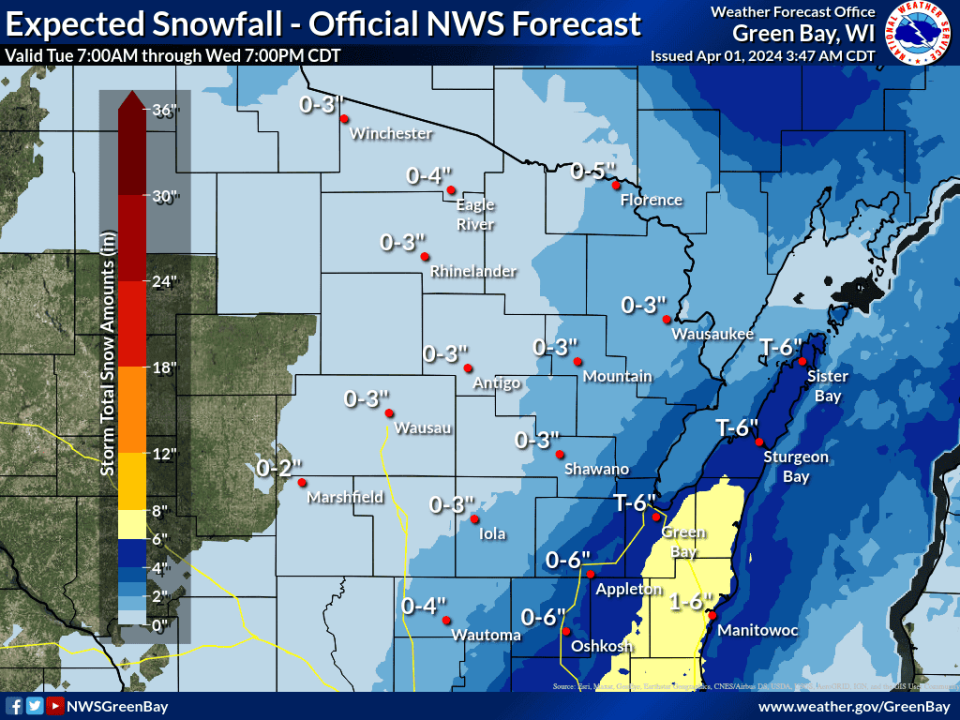
A high chance of snow is predicted for the lakeshore. Manitowoc County and most of Sheboygan County could receive 1-8 inches of snow. There is a 40% to 70% chance that communities to the west, like Fond du Lac and Oshkosh, could receive snow, too, possibly up to 6 inches.
Wind speeds could increase Wednesday morning, with gusts reaching more than 40 mph. Blowing snow could lead to possible minor tree damage and reduced visibility.
Community stories: Sheboygan North student shares community stories with traveling installation
Have a story tip? Contact Alex Garner at 224-374-2332 or agarner@gannett.com. Follow her on X (formerly Twitter) at @alexx_garner.
This article originally appeared on Sheboygan Press: Snow in forecast in Manitowoc, Sheboygan, Fond du Lac, Oshkosh

