Why clouds look the way they do during thunderstorms
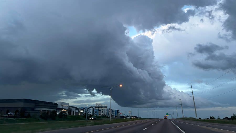
(COLORADO SPRINGS) — On Monday night, May 20 some interesting-looking clouds were captured in northern Colorado Springs, but were just part of a common phenomenon that happens during thunderstorms.
Courtesy: FOX21 News Courtesy: FOX21 News
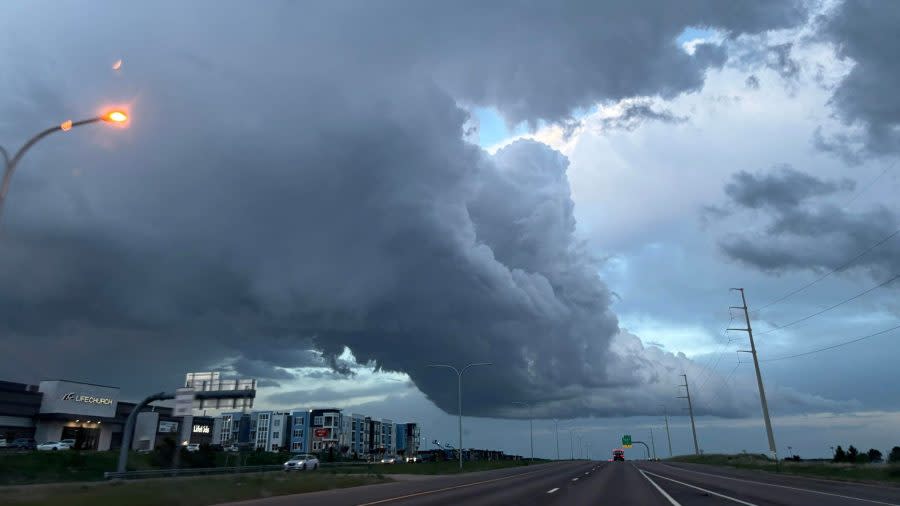
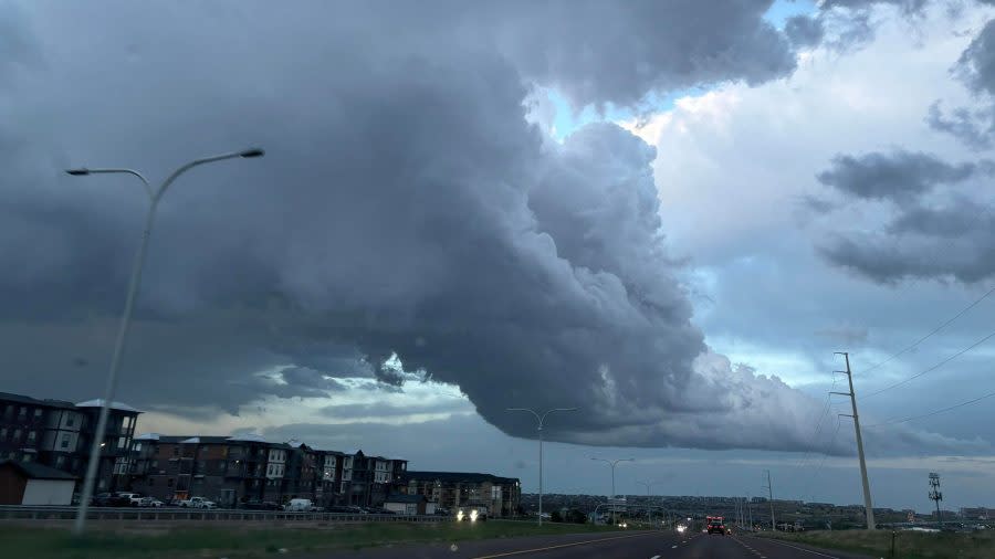
According to FOX21 Storm Team Chief Meteorologist Matt Meister, the pictures show the updraft of the severe thunderstorm that dropped 1-1.5” diameter hail from Peterson Space Force Base to Falcon on Monday Night.
According to the National Oceanic and Atmospheric Administration (NOAA), an updraft is the developing stage of a thunderstorm, marked by “a cumulus cloud that is being pushed upward by a rising column of air.” The stronger the updraft, according to NOAA, “the stronger the thunderstorm and the larger the hail it can produce.”
According to Matt, the pictures show air heading up through the updraft (from left to right) before descending just off the left-hand side of the photos as rain and hail. “The storm formed as moisture-laden air moved toward the higher terrain of the Pikes Peak Region from the eastern plains late Monday,” Matt said.
To learn more about updrafts and how thunderstorms form, click on the links above.
Copyright 2024 Nexstar Media, Inc. All rights reserved. This material may not be published, broadcast, rewritten, or redistributed.
For the latest news, weather, sports, and streaming video, head to FOX21 News Colorado.

