Two EF-1 tornadoes hit Kentucky during deadly weather outbreak. Here's what we know
This article will update.
At least five people are dead following severe weather, including tornados and thunderstorms, that tore across Kentucky on Sunday.
One of the deceased is a 34-year-old Louisville man who died after being struck by a tree when damaging winds moved through the city Sunday afternoon. Another round of strong storms hit the area overnight, with the "all clear" coming in around 3:30 a.m. Monday.
Fifth storm-related death
In a statement sent on X just before 5 p.m. Monday, Gov. Andy Beshear shared that a fifth person had died related to the severe weather.
"I’m sad to share we have another reported death as a result of yesterday’s storms," read the post. "A 54-year-old man died from a heart attack while cutting fallen trees in Caldwell County. His loved ones are in our prayers during this difficult time."
I’m sad to share we have another reported death as a result of yesterday’s storms. A 54-year-old man died from a heart attack while cutting fallen trees in Caldwell County. His loved ones are in our prayers during this difficult time.
— Governor Andy Beshear (@GovAndyBeshear) May 27, 2024
Tornadoes confirmed
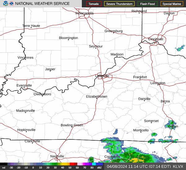
The National Weather Service in Louisville sent out survey crews to assess the storms and weather events from Sunday early Monday morning. By Monday afternoon, preliminary results were coming in from the NWS, confirming a tornado in eastern Meade and northern Hardin counties that was at least an EF-1 moving at 90 mph.
📌(Updated 5/27/24 at 200PM) Damage survey crews are assessing damage from the May 26th, 2024 Event.
Information will be updated as survey results are determined.
Survey results in Butler and Meade/Hardin Counties concluded at least an EF1 tornado.#kywx #inwx pic.twitter.com/S4AxKdZEDR— NWS Louisville (@NWSLouisville) May 27, 2024
A second tornado, also at least an EF-1, was captured in the preliminary survey results in Butler and northern Warren counties.
In Grayson County, straight line winds of 85 mph were recorded in the NWS survey.
Road closures
Louisville Metro Police Department closed Interstate 265 in both directions between Dixie Highway and Stonestreet Road at 2 p.m. Monday, as LG&E crews work to repair down lines in the area. There is not a scheduled time for the lanes to reopen, according to LMPD’s post on X.
“This will disrupt the flow of traffic in that area. You will need to use alternative routes if you live or must go to work in that area. Once the needed repairs have been completed, we will reopen the roadway,” read the post. “Obviously, this is an unscheduled repair work that will cause delays in that area. We ask for patience from drivers as LG&E & their contractors work to restore power to those hampered by the storms.”
LG&E leads power restoration efforts
About 78,000 people were without power across the state as of 7:30 a.m. Monday, according to the LG&E and KU power outage map. In all, roughly 120,000 customers were impacted by the storms and high winds, LG&E and KU, a major gas and utility provider in the state, reported. There are an estimated 1,000 downed wires across the coverage territory as well. In Jefferson County, nearly 39,000 people are without power.
An additional 700 line workers and support personnel are coming to Kentucky from surrounding states to assist with the "massive, multi-day restoration event" to bring back power to customers.
To keep up to date with LG&E and KU restoration efforts and remaining outages, please visit: lge-ku.com/storm
Gov. Andy Beshear declares state of emergency
At 12:12 a.m. Monday, Gov. Andy Beshear issued a state of emergency "to ensure the communities impacted have the resources they need to respond."
Severe weather continues to move through the commonwealth with multiple reports of wind damage and tornadoes. I have issued a State of Emergency to ensure the communities impacted have the resources they need to respond.
— Governor Andy Beshear (@GovAndyBeshear) May 27, 2024
The governor is expected to host a press conference Monday morning to provide more information about the damage from the storms.
What happened Sunday?
Much of the Louisville metro area was put under a tornado watch until 4 p.m. Sunday. The National Weather Service reported a few tornadoes were likely and wind gusts could reach up to 75 mph. Scattered hail could be up to 2 inches in size.
A tornado watch has been issued for parts of Indiana, Kentucky and Tennessee until 3 PM CDT pic.twitter.com/A0sRdPRkEy
— NWS Louisville (@NWSLouisville) May 26, 2024
A tornado was observed near Mayfield around 8:18 a.m. local time, according to a tweet from the National Weather Service in Paducah. Mayfield was hit with a tornado in 2021 that killed at least nine people, The Courier Journal previously reported.
8:18 am 5/26/24: Take cover if you live near Mayfield, KY! Radar confirmed tornado approaching from the west!!!
— NWS Paducah, KY (@NWSPaducah) May 26, 2024
In a LENSAlert sent out around 10 a.m. Sunday, Louisville Metro Emergency Services advised residents to monitor the weather forecast throughout the day.
"Strong to severe storms likely this afternoon," Metro EMS said in a statement. "Damaging winds, tornadoes, and flooding are possible."
NWS Louisville: More severe storms could arrive starting at 8 p.m.
Though the risk for floods and tornadoes is forecast to be greater in southwestern Kentucky, Louisville could be in for a rainy and dangerously windy night that may extend into early Monday morning.
"We're going to have a line of storms with a lot of wind in them," National Weather Service meteorologist John Gordon said during a briefing Sunday afternoon. "There's a probability of strong to severe storms tonight."
An outlook from the Storm Prediction Center showed a 30% of winds 70 mph or greater to move through Louisville overnight Sunday. Parts of Oldham and Shelby counties were included in an area that could experience "hurricane-force" winds 75 mph or greater.
Louisville could receive one to three inches of rain Sunday night, with locally higher amounts possible, Gordon said.
Tornadoes remain a possibility overnight because of strong wind shear, instability in the atmosphere and high moisture, Gordon said.
"These are the three worst things you can get," he said.
An increase in clouds Sunday afternoon would be a good thing, Gordon said, because it would help stabilize the atmosphere, therefore lowering the risk for tornadoes.
Gazebo Festival, Louisville Bats game canceled due to weather
Gazebo Festival officials announced Sunday, the second day of the event expected to be headlined by Jack Harlow, would be canceled due to ongoing weather activity impacting the area.
"The safety of our patrons, artists and staff is paramount. Due to continuing hazardous conditions throughout the early afternoon and a second wave of weather expected this evening, we have made the very difficult decision to cancel the remainder of Gazebo Festival," a festival spokesperson told The Courier Journal.
Sunday ticket holders will receive a full refund. Weekend pass ticket holders will be refunded 50%. All refunds will be issued within 30 days.
The safety of our patrons, artists and staff is paramount. Due to continuing hazardous conditions throughout the early afternoon and a second wave of weather expected this evening, we have made the very difficult decision to cancel the remainder of Gazebo Festival. pic.twitter.com/t2XvLW9vBO
— Gazebo Fest (@gazebofestival) May 26, 2024
There also won't be any baseball played in downtown Louisville on Sunday. The Louisville Bats announced their series finale against the Toledo Mud Hens was canceled due to severe weather in the forecast.
"The Bats and Toledo will not make up this game due to us not playing each other in the first half of the season," the team said in a statement.
Tickets to Sunday's game can be exchanged for admission to a future game, as long as the ticket is of "equal or lesser value," according to the Bats website. Attendees with suites, season tickets and group tickets can contact their account representative for more information.
1 dead following afternoon storms in Louisville
A man was killed Sunday after he was struck by a tree in east Louisville, between Anchorage and Lyndon, Louisville Metro Police spokesperson Matthew Sanders said in a statement. LMPD's homicide unit is conducting a death investigation in the 10700 block of Hobbs Station Road east of downtown. The man was pronounced dead at the scene.
The death was reported at 12:32 p.m.
No other details were given.
Gazebo Festival 'on pause' due to weather
Gazebo Festival is "ON PAUSE" with further updates expected to come "soon," according to the official Gazebo Festival account on X, the platform formerly known as Twitter.
Gazebo Fest is currently on pause. Updates coming soon. pic.twitter.com/GtWbRcQVIi
— Gazebo Fest (@gazebofestival) May 26, 2024
1 round of severe storms pass Louisville. Another is on the way tonight
Don't let your guard down just yet.
Louisville and surrounding cities in Kentucky and Indiana remain under a tornado watch until 4 p.m., but there could be more severe weather to monitor Sunday.
The National Weather Service in Louisville said the greatest chance for flooding in Kentucky will come Sunday night, with counties in the southern part of the state possibly getting the most rainfall. A flood watch remains in effect in the Louisville metro area until 8 a.m. Monday.
Over 45,000 people in Louisville were without power as of 1:45 p.m. Sunday, according to LG&E's outage tracker.
'Destructive' winds cause power outages in Louisville
A severe thunderstorm warning for Louisville included "destructive" winds up to 80 mph, according to an alert from the National Weather Service. The warning expired 12:30 p.m. Sunday. Thunderstorms headed east and north out of Jefferson County.
As of 12:35 p.m., 55,950 customers were without power, according to LG&E's tracker. Outages were reported throughout the city.
Is your power out? Here's how to check the status of LG&E, KU, ODP in Louisville
Winds of up to 63 mph were reported at the Louisville Muhammad Ali International Airport, according to storm reports from the weather service.
When will severe weather reach Louisville today?
The National Weather Service in Louisville said there would be two waves of storms Sunday, with the first arrived in the metro area around 11 a.m. and could last as late as 6 p.m.
"These storms may be sub-severe when they arrive, but afternoon strengthening is possible," the weather service said in a statement early Sunday. "A few storms could become severe."
A second wave of storms, forecast to arrive as early as 10 p.m. and potentially linger into Monday morning, represents the "greatest risk for severe weather" Sunday, the weather service said. Widespread damaging winds and flash flooding were the main overnight threats.
The tornado risk for the overnight hours appears to be greater than the first wave of storms, according to a graphic from the weather service. Large hail could also be a threat overnight.
Abbey Road on the River delays Sunday start
Due to storms in the weather forecast, Beatles fans will have to wait until 4 p.m. for Abbey Road on the River, according to an updated schedule posted on the concert's series website. Gates at the Big Four Station Park in Jeffersonville will now open at 3:30 p.m.
The festival will run until 8 p.m. Sunday.
Gazebo Festival delayed
Gazebo Festival will not open the gates at its anticipated 1 p.m. start time due to severe weather conditions impacting the region.
"With the utmost concern for the safety of our fans, artists and staff, with unsafe weather conditions expected, the festival will be operating on an adjusted schedule. Gates will not open at 1 p.m. as planned. Stay tuned to the official Gazebo Festival app and socials for updated information," Holly Weyler with Gazebo Festival PR said in a statement.
Gazebo Festival, a new music festival put on by booming rap star and Louisville native Jack Harlow is a two-day event at Waterfront Park featuring popular and upcoming hip-hop and R&B acts. The first day of the festival was Saturday featuring SZA as headliner.
Sunday, Harlow is expected to be the headliner. Due to a tornado watch and severe thunderstorm warning issued for the Louisville area, the festival has been delayed.
At the writing of this article, it is not yet clear when Gazebo Festival will open and how the delay will impact the acts expected to perform today, including artists such as Omar Apollo, PinkPantheress, or even Harlow.
What we know: Gazebo Festival delayed due to predicted severe weather.
This article originally appeared on Louisville Courier Journal: Kentucky storm damage result of storms, 2 confirmed EF-1 tornados
