Significant severe weather threat continues tonight – here’s what to expect
A potent weather setup will bring the risk for all modes of severe weather to the two Virginias Tuesday, including the risk for tornadoes, damaging wind gusts, large hail and flooding.

This is all taking place due to a strong low pressure system moving into the Great Lakes – the system is strengthening as it does so. In addition, very warm air is colliding with a very cold air mass – we’ll likely have snow showers around by Wednesday! The differences in these vastly different airmasses will help create the setup necessary for severe thunderstorms to thrive.
A strong cold front races toward our region by the evening hours.
Overall Severe Weather Threat

Significant threat for severe weather late Tuesday afternoon through the evening hours.
All types of severe weather are possible in our region, including tornadoes, damaging wind gusts, large hail, and flooding.
Severe weather threat will wrap up around midnight Wednesday morning – temperatures will then crash and we’ll see rain and snow showers Wednesday into Thursday!
The BEST chance for severe weather will be in our western counties, west of I-77 in southern West Virginia/Virginia, though EVERYONE could see severe weather.

The western half of our region is under a level 3 out of 5 for severe weather – an enhanced risk. This means that multiple strong to severe thunderstorms are expected.

Tornado Threat

The tornado threat for our region is elevated at a 5% chance of any point on the map shaded in brown within 25 miles of a town. Typically we see 2% or less any given day of the year so 5% is high enough to put it on our radars for a threat we face. Any strong to severe thunderstorm this evening could produce a quick spin up tornado as our atmosphere is ripe for this development.
Damaging Wind Gusts Threat

The threat for damaging wind gusts will be highest in our western counties – where the threat for damaging wind gusts is forecast to be at 30% within 25 miles of a town. This means that, for example, Pineville has a 30% risk of seeing damaging wind gusts within 25 miles of town. The risk drops a bit farther east, where severe weather is expected to be less numerous in coverage. But still – a 15% risk is not something we see every day in our area.
30% Risk: Beckley, Oak Hill, Fayetteville, Summersville, Pineville, Welch, Gauley Bridge, and other areas shaded in the red shade above.
15% Risk: Princeton, Union, Hinton, Bluefield, Lewisburg, White Sulphur Springs, Rainelle, Richwood, Marlinton, Pearisburg, Richlands, Bland and other areas in the yellow shade above.
Large Hail Threat

The threat for large hail is forecast to be very similar to damaging hail and will be highest in our western counties – where the threat for damaging wind gusts is forecast to be at 30% within 25 miles of a town. This means that, for example, Oak Hill has a 30% risk of seeing damaging wind gusts within 25 miles of town. The risk drops a bit farther east, where severe weather is expected to be less numerous in coverage. But still – a 15% risk is once again not something we see every day in our area.
30% Risk: Beckley, Oak Hill, Fayetteville, Summersville, Pineville, Welch, Gauley Bridge, and other areas shaded in the red shade above.
15% Risk: Princeton, Union, Hinton, Bluefield, Lewisburg, White Sulphur Springs, Rainelle, Richwood, Marlinton, Pearisburg, Richlands, Bland and other areas in the yellow shade above.
Flooding Threat

Pocahontas and Nicholas counties are currently under a Flood Watch until 11 PM Wednesday. Most of our area is under a level 2 out of 4 (Slight Risk) for flooding, with our southeastern locations at a level 1 out of 4 (Marginal Risk) for flooding. Though our flood threat is not zero, thankfully we did not see a lot of rain in most towns this past weekend, which should help that threat a little, at least.

Storms will be capable of dropping brief but locally heavy rainfall as they pass, which could create issues on some area streams and creeks.

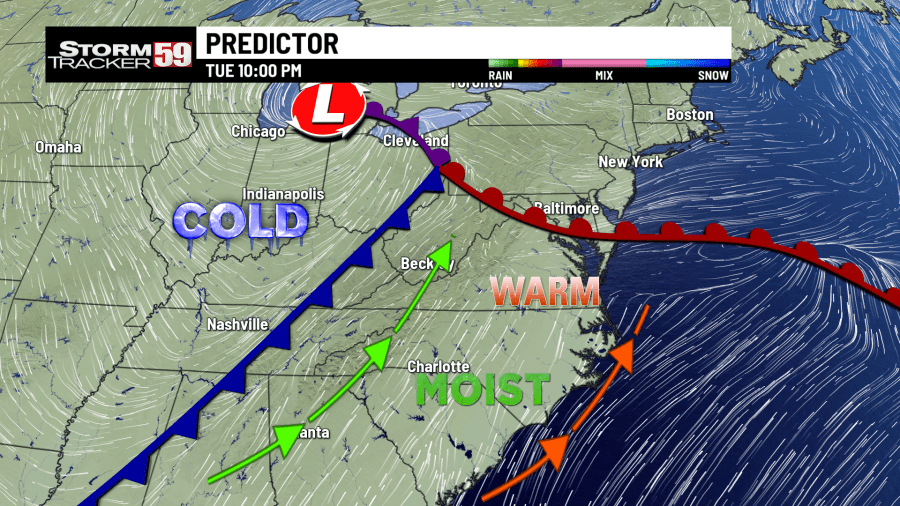
Predictor
Here is a look at Predictor for the near-term, which will automatically update each hour with the latest on what is expected to come our way!


The StormTracker 59 team has you covered to help keep you and your family safe when the threat for severe weather is possible! There are multiple ways of staying up to date with us on the latest warnings for our region that would indicate this potential threat:
On air on WVNS-TV 59 on CBS at 5 AM, 6 AM, 12 PM, 5 PM, 6 PM and 11 PM Monday through Friday and 6 PM and 11 PM on the weekends.
On air on WVNS-TV 59 on Fox at 7 AM Monday – Friday and 10 PM Monday through Sunday.
Online on our website here, where you can see the latest watches, warnings, forecast discussions, videos, current data and so much more!
The StormTracker 59 mobile app, free on the Apple and Google Play.
The StormTracker 59 Facebook page and Twitter page.
For the latest news, weather, sports, and streaming video, head to WVNS.

