Memorial Day offers up chance for severe weather

With so many eyes on the festivities of Memorial Day Weekend many eyes turn to the weather to make sure their plans are safe. Thankfully the majority of the weekend features warm and dry weather. Memorial Day itself unfortunately proves to be the one exception, with showers and storms returning to the region in force and now even potential for some storms to be severe. Let’s break it down.
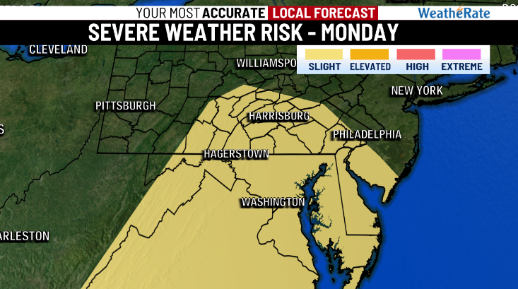
What we’re going to see Monday is the leftovers of severe weather which will batter parts of the Midwest on Saturday and Sunday. Movement of a shortwave trough into the region combined with the return of moisture in force from the south will bring the necessary ingredients into play for strong storms. To this point we expect the primary threat to be damaging winds, although isolated cases of large hail or a tornado cannot be ruled out. Localized downpours are also likely which could contribute to limited flooding of streets and other low lying areas. The day will start out with some scattered shower activity before thunderstorms start to develop in the afternoon, continuing into the evening and dissipating overnight. The storms themselves will likely form by themselves before merging together to form a line that will push through the area.
We’ll continue to keep you updated over the coming days as new model guidance fleshes out the full scope and timing of this Monday event. As always, make sure you have multiple ways to get weather information so that you can stay well-informed. For your most accurate local forecast download the ABC 27 weather app!
-Meteorologist Jackson Chastain
Copyright 2024 Nexstar Media, Inc. All rights reserved. This material may not be published, broadcast, rewritten, or redistributed.
For the latest news, weather, sports, and streaming video, head to ABC27.

