Severe threat winding down tonight
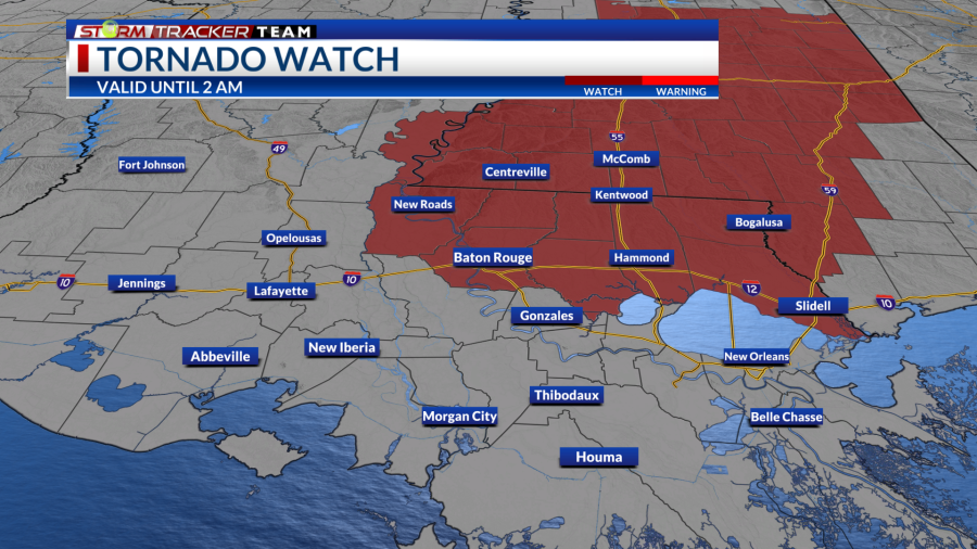
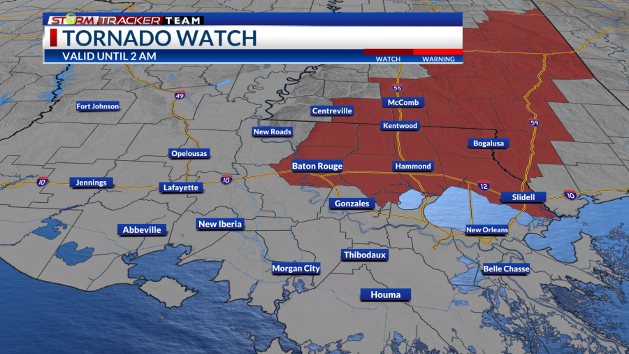
11 PM Update: A tornado watch will expire at 2 AM for areas near and north of the 10/12 corridor. This includes:
[LA]: East Feliciana, St. Helena, Tangipahoa, West Baton Rouge, East Baton Rouge, & Livingston
[MS]: Amite, & Pike
Remember, a tornado watch means that conditions are favorable to severe thunderstorms with the potential to produce tornadoes in and around the watch area.
Overview:
A cold front will be approaching the region late in the day towards the night and will likely bring a line of showers and storms out ahead of it. There is the chance that a few storms may become strong to severe. An Enhanced Risk (3/5) is placed over northern areas while a Slight Risk (2/5) is placed over the rest of the area.
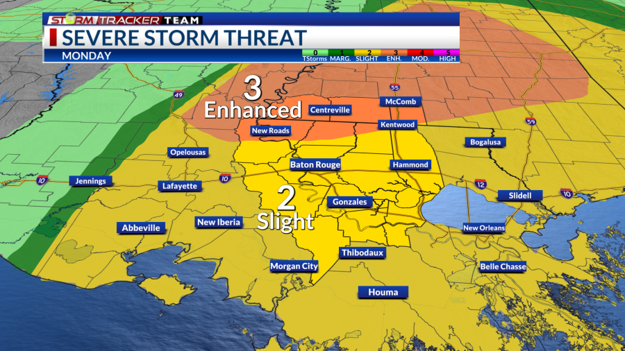
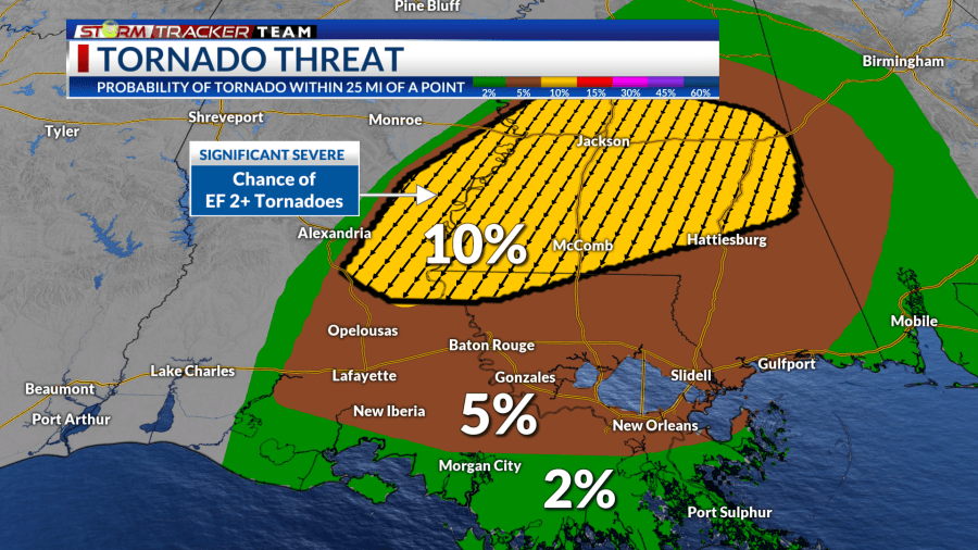
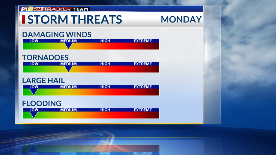
Threats:
We’ll likely see a squall line or broken line of storms move into the area presenting the main concern of damaging wind gusts. and embedded tornadoes within the main storm line as well, with the risk increasing the more north you go.
A few tornadoes may even be on the strong side (EF2+) where there is a hatched significant severe outline. There is the chance for these potent storms, but there is low confidence in them.
Some hail cannot be ruled out, but that threat is lower. We may see some downpours that produce localized heavy rainfall issues like ponding; however, widespread flash flooding is not a concern. Around 1-2″ of rain is expected with higher amounts towards Southwest Mississippi.
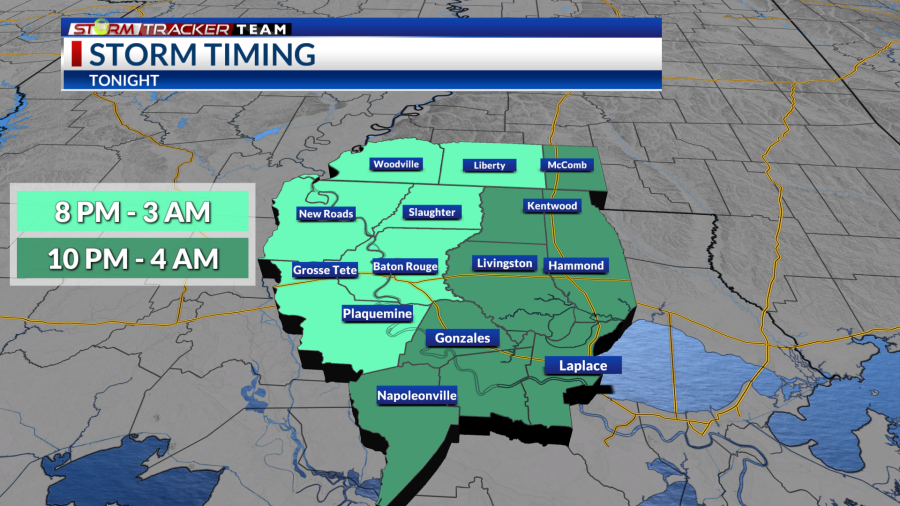
Timing:
Scattered showers will move across the area in the afternoon and early evening hours ahead of the main line. The primary line of storms will likely move into the western area during the late evening and push eastward into the overnight. Most of the rain will clear our area a few hours after midnight, but a few showers may linger in the pre-dawn hours.
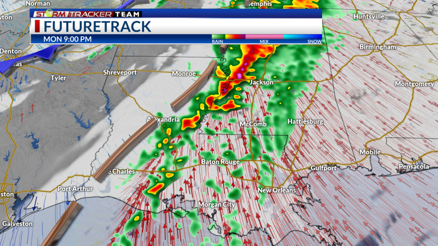
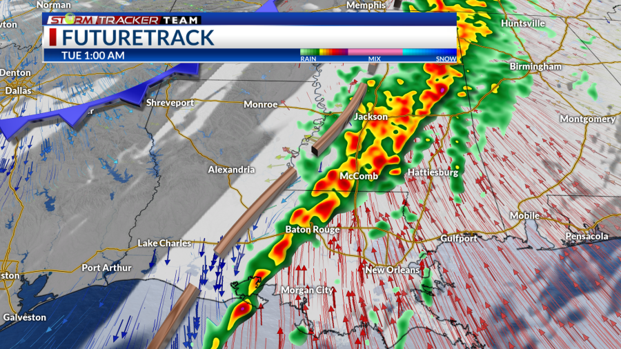
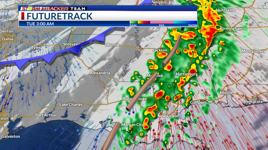
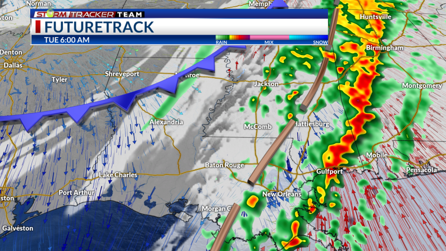
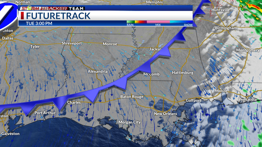
Below is the HRRR model depiction of the squall line as it moves through tonight. Give or take an hour or so with the estimated time stamps.
~9 PM Mon ~12 AM Tue ~3 AM Tue ~6 AM Tue ~3 PM Tue
How to Prepare
Be sure to multiple ways to receive weather alerts and stay tuned to updated forecasts during the day. Make sure your phone is unmuted, charged, and turned on for WEA notifications. Turn off your do not disturb and take your phone off of silent mode so those WEA alerts can push through to you.
With an overnight aspect to this event, make sure any alerts or warnings can wake you up as well.
Have a plan and a safe place to go to if a warning is issued for your location. Find a lower-level, interior room away from windows.
You can always check out the Interactive Radar here.
For the latest forecast information, check out our weather page!
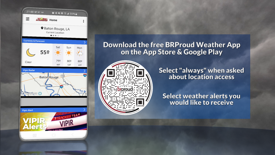
Remember that you can download our weather app. It’s available to download now in the App Store and Google Play. Just search for “BR Proud Weather”.
Follow and keep up to date with the Storm Tracker Team:
Chief Meteorologist Sam Parish – sparish@brproud.com
Meteorologist Brandon Lashbrook – Twitter | Facebook | blashbrook@brproud.com
Meteorologist Ashley Renee – Twitter | Facebook | arenee@brproud.com
For the latest news, weather, sports, and streaming video, head to BRProud.com.

