Key Bridge in Baltimore no longer appearing on Google Maps
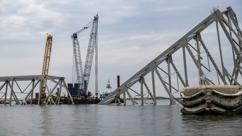
BALTIMORE, Md. (DC News Now) — Google Maps users noticed a change on Thursday — the Francis Scott Key Bridge, which collapsed in Baltimore after a barge hit it on Tuesday, March 26, no longer appears.
Screenshots and videos of Google Maps immediately following the collapse shared online showed that the bridge had been marked as closed, but users noticed Thursday that the maps show I-695 ending on either side of the Patapsco River.
Officials plan to move cargo off ship that struck Baltimore’s Key Bridge
Around 35,000 people drove across the bridge daily before its collapse. The bridge also served as an important point of entry into the Port of Baltimore.
The Maryland State Highway Administration reminded drivers to account for extra time while driving due to changing traffic patterns around where the Key Bridge used to stand. It provides a traffic information site to help plan commutes.
For the latest news, weather, sports, and streaming video, head to DC News Now | Washington, DC.

