Hilton Head drivers still seeing red. What are latest options to fix the traffic jams?
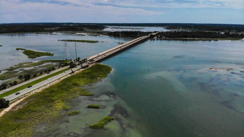
Punch in a Google Maps route across the bridges to Hilton Head Island during regular commuting hours and dark-red traffic delays scream back from the phone screen. The William Hilton Parkway Gateway corridor is red in the summer. Red during special events. A random Thursday afternoon? Red.
Maybe it’s easier to delete that search, forget about being in bumper-to-bumper traffic and nix the island trip altogether. It’s a decision that many Hilton Head Island workers have made in the past years, combined with a workforce housing shortage to force stores to close, restaurants to have longer wait times and shops to limit hours.
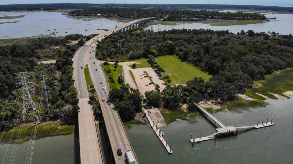
Hilton Head has a traffic problem. It impacts the character of the island and frustrates tourists, residents and workers alike. The town also has a proposed solution: the U.S. 278 corridor project to expand the four-lane bridge to six lanes. The holdup is the project’s last mile once cars get off the bridge within Hilton Head town limits. The South Carolina Department of Transportation needs approval — called municipal consent — to move forward. However, the town won’t approve the plan until they’re satisfied with an independent study analyzing different options, including the option Beaufort County and SCDOT have planned.
If the town council doesn’t agree with SCDOT and the county over an option and withholds municipal consent, “the project will have to go back to square one,” said State Sen. Tom Davis, R-Beaufort. In that case, SCDOT would likely only fix the structurally deficient part of the bridge, he said. It would leave Hilton Head workers, visitors and residents stuck in traffic without a solution.
At the same time, Hilton Head officials said they don’t want to be rushed into an option or take the decision lightly because the developments will impact the island for decades to come.
“I’m trying to balance everything between moving traffic safety, but also keeping the character of our island,” Mayor Alan Perry said at the town’s Independent Review Advisory Committee on Wednesday.
Beaufort County Council Chairman Joseph Passiment wasn’t immediately available by phone on Friday.
If the town, county and state don’t agree
Potential trouble comes if the town council doesn’t agree with SCDOT and the county on the best alternative.
“The hope is to do this whole project in one fell swoop with everybody on board together,” town spokesperson Andrew Davis said of the Town of Hilton Head, Beaufort County, and the state. He explained that if the town and county can’t agree with how to proceed with the last mile, then the state and county could do the project up to town limits.
That would push the problem over the bridge without solving it. “It would just cause a traffic jam farther down the road,” Andrew Davis said. “The bridge would be six lanes and then the rest of it would be four.”
But it’s unlikely the state and county would only partially complete the project, Sen. Davis said. What’s more probable is that the lack of municipal consent would jeopardize $120 million in funds promised by the South Carolina Transportation Infrastructure Bank and halt the project. That’s 30% of the funds with the project’s sticker price estimated at around $400 million, according to Sen. Davis, which is up from the once-estimated $328 million.
“So long as there’s good faith and so long as there’s progress toward a decision, I think that that money is in place,” Sen. Davis said Saturday of both the $120 million from the South Carolina Transportation Infrastructure Bank and SCDOT’s commitment toward covering needed extra funds. The senator estimated the SCDOT commitment totals around $200 million and said the remaining $80 million comes from Beaufort County’s one-cent sales tax passed in 2018.
The best case scenario is that the town, county, and state all agree on what’s most effective for the community, according to Andrew Davis, and then the project can move forward.
“At some point, you need to break some eggs and make an omelet,” Sen. Davis said.
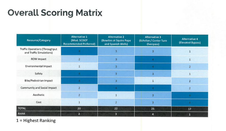
Four construction alternatives for the last mile
Right turns, left turns, bypasses, overpasses, bowtie intersections, echelons. On Wednesday, listening to the town’s independent Review Advisory Committee was equivalent to construction terminology alphabet soup.
But somewhere within the jargon, the town-hired consulting firm — the Lochmueller Group — presented and ranked four options to reconfigure the last mile of the project. In the coming months, the group will inform the town’s Independent Review Advisory Committee, which will present its preferred option to the town staff. Town staff will then inform town council, and council members will make a decision on what option the town wants for the corridor.
On Wednesday, the group hinted toward a potential hang-up by not ranking SCDOT and Beaufort County’s chosen alternative as the highest. They presented what the corridor could look like for tourists, residents and commuters to get on and off the island.
The town entered a $429,375 contract with the Lochmueller Group in October. It tasked the group with creating and evaluating potential options based on a slew of factors, including traffic and environmental impact, according to documents provided by the town. In the upcoming May 8 meeting, the group will present a more exact cost analysis. Despite not having finite numbers on Wednesday, the group was able to rank the options from least to most expensive, with Alternative One being the least expensive and Alternative Four being the most.
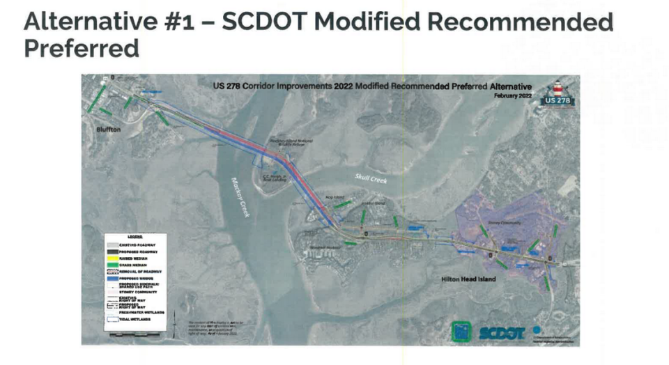
Alternative Four is an elevated highway that would go over the existing highway. While it’s ranked the highest, it’s most costly and has the largest construction impact. The SCDOT plan, Alternative One, is ranked second. This option is the least expensive and would widen the lanes of the existing corridor from four to six lanes. Residents are concerned that any option might impact the Big Stoney Historic Gullah Neighborhood and potentially displace Gullah landowners. Big Stoney includes areas along U.S. 278 from the causeway at Jenkins Island to Spanish Wells Road.
During the meeting, the advisory committee also asked for a more complete breakdown of who owns the land that would be used for each option. Under the current analysis, the consulting group said that Alternative Two and Three would impact the Big Stoney Historic Gullah Neighborhood the most.
“If you can take another route to make all this happen, then please do,” Louise Miller Cohen said of using historic Gullah land to build the corridor. “Our ancestors (...) bought land to make sure we had a place to live here on Hilton Head Island.”
Once the group identifies its final preferred alternative, it will create a model of that alternative. As of last week, there are only basic diagrams of each model. The Island Packet and Beaufort Gazette pulled from other states’ Department of Transportation materials to provide comparable visuals for the options.
Alternative One: SCDOT modified recommendation
This option involves lane widening and street-level intersection improvements throughout the corridor.
Alternative Two: Bowties at Squire Pope and Spanish Wells
They propose bowtie intersections at Squire Pope and Spanish Wells for this option.
Bowties replace left turns or right turns with roundabouts on the cross street.

Alternative Three: Echelon/center turn overpass
They propose an echelon or center turn overpass at either Squire Pope or Spanish Wells, but not both for this option.
An echelon creates a bridge and splits traffic into two levels, creating two separate intersections of one-way streets. It eliminates opposing traffic for left turns, meaning there is more green-light time for vehicles.
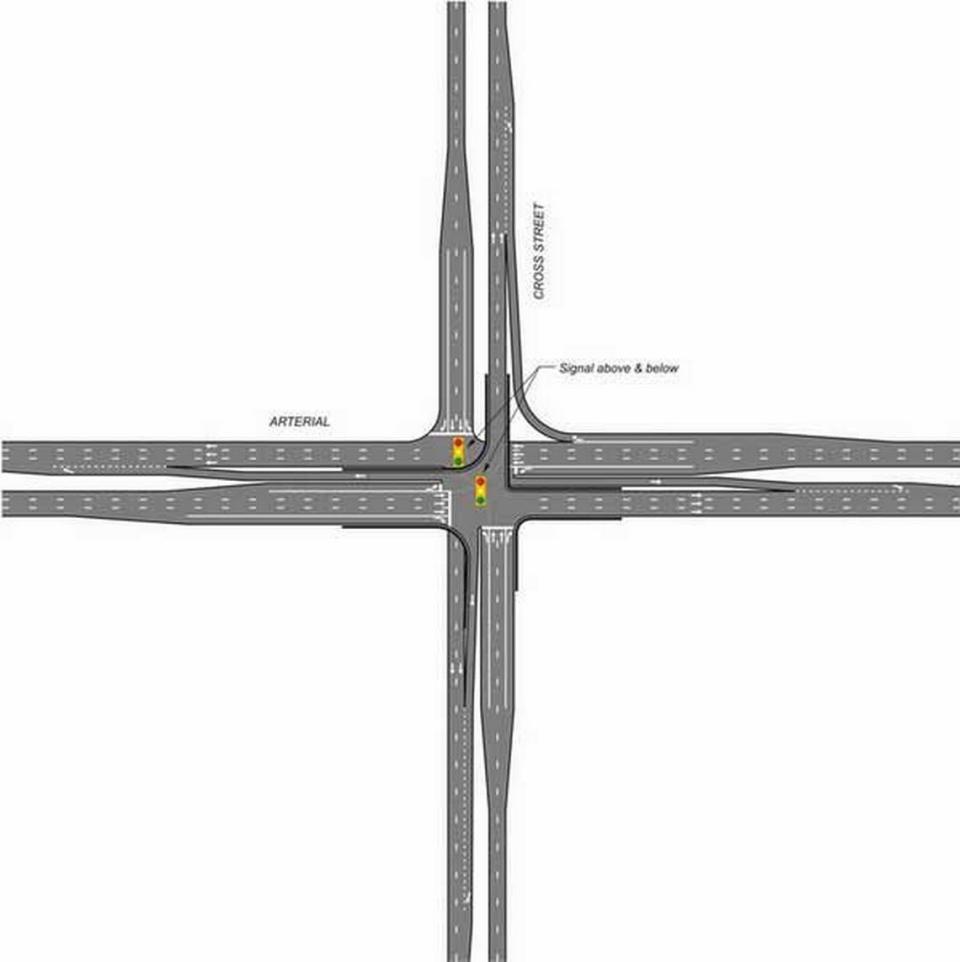
A center-turn overpass separates left-turns by relocating them to an elevated structure using narrow ramps within the median. Vehicles would go up over a bridge to turn left.

Alternative Four: Elevated bypass
An elevated bypass would be raised above the existing street-level highway, while still allowing traffic to pass underneath.
Eastbound traffic would bypass Squire Pope and Spanish Wells Roads completely and connect to the Cross Island Parkway or touch down past Gumtree Road, according to the consultants.
Westbound traffic would similarly bypass Squire Pope and Spanish Wells Roads. It would touch back down west of Squire Pope Road, according to the consultants.

