How full are SLO County reservoirs after spring rains? Here’s how the water supply looks
After a wet winter that filled three local reservoirs to overflowing, San Luis Obispo County’s water supply has been further buoyed by spring rains.
The area has seen a series of storms in recent weeks — and the trend isn’t done, with more in the forecast this weekend.
The National Weather Service predicted that weekend showers will dump more than an inch of rain in San Luis Obispo, with the majority of it falling Friday night and Saturday.
An inch of rain is expected to fall in Cambria over the weekend with about two-thirds of an inch expected in Paso Robles, the Weather Service said.
That will mean more spilling from several lakes and reservoirs in the San Luis Obispo County. Here’s a look at where they stand after a second consecutive wet winter.
How full are Santa Margarita Lake and Lopez Lake?
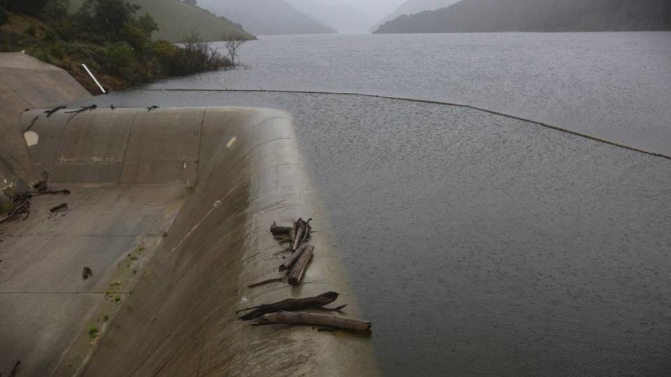
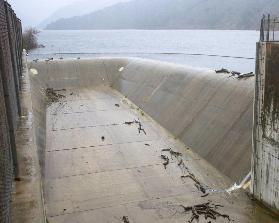
The Salinas Dam at Santa Margarita Lake was at 101.6% of total capacity as of midday Thursday, according to the San Luis Obispo County Public Works Department.
The reservoir in central San Luis Obispo County spilled on Feb 5.
It feeds the Salinas River, which runs north through Templeton, Atascadero and Paso Robles before making its way through the Salinas Valley and out to the ocean at Monterey Bay.
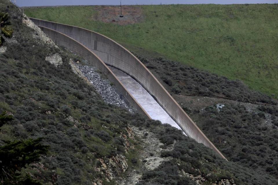
Lopez Lake northeast of Arroyo Grande was at 100.2% of capacity on Thursday, county data showed, having accumulated more than 25 inches of rain since July 1.
The reservoir spilled for the second time in 25 years on Feb. 10.
It’s located along Arroyo Grande Creek, which runs southeast through Arroyo Grande and empties into an estuary adjacent to the Oceano Lagoon.
What are water levels at Whale Rock Reservoir?
Whale Rock Reservoir just outside of Cayucos was at 100% capacity as of Tuesday, according to the city of San Luis Obispo.
In March, that reservoir spilled for the first time in 18 years, after gaining about 3.5 billion gallons of water since Jan. 1. the city said.

What about Lake Nacimiento and San Antonio Lake?
Lake Nacimiento in northern San Luis Obispo County was at 94% capacity as of Tuesday, with water levels nearly 4 feet below its 800-foot-elevation spillway, according to the Monterey County Water Resources Agency, which manages the lake’s water.
However, Monterey County officials have yet to begin releasing water from the reservoir into the Salinas River to prevent the lake from overflowing, as they did in January 2023.

Lake Nacimiento spills when it hits 377,900 acre-feet.
The lake also spilled in 1958, 1969, 1983, 2011 and 2017.
In southern Monterey County, San Antonio Lake was at 81% capacity on Tuesday, falling far short of overflowing, according to the agency.
How does that compare to California’s largest reservoirs?
The majority of California’s 17 major reservoirs were above their historic average levels as of early April, according to data from the California Department of Water Resources.
The two largest reservoirs in the state, Lake Shasta and Lake Oroville, were at 118% and 122% of their average levels, respectively.
Cachuma Lake in Santa Barbara County was at 131%, and Lake Casitas in Ventura County was at 118%.
Only two reservoirs, San Luis in western San Joaquin Valley and Castaic in Southern California, were below average.
San Luis Reservoir was at 87%, while the much smaller Castaic Lake in Los Angeles County was at 92%.
What is California’s drought status?
Two years of healthy rainfall have left California drought-free as of early April, according to the U.S. Drought Monitor.
No one in the state has lived in drought conditions since November, falling from roughly 3,000 people in October and about 9,800 people in September.
Approximately 903,000 people were living in drought areas in August.
However, roughly 4.5% of the state — parts of Inyo, Lassen, Modoc, Mono, Riverside, San Bernardino and Siskiyou counties — remained “abnormally dry” as of April 2, according to the U.S. Drought Monitor.
That’s an improvement from 7% on Feb. 27.

