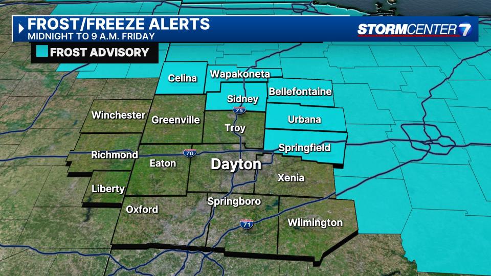
Frost Advisory in effect for northern Miami Valley counties; warm up on the way
QUICK-LOOK FORECAST:
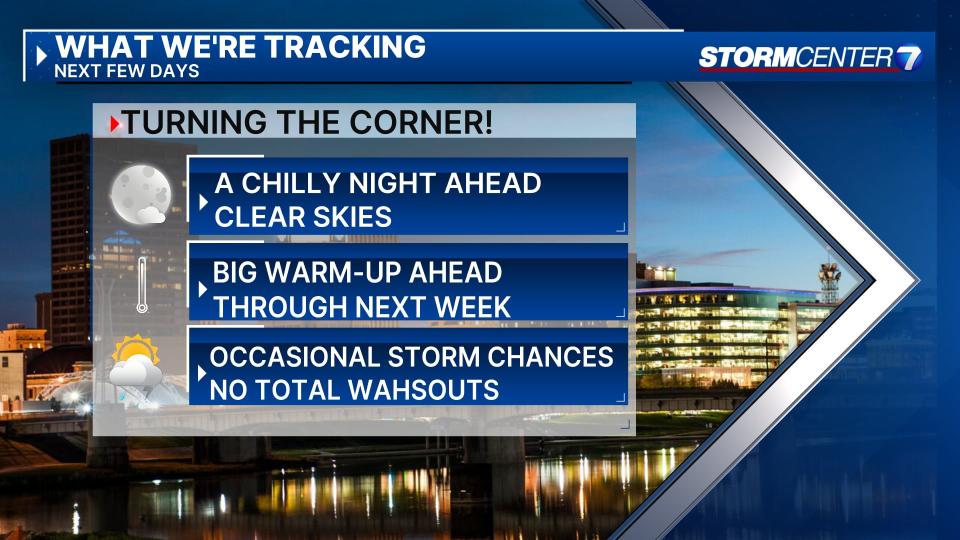
Frost possible north tonight
Big warmth on the way
Occasional rain chances late this week into next week
>>TRACK THE LATEST CONDITIONS: Live Doppler 7 Radar
DETAILED FORECAST:
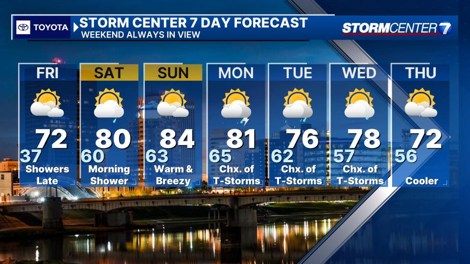
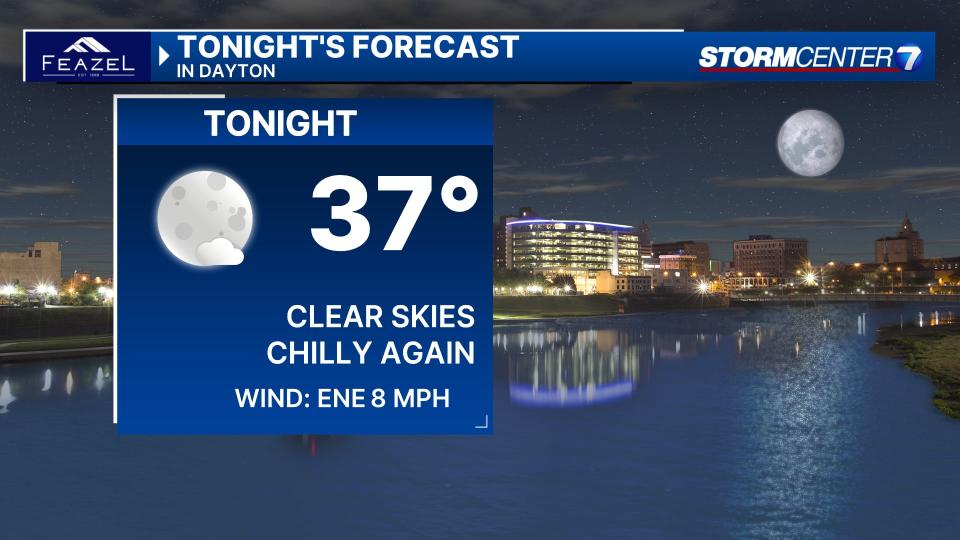
TONIGHT: Clear skies with frost possible north and northeast of Dayton. Lows generally in the middle to upper 30s. according to Storm Center 7 Weather Specialist Nick Dunn.
FRIDAY: Sunny to start the day with temperatures rapidly warming into the 70s during the afternoon with clouds building.
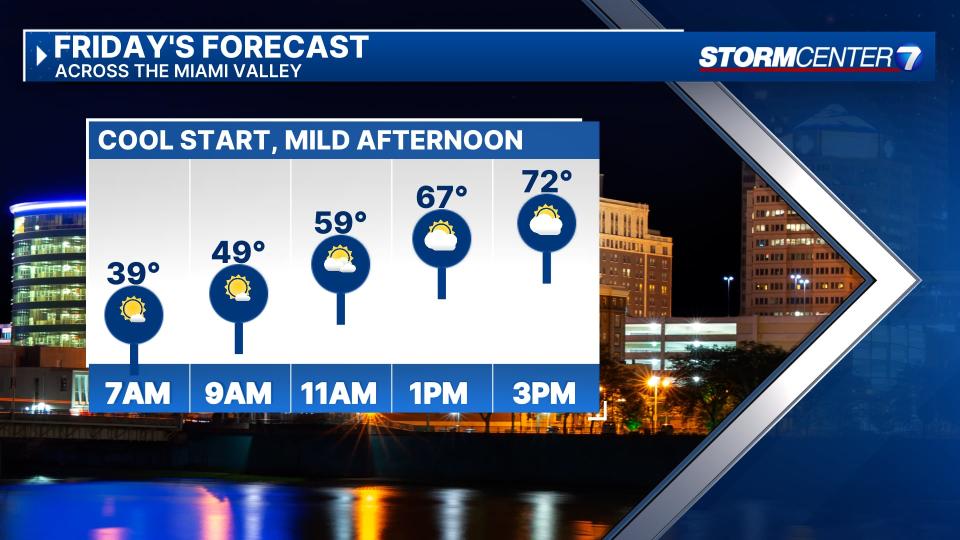
Rain looks to hold off until after 5 p.m. and we may see a few thunderstorms into tonight. No severe weather is expected.
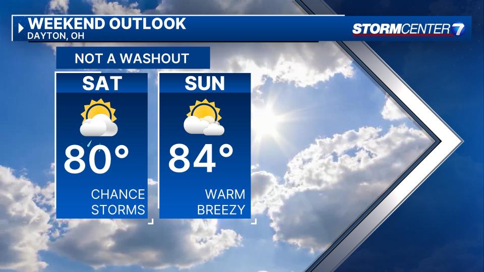
SATURDAY: A morning shower or storm possible followed by some clearing and breezy. Gusts 20 mph to more than 30 mph. Highs near 80.
SUNDAY: Breezy, warm with gusts of 20 mph to more than 30 mph. Partly cloudy with highs in the lower to mid-80s.
MONDAY: Partly cloudy with another chance for showers and storms. Breezy. Highs in the lower 80s.
TUESDAY: A chance of a few showers and thunderstorms with highs in the mid-70s.
WEDNESDAY: Chances for a few more showers or thunderstorms with highs in the upper 70s.
THURSDAY: Drier and a bit more seasonable with highs in the lower 70s. Partly cloudy to mostly sunny skies.