Europe's upcoming Mars rover now has a detailed map to aid its search for ancient Red Planet life (video)

- Oops!Something went wrong.Please try again later.
We now have a better picture of where the European Space Agency's Rosalind Franklin ExoMars rover will be driving when it lands on Mars for its life-seeking mission, all thanks to a brand new geological map of its landing zone.
"This map is exciting because it is a guide that shows us where to find the answers," said Peter Fawdon of the UK's Open University in a press statement. "It serves as a visual hypothesis of what we currently know about the different rocks in the landing site. The instruments on Rosalind Franklin will allow us to test our knowledge on the spot when the time comes."
Originally a partnership with Russia, who were providing the landing platform for the rover, the mission has been delayed since Russia's invasion of Ukraine in 2022. The new launch date is scheduled for no earlier than October 2028 as scientists revamp the mission and design and construct a new landing platform, with the intention to arrive on Mars by 2030.
Related: ExoMars: Europe's astrobiology missions to Mars
The chances of finding microbes living on Mars today is very slim given the cold, dry and irradiated conditions on the red planet, but the prevailing hypothesis is that Mars was warm and wet and potentially had conditions for life over 3.5 billion years ago. We see evidence for this in the remains of river channels, floodplains and coasts, in the mineralogy of these regions, and in the presence of organic molecules.
If life did exist long ago, perhaps its biosignatures remain locked up in Martian rocks that are just waiting to be discovered by the Rosalind Franklin rover.
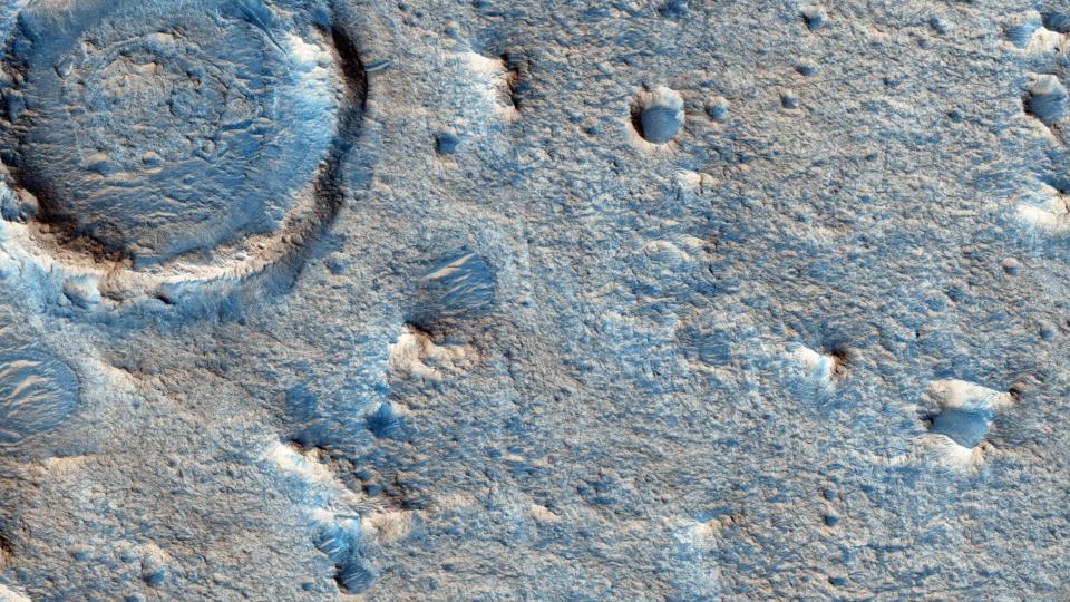
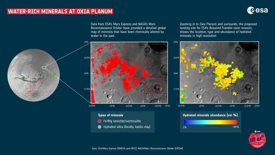
The rover's mission will involve driving many kilometers across Oxia Planum, which is a huge plain rich in clay-bearing minerals that were laid down long ago by liquid water. The rover will routinely drill 2 meters (6.5 feet) into those clay sediments and retrieve samples to be analyzed by the rover's on-board 'Pasteur' suite of instruments.
Clays are considered an excellent material for preserving biosignatures, and among the tools that the rover will use to study these samples with is its Mars Organic Molecule Analyzer (MOMA), which will test the sampled material to try and identify organic, carbon-based molecules such as amino acids, lipids and even RNA and DNA (or their Martian analog) that could only have been left behind by life. Hence why the rover has been named after Rosalind Franklin, the British chemist who played a critical role in the understanding of the structure of DNA.
However, once the rover's wheels are touching Martian dirt, scientists back on Earth need to know where to drive Rosalind Franklin to stand the best chance of achieving its goals.
The new map will therefore help scientists plan the rover's journey, with the identification of 15 specific types of geologic unit in the Oxia Planum region, including boulder fields, transverse aeolian ridges (TARs) believed to be formed by wind, widely spaced fractures, craters and their associated material such as ejecta, honeycomb material formed from polygonal and rectilinear troughs, overlying dark material, and different bedrock types and layers of sediment dating back nearly 4 billion years.
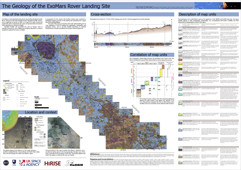
It's still not clear how all these features formed; polygonal forms have often been linked to sub-surface ice or permafrost typically found at higher latitudes, for example, but the presence of ice below the surface of Oxia Planum, which is at the low latitude of 18 degrees north of Mars' equator, has not yet been discovered (although ice has been found elsewhere near Mars' equator).
RELATED STORIES:
— European Space Agency suspends Mars rover launch on Russian rocket
— Europe's ExoMars parachute still experiencing problems in drop test
— Drilling for water ice on Mars: How close are we to making it happen?
These varied geological types, and the epochs that they originate from (the Noachian epoch dating from 4.1 to 3.7 billion years ago, the Hesperian from 3.7 to 3 billion years, and the Amazonian from 3 billion years ago to the present day) ago are color-coded on the map. It has a scale of 1:25000, meaning that every centimeter (0.4 inches) on the map represents 250 meters (820 feet) on Mars. An average daily drive by the rover of 25–50 meters (82–164 feet) would span just a few millimeters on the map.
The genesis of the map was actually a COVID-lockdown project, with 80 trained volunteers characterizing 134 discrete locations each a square kilometer in area based on data from Europe's ExoMars Trace Gas Orbiter and NASA's Mars Reconnaissance Orbiter.
The rover's lead scientists then pieced together all the information from the volunteers to build the final version of the map, which was published in the Journal of Maps.

