Damaging winds, hail may be headed our way Thursday. Here are the details for metro-east
Thunderstorms with damaging winds of up to 70 mph and golf ball-size hail are possible Thursday afternoon and evening in the metro-east, which is under a severe thunderstorm watch until 8 p.m., the National Weather Service said.
The high winds are the “greatest threat” with the storms, said Molly Gerhardt, a meteorologist in training with the National Weather Service in St. Louis.
“If the storms do form a line, some weak tornadoes are also possible but that is on the lower end of the threat,” Gerhardt said.
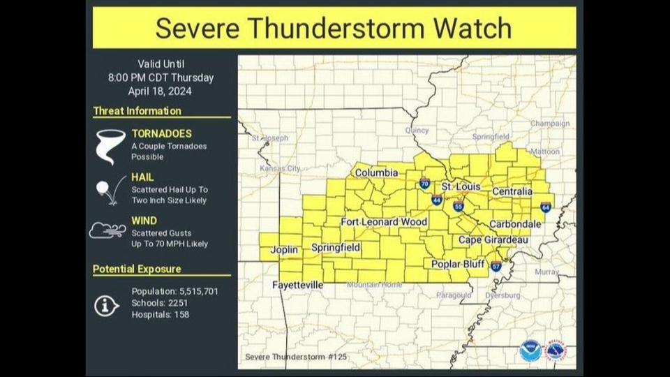
The St. Louis metro area could see storms beginning between noon and 2 p.m. and ending around 8 p.m.
Gerhardt advised evening commuters to keep a check on the forecast before they head home from work.
The storms are expected to move in a southeast direction through the St. Louis metro area as a cold front moves into the region.
And this cold front will bring a sharp change in daily high temperatures. After highs in the 80s this week, the high on Friday is expected to be about 60.
As far as the weekend, the National Weather Service forecast calls for mostly sunny skies with highs near 60.

