Clear and warm start to Monday with few showers this afternoon
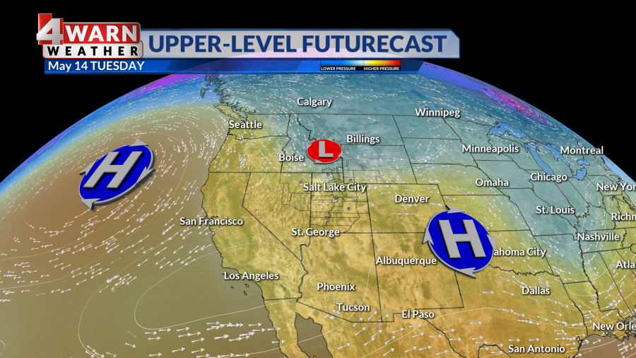
SALT LAKE CITY (ABC4) – Happy Monday, Utah! Increasing southwest flow today will help temperatures warm a bit more for the state ahead of a weak storm system moving through northern Utah this evening into Tuesday.
Bottom Line?! A series of weak troughs moving through the region Monday into Tuesday will bring showers and thunderstorms to the state.
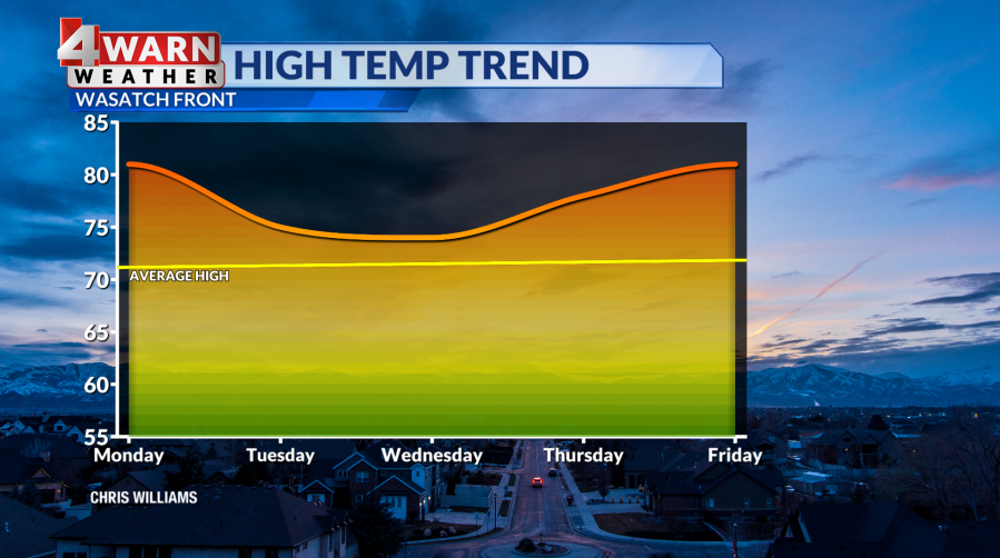
Temperatures will warm into the low 80s along the Wasatch Front with low 90s for St. George. Plan on increasing cloud cover on Monday afternoon with a chance of isolated showers this evening. Gusty outflow winds are possible from storms that do form, otherwise limited moisture is expected.
The greatest threat for showers will be over the northern mountains tonight with increasing potential statewide on Tuesday. Plan on partly cloudy skies along the Wasatch Front with a slight chance of a shower or thunderstorm.
Winds will be breezy, and temperatures will dip into the mid-70s on Tuesday afternoon and the low 70s on Wednesday. Southern Utah will see increased cloud cover from the passing storm with partly cloudy skies for St. George on Tuesday and Wednesday with breezy winds. Otherwise, temperatures will remain in the low 90s for Lower Washington County.
Beyond the midweek system, high pressure will return to the region for the latter half of the week. Ample sunshine and warming temperatures will once take over. Daytime highs will reach the upper 70s for northern Utah, possibly 80 degrees for Salt Lake on Friday. Stay tuned.
We’ll keep you updated on our 4Warn Weather forecast both on-air and online, we are Good4Utah!
For the latest news, weather, sports, and streaming video, head to ABC4 Utah.

