Active skies in place Saturday as we kick off Memorial Day weekend
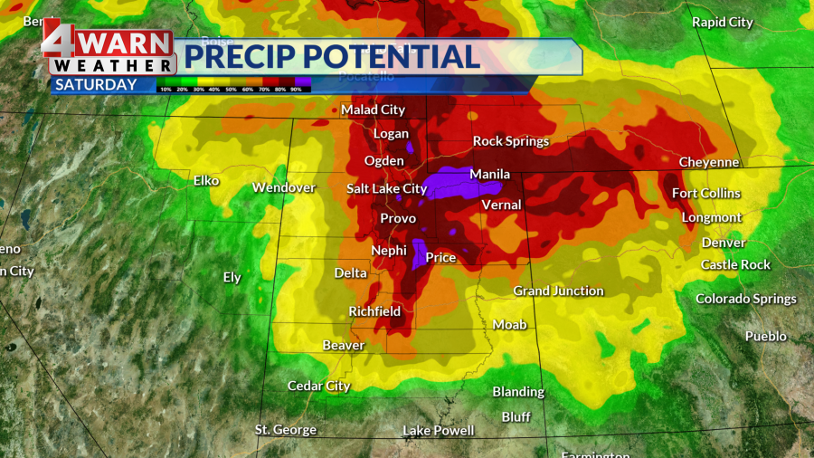
SALT LAKE CITY (ABC4) — Happy Memorial Day weekend, Utah! Many of us are waking up to a soggy Saturday and isolated showers and thunderstorms will likely grip the Beehive State through the afternoon before tapering off in the evening.
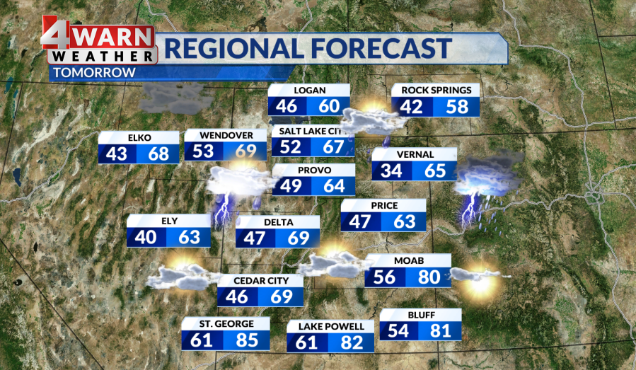
This round of wet weather was brought to us by a cold front, which means daytime highs will pull back a few degrees, dipping into the 60s for most. Meanwhile, southern Utah will see a mix of 60s and 70s with the warmest spots hitting the 80s. Higher elevations will run a bit cooler as we’d expect, but it could get cold enough for light snow accumulation above 8,000 feet, including the upper Cottonwoods and high Uintas.
Child wakes up from coma after driving toy tractor into Beaver Co. river, nearly drowning
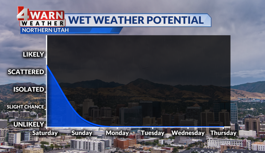
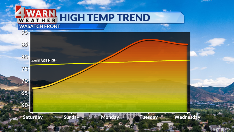
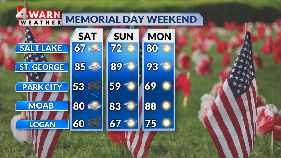
A large high pressure system will begin to build over the western United States Saturday night which will shift the weather pattern to what we like to see on holiday weekends. By Sunday we’ll have mostly sunny skies with highs in the low 70s and 80s. When Monday rolls around we’ll have perfect barbecue weather with highs along the Wasatch Front in the upper 70s to low 80s and the low 90s in St. George with plenty of wide blue skies and sunshine to go around.
Temperatures will continue heating up into Tuesday which could be the warmest day of the year so far with highs in the upper 80s to mid 90s possible. We have a solid stretch of warm dry weather to look forward to!
The bottom line? We have a bumpy start weather-wise to the weekend, but it closes out on a warm and sunny note.
We’ll continue to keep you up-to-date on the latest developments on our 4Warn Weather forecast both on-air and online, we are Good4Utah!
Copyright 2024 Nexstar Media, Inc. All rights reserved. This material may not be published, broadcast, rewritten, or redistributed.
For the latest news, weather, sports, and streaming video, head to ABC4 Utah.
