Beyond Everest: Hiking the Himalaya
You might be forgiven for thinking that Everest and its surrounds are a circus of helicopters and crowds. But after 16 days hiking a medley of trails, it’s obvious to me that the region remains a spectacular place to visit. Although the region gets 80,000 tourists a year and you are never far from another human, you can still find solitude amid the world’s highest peaks.
From the terai to the mountains
It had been eight years since my last trip to Nepal. That was a very different journey, focused on the sweaty lowlands. During that trip, my only experience of the high Himalaya came through a grubby window on flights between Kathmandu and Nepalgunj. I watched the snow-capped peaks appear suddenly from the near-constant Kathmandu haze as we climbed, then disappear again when we approached Nepalgunj, a dusty industrial-feeling terai town.
From there, I muddled my way via rammed local buses blaring Hindi hits to Bardia National Park. I spent a week tracking tigers on foot and occasionally making panicked ascents of nearby trees.
This time, I headed into the mountains with a group from World Expeditions. We were hiking a combination of Everest Base Camp, Gokyo, and Three Passes routes. This is one section of a much larger whole that World Expeditions presents. Our Everest and Rolwaling Traverse is part three of the enormous Great Himalaya Trail.
Arriving in Kathmandu from Saigon, it was obvious that neither the haze nor the traffic had improved. Kathmandu butts up against the Himalaya, and you should be able to view the mountains from the city. But Kathmandu sits in a bowl-like depression. Industrial fumes mingle with smoke from farmers burning their fields. The cocktail collects over the city, blotting out the mountains except for brief glimpses after heavy rain.
Cheerful chaos
In recent years, flights to Lukla have operated from Ramechap Airport rather than Kathmandu. Five hours outside the city, a night in Ramechap is an anti-climactic start to a Himalayan hike. A huddle of houses on a river, the liveliest place in town is the small airstrip.
At first glance, particularly through bleary, early morning eyes, the airport is utter chaos. Guides rush around collecting tickets and greeting friends, huge expedition duffels litter the ground, and an enormous crowd of trekkers and climbers mill about in similar-looking clothing, trying to work out where to go.
But there is a method to the madness, and eventually, I was bundled into a Twin Otter with other hikers. The strained sound of the small plane’s engine is familiar to many expeditioners, but it always gets off the ground all right, despite sounding like an overtaxed lawnmower.
The short flight to Lukla brought us out of the terai’s smog. We skidded to a halt on Tenzing-Hillary Airport’s iconic runway, which looks like you’re flying straight into the side of a mountain.
Lukla and the route to Everest
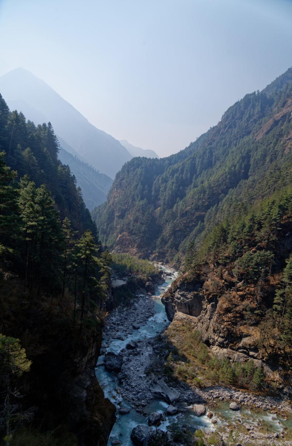
Hiking out of Lukla, the scenery is instantly spectacular. Above the town, Numbur Peak scrapes 7,000m, and ahead, the Dhudh Kosi snakes down the valley. Dhudh Kosi means “milk river” in Hindi and the rapids froth bright white among the meltwater blue.
My group consisted of a French-Canadian couple and our guide Bikash. At the end of each day’s hiking, we’d see the other members of our team, our cook Karna, and, depending on our day’s pace, perhaps our porters arriving with the cooking and camping equipment. Later, in Gokyo, we met up with three Australians hiking the full Great Himalaya Trail with World Expeditions (for six months!).
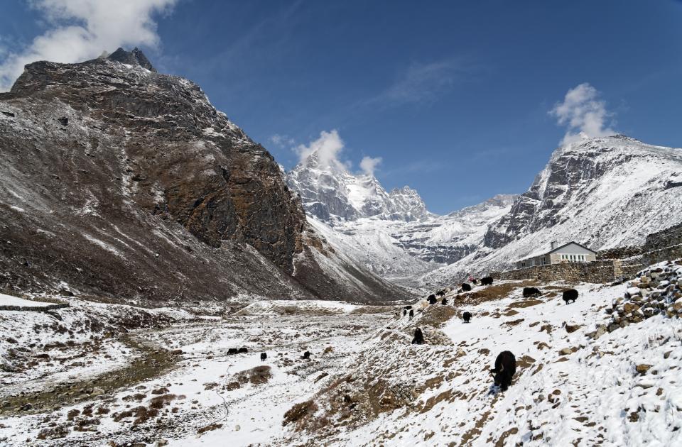
The first few days are necessarily slow to allow for acclimatization. Lukla is already over 2,800m, and you slowly climb higher as you meander through the villages to Namche Bazaar. The route is pretty busy with hiking groups, porters (some ferrying goods between villages, others attached to climbing or trekking expeditions), and beasts of burden: donkeys, horses, and chauri gai — hybrid yak-cows that fare better than yaks at lower elevations.
The government sets a standard weight allowance of 35kg for porters, and World Expeditions limits their porters to 30kg, but locals often carry substantially heavier loads. They are paid based on the weight they carry, and their loads often look eye-watering.
100kg packs
Of particular note are the porters moving cases of beer. According to our guide, their loads can approach 100kg. Others tote huge piles of timber for building. Whatever the cargo, it is balanced on the back and secured by a tump line around the head (locally called a namlo). Porters with the heaviest loads use a T-shaped stick to support the haul when they rest, wedging it under their consignment like a camping stool.
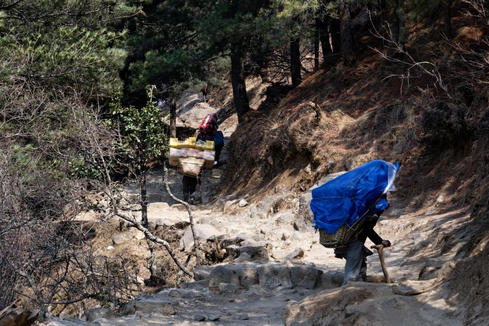
Unsurprisingly, a 2005 study found that Nepalese porters are “the world’s most efficient carriers.” Their carrying method allows them to exert only half the energy Westerners use with heavy backpacks (when the load is more than half (60%) of their body weight). It’s impressive but remains grueling and sometimes dangerous work.
This initial trail is now primarily used by groups heading to Everest Base Camp. It’s a wide, easy track, through villages that are now almost completely dedicated to tourism. There are beer gardens (including an Irish pub), bakeries, and countless teahouses.
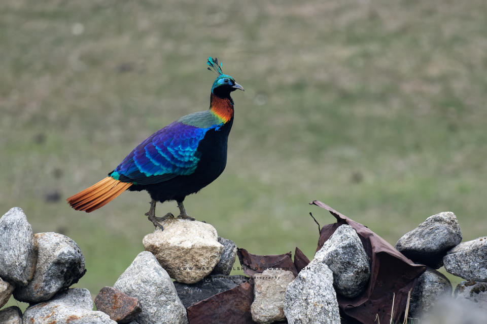
Rhododendrons, Nepal’s national flower, dot the valley flanks and Buddhist prayers line the rocks, flags, and prayer wheels around every bend. Brown dippers and water redstarts flit along the river in pleasingly dense numbers and laughing thrushes chortle through the undergrowth right by the path, seemingly emboldened by the Buddhist populations’ respect for life and the protection of Sagarmatha National Park.
Acclimatizing and inching higher
After the village of Manjo, it is a steeper uphill grind to Namche Bazaar, crossing the Hilary Bridge (which appears to have a bungee jump under construction beneath it…) and then plodding up switchbacks while avoiding descending mule trains.
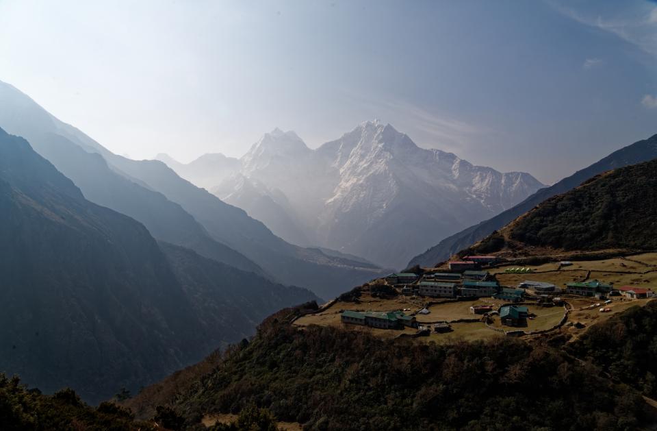
Namche Bazaar is an important acclimatization stop, and many hikers will spend two or three nights here at 3,440m. We stayed two nights, grabbing our first views of Everest and Lhotse from above town on our day off.
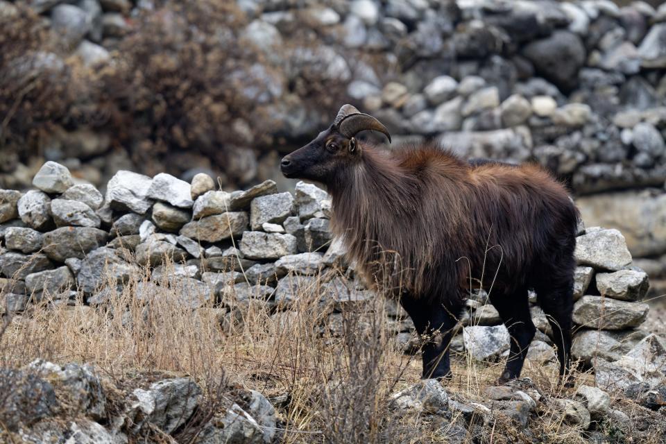
From Namche Bazaar, it is an up-and-down (“Nepali flat” as many guides are fond of joking) day to Phortse at 3,950m. Surrounded by birch forest, this is the only place I spotted mammals during the hike. Alpine musk deer and Himalayan tahr are both common. Allegedly, a fairly recent Yeti “sighting” took place in nearby Dole, but I see no evidence of a cryptid beyond a lone hirsute trekker.
Phortse is where we branch off from the Everest Base Camp route toward Gokyo. From here, foot traffic decreases significantly. There are still sporadic hikers, but the huge tour groups disappear. An occasional passing yak replaces the mule trains.
The next few days, via Dole and Machermo, are easy but bring solid altitude gains. Hiking in the Himalaya is very different from what I’m used to elsewhere. Days are very short, both in terms of distance covered and time walking. The slow speed is designed to minimize the risk of altitude sickness. This proved particularly challenging for one of our group. A semi-professional marathon runner, Melanie was fresh off an eighth-place finish in the LA marathon and was used to a much more intense cardio workout.
In the shadow of Cho Oyu
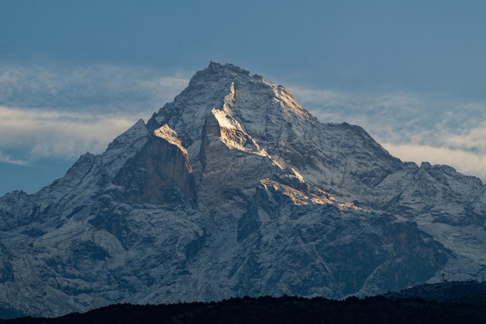
Leaving the tree line, we continued up the valley, steadily climbing toward Gokyo. Ahead, the monolithic Cho Oyu dominated the skyline, a huge block of snow and ice against the blue. To my untrained eye, it looked imposing but not incredibly technical. Looks can be deceiving. Four teams have tried Cho Oyu from the south in the last three years, and all four failed to summit.
Now well above 4,000m, most days started clear and sunny but usually clouded over in the early afternoon. We experienced snow flurries some evenings and nighttime temperatures plummeted. Even in teahouses, I now slept in my thermals. When camping, I was often in two or three layers. After eight years in Vietnam, I’m no longer adapted to the cold, and my wool beanie was now practically fused to my head, as much a part of me as my hair.
The trail flattened at around 4,700m and wound past two small alpine lakes, still partially frozen, their shores lined with stone chortens. A third lake, Dudh Pokhari, was much larger and ice-free. From the shore, a small rise hides Gokyo, a picturesque village sandwiched between the lake and the Ngozumba Glacier. At 36km, Ngozumba is the longest glacier in the Himalaya.
Editor’s note: Part two of the journey will be published next week.
The post Beyond Everest: Hiking the Himalaya appeared first on Explorersweb.

