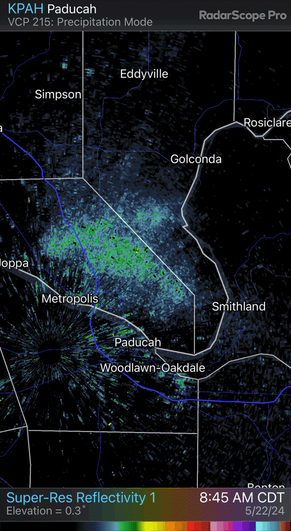
A weird image showed up on Evansville-area weather radar Wednesday. It wasn't rain.
A strange, green blob lurched across the weather radar Wednesday morning. And it wasn’t rain.
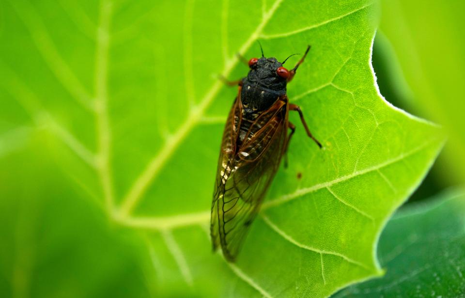
According to Justin Gibbs with the National Weather Service office in Paducah, Kentucky, the spot that flared up around the Shawnee National Forest in Southern Illinois was likely caused by a confluence of bugs. And considering the time of year, it was probably cicadas.
“It’s not terribly uncommon to see what we call biological scatters of bugs and birds and things like that on the radar,” he said. “We’ve just never noticed it in this particular spot before.”
The blip emerged along the Western Kentucky / Southern Illinois border around 9 a.m. Wednesday, its edges tinged green like a light spring rain, and its middle freckled with stronger shades of yellow.
Gibbs couldn’t be positive cicadas were to blame, but it would certainly make sense.
Spokeswoman Sue Hirsch said the Shawnee National Forest is “in the middle” of its cicada emergence right now. This spring, Illinois serves as the epicenter of a historic convergence of two cicada varieties – the 13-year Brood XIX and the 17-year Brood XIII – that are crawling out of the dirt simultaneously for the first time in more than 200 years.
Hirsch believes both types are hanging out in Shawnee, “but I’m not an entomologist,” she said.
“I have not taken a reconnaissance this week, as far as where numbers are high on each side of the forest, but people can pretty much go anywhere and any wooded area is gonna be pretty high in activity,” she said. “And noise.”
Now they’re making their presence felt on weather maps, too. Gibbs said NWS recently added a new radar “slice” that detects activity closer to the earth.
“It’s probably making it a little bit worse,” he said of the blip. “And there’s probably similar blooms going on farther away from the radar than we can see.”
This isn’t the first time a strange substance disrupted Evansville-area radar. In December 2018, a minor mystery erupted when an unexplained cluster blared across the map. Days later, the Air National Guard claimed a C-130 traveling back from a training exercise had released a massive cluster of chaff – or radar-jamming material – from its innards, briefly causing a rain-like blip to appear.
This time, the disturbance came from below instead of above.
The emerging cicadas will mate and stick around for about a month before dying off and allowing the next generation to be born. So it might not be the last time they show up on the map.
This article originally appeared on Evansville Courier & Press: What was the weird image that showed up on Tri-State weather radar?

