Updates: Tornado watch still in effect as severe thunderstorm crosses Oklahoma
Severe thunderstorms and a chance for tornadoes Thursday are moving across parts of south-central and southeast Oklahoma.
"Large hail, damaging winds, and a few tornadoes will be possible (Thursday) afternoon," the National Weather Service in Norman said. "Heavy rain/flooding also continues to be a concern."
Here's everything we know:
1:09 PM - Severe thunderstorms continue to move across portions of OK and north TX. Large hail, damaging winds, and a few tornadoes will be possible this afternoon. Heavy rain/flooding also continues to be a concern. #okwx #texomawx pic.twitter.com/9QcfxzGijl
— NWS Norman (@NWSNorman) March 14, 2024
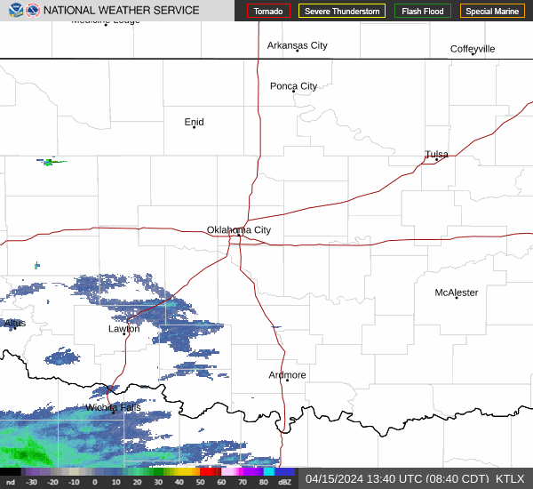
Live radar Oklahoma weather
Tornado watch issued until midnight in southeastern Oklahoma
A tornado watch has been issued until midnight for McCurtain County in the southeast corner of Oklahoma.
A tornado watch has been issued for parts of Arkansas, Oklahoma and Texas until 12 AM CDT pic.twitter.com/RUWm5saYlb
— NWS Tornado (@NWStornado) March 14, 2024
Scattered hail the size of tennis balls and gusts up to 65 mph were likely, according to the National Weather Service.
Parts of Arkansas and Texas will be under the same watch.
-Jessie Christopher Smith
Severe storms reported in central, south-central Oklahoma
Severe Thunderstorm Warning including Konawa OK, Maud OK and Bowlegs OK until 4:45 PM CDT pic.twitter.com/mu97Y3WpY4
— NWS Severe Tstorm (@NWSSevereTstorm) March 14, 2024
Meteorologists reported severe storms in parts of central and south-central Oklahoma as 4 p.m. drew near.
A severe thunderstorm warning has been issued until 4:30 p.m. for Coal and Johnston counties in southeastern Oklahoma, and for Pontotoc County in east-central Oklahoma.
Cities and towns such as Konawa, Maud, and Bowlegs, located in Seminole County, are also under severe thunderstorm warnings.
3:39 PM - New storms have begun to develop over the last hour in parts of central and south central OK. Strong to severe storms are possible into this evening with large hail, damaging winds, and a few tornadoes possible. Heavy rain/flooding also a concern. #okwx #texomawx pic.twitter.com/F3zXIoBcmM
— NWS Norman (@NWSNorman) March 14, 2024
Quarter-sized hail and 60 mph winds are possible threats, according to the National Weather Service. "A few tornadoes" are still possible, meteorologists say.
-Jessie Christopher Smith
Weather agency says tornado potential still present as storms move east
While thunderstorms continued their trajectory eastward, the National Weather Service in Norman cautioned residents in central Oklahoma and elsewhere to remain vigilant.
“You might be wondering if we are done with only a few storms ongoing. Not yet,” the weather agency posted shortly after 3 p.m. on X, the website formerly known as Twitter.
“An increase in the amount of storms is expected with severe storms remaining possible late (Thursday) afternoon and evening. Continue to keep an eye on the weather!”
3:05 PM - You might be wondering if we are done with only a few storms ongoing. Not yet. Another increase in the amount of storms is expected with severe storms remaining possible late this afternoon and evening. Continue to keep an eye on the weather! #okwx #texomawx pic.twitter.com/uaAgJ3CNMB
— NWS Norman (@NWSNorman) March 14, 2024
Shortly before 1:45 p.m., the Department of Campus Safety at The University of Oklahoma announced a tornado watch for the Norman campus, initially expected to last until 6 p.m., had ended.
“The Tornado watch has been CANCELLED for campus as the risk has moved safely east,” the department’s X account posted. "It’s spring! Always stay weather aware and #OUSafe."
-Jessie Christopher Smith
Tornado warning issued for northeastern Oklahoma
The National Weather Service issued a tornado warning for northeastern Oklahoma, including Tahlequah, Eldon, Westville, Watts, and Proctor.
Tornado Warning including Tahlequah OK, Westville OK and Eldon OK until 3:00 PM CDT pic.twitter.com/0LM65IyXBj
— NWS Tornado (@NWStornado) March 14, 2024
The warning is valid until 3 p.m.
-Jessie Christopher Smith
Tornado threat persists near Clearview in Okfuskee County
Meteorologists reported clouds were still rotating near the historically Black town of Clearview and the neighboring town of Weleetka in Okfuskee County. Storms continue an eastward path.
Rotation a tad weaker, still a tornado threat near Clearview and Weleetka, moving E. #okwx pic.twitter.com/FGyVpjg7T9
— 𝘑𝘢𝘮𝘦𝘴 𝘈𝘺𝘥𝘦𝘭𝘰𝘵𝘵 📡🌪️🤓🍷🏴☠️ (@jamesaydelott) March 14, 2024
A tornado watch will remain in place until 6 p.m. "A couple of tornadoes are possible," according to the National Weather Service in Norman.
-Jessie Christopher Smith
Severe storm warnings issued throughout south-central Oklahoma
Severe thunderstorm warnings were issued early Thursday afternoon for multiple cities and towns in south-central Oklahoma, including Davis, Dougherty, Prague, Pauls Valley, Paoli, Springer, Wynnewood, and Terral.
Pingpong ball-sized hail and wind gusts of up to 70 mph were being reported along with the storms.
Heavy rain and flash-flooding were also possible in Wewoka and Holdenville. Meteorologists advised travelers to not drive on flooded roadways.
-Jessie Christopher Smith
Tornado warning issued for Seminole County
Meteorologists issued a tornado warning for Seminole County.
Severe thunderstorm warnings were also issued for Davis, Springer, and Dougherty until 1:45 p.m.
Tornado Warning including Seminole OK and Cromwell OK until 12:45 PM CDT pic.twitter.com/lUlTORlddi
— NWS Tornado (@NWStornado) March 14, 2024
Tornado watch issued for south-central, southeast Oklahoma
A tornado watch also has been issued for areas with cities mostly south and east of Oklahoma City, including Norman, Duncan, Ardmore, Ada, McAlester, Tulsa and Muskogee.
Forecasters said severe weather and the possibility of tornadoes would develop “most likely” between the hours of noon to 6 p.m. and end around 9 p.m. Thursday.
Baseball-sized hail and damaging winds are major concerns.
A tornado watch has been issued for parts of Oklahoma and Texas until 6 PM CDT pic.twitter.com/NlEZCsN69T
— NWS Tornado (@NWStornado) March 14, 2024
Meteorologists are warning of a “medium threat” for tornadoes east of Ardmore and Ada, along with multiple storms and localized flooding.
“Persons across south-central and southeast Oklahoma should have a safety plan in place for today,” the weather agency advised.
-Jessie Christopher Smith
Weather alerts: Tornado watch, tornado warnings issued
What to do when there's a tornado watch
Be prepared — tornadoes are possible in and around the area mentioned in the watch. Be ready to act quickly.
NWS: How to prepare for a tornado
What to do when there's a tornado warning
Take action now. A warning means someone saw a tornado or one was indicated by weather radar. Under a tornado warning, there's imminent danger to life and property. Everyone should move to an interior room on the lowest floor of a sturdy building and avoid windows.
-Cheyenne Derksen
How to prepare for possible tornadoes
If you live an area where tornadoes are in the forecast, here are some tips on preparing before the storm comes:
Clean out your storm shelter or other safe space in the event you need to take shelter during a tornado
Stock an emergency kit with supplies like non-perishable food, water, medications, first aid supplies, flashlights, batteries, and a battery-powered weather radio
Have weather alerts sent to your phone and know how to monitor local news and radio stations for updates
-Jana Hayes
This article originally appeared on Oklahoman: Live updates: Tornado warning issued in Oklahoma, severe thunderstorms
