Tornado warnings, watches across St. Louis region Sunday
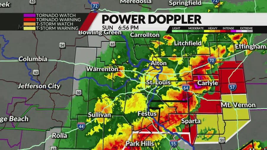
ST. LOUIS – Tornado watches and warnings are issued across the St. Louis viewing area Sunday afternoon and into the evening.
Dangerous, severe storms capable of producing large hail and possibly tornadoes are rapidly developing along a cold front.
These storms will affect metro St. Louis through 6 p.m. before dropping further south.
It is time to stay very weather-aware if you live along and south of Interstate 70!

This follows an early round of intense storms that rolled through the bi-state area Sunday morning.
Both rounds of storms present threats of heavy rain, heavy winds, hail and possibly even tornadoes. Our latest projections indicate wind gusts could reach up to 70 or 80 miles throughout Sunday.
St. Louis radar: See a map of current weather here
Afternoon storms
The morning storms are going to have a significant impact on how the afternoon storms develop. That being said, there remains a risk of strong to severe storms redeveloping this afternoon along or south of I-70. The initial redevelopment should be near I-70 and the Missouri River early this afternoon.

These storms will build southeast steadily and could become severe as they encounter a return of unstable air from the south. The highest risk for severe storms will be over southern Illinois and southeast Missouri, to the southeast of metropolitan St. Louis.
For the metro area, I’m going with a Level 2 (out of 5) risk, with a level 3 (out of 5) risk further south. All severe hazards are possible, including very large hail, flash flooding, and potentially a couple of tornadoes. The threat from this second round will be scattered and isolated.
There is a flood watch in place through 1 a.m. Monday. Behind this first round of rain, we may see some sunshine return, and temperatures will climb to the low to mid-80s with a very humid feel.
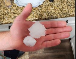
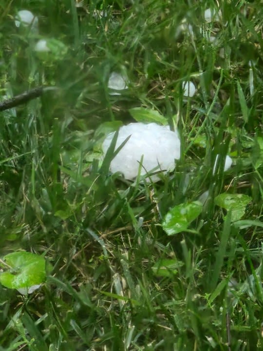
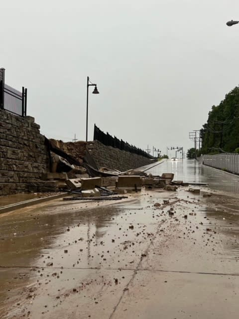
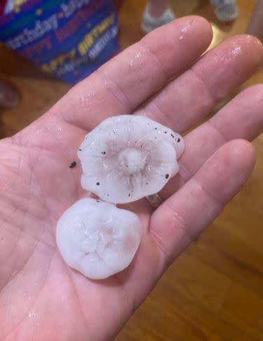
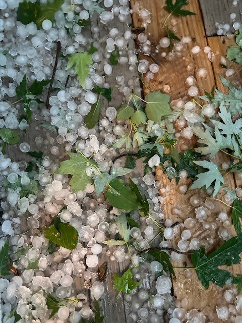
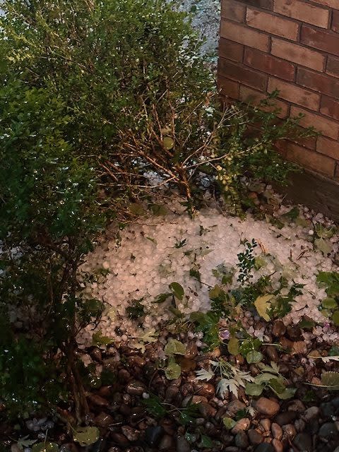
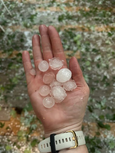
Hail in Stony Hill. (Courtesy: Glenn Zimmerman) Hail near Washington, Missouri. (Courtesy: Karen Humphrey) This is damage to a retaining wall along Woolworth Drive near Watson and Sappington in Crestwood. It is located behind the Dierbergs. (Courtesy: Kelly Fortune Krussel) This is damage to a retaining wall along Woolworth Drive near Watson and Sappington in Crestwood. It is located behind the Dierbergs. (Courtesy: Kelly Fortune Krussel) Hail in Manchester (Courtesy: Jon Davis) Hail in Ballwin (Courtesy: Kristen Christopher) Hail in Ballwin (Courtesy: Kristen Christopher) Hail in Ballwin (Courtesy: Kristen Christopher) Hail in Ballwin (Courtesy: Kristen Christopher) Hail in Ballwin (Courtesy: Kristen Christopher)


Make sure to stay weather prepared and download the FOX 2 News and Weather apps to stay on top of ever-changing conditions.
Copyright 2024 Nexstar Media, Inc. All rights reserved. This material may not be published, broadcast, rewritten, or redistributed.
For the latest news, weather, sports, and streaming video, head to FOX 2.

