Warm stretch continues this week, tracking a few storms Tuesday
EVENING: Mostly clear, very warm. Temps in the 80s.
TONIGHT: Scattered clouds and warm. Low 60.
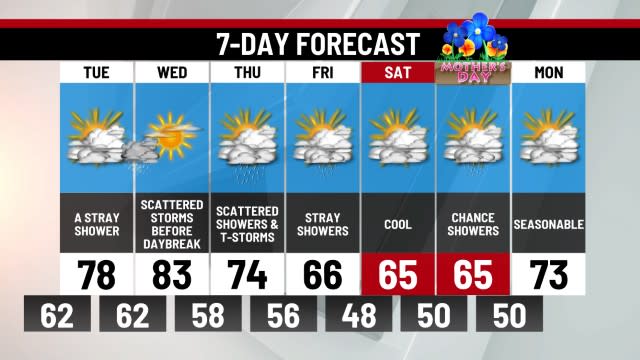
TUESDAY: Very warm, scattered storms after 4pm. High 86.
Monday’s high of 89 degrees was one degree short of tying the record high of 90 (1974) on Monday. Monday was our warmest day of the week, but we still expect several days to warm in the 80s. Tonight remains warm with temperatures in the 60s overnight.
A cold front will bring a narrow line of storms into the area Tuesday evening. Any outdoor plans after 4pm will just need to watch for pop-up storms, very similar to typical summertime storms for our area.
The rest of the week stays warm, just not quite as warm. Temperatures on Wednesday and Thursday will be in the lower 80s and both days should feature sunshine and pleasant conditions. Friday will bring increasing clouds ahead of a front that will drape itself across the area by next weekend.
The front for the weekend may stall across the state for Saturday and be stubborn to clear Sunday. At this time, Saturday could bring scattered showers with a drizzly start Sunday. Stay tuned for more updates for the weekend. We’ll be watching it.
-Meteorologist Eric Finkenbinder
For the latest news, weather, sports, and streaming video, head to ABC27.

