Storm Reports: Landspout touches down in western Kansas
WICHITA, Kan. (KSNW) — The KSN Storm Track 3 Weather team tracking the latest round of storms on Wednesday across southwest Kansas.
A tornado watch was issued until midnight for Barber, Barton, Clark, Comanche, Edwards, Ellis, Finney, Ford, Gove, Grant, Gray, Haskell, Hodgeman, Kearny, Kiowa, Lane, Logan, Meade, Ness, Pawnee, Pratt, Rush, Russell, Scott, Seward, Stafford, Stevens, Trego, and Wichita County. Beaver County, Oklahoma, was also included.

Storm Reports:
10:41 p.m.
Quarter size hail – 9 S McDonald – Rawlins County
80 MPH wind gust – Hoxie – Sheridan County
Golf ball and ping pong ball size hail – 5 NW Haigler, Dundy County, NE
2-inch hail – 1 ENE Haigler – Dundy County, NE
Quarter-size hail – 4 NW Trenton, Hitchcock County, NE
Quarter-size hail – 3 W Trenton
59 MPH Wind gust from KS Mesonet – 7 NNE Tasco – Sheridan County
74 MPH wind gust from KS Mesonet – 7 NNE Tasco – Sheridan County
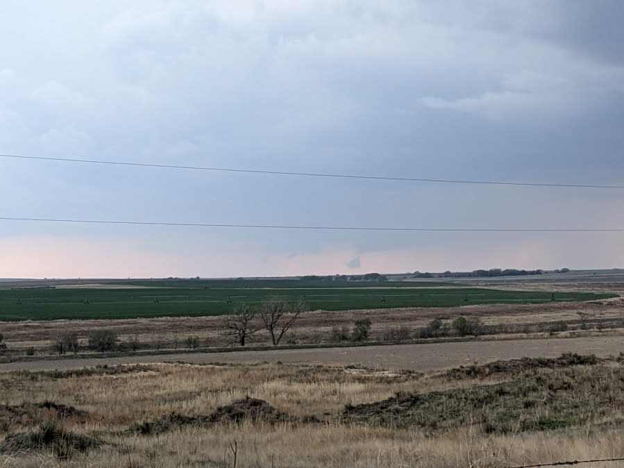
8:51 p.m.
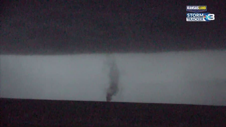
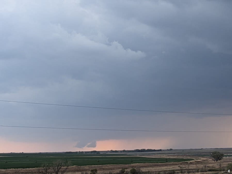
Storm Tracker 3 has a visual on a landspout in Ness County
8:33 p.m.
Tennis ball size hail reported 1 WNW Haigler, Dundy County
8:22 p.m.
Softball size hail reported in southern Gove County, 6.2 miles north of Shields on Highway 23
8:06 p.m.
Baseball size hail – Road G and 23 in Gove County
7:58 p.m.
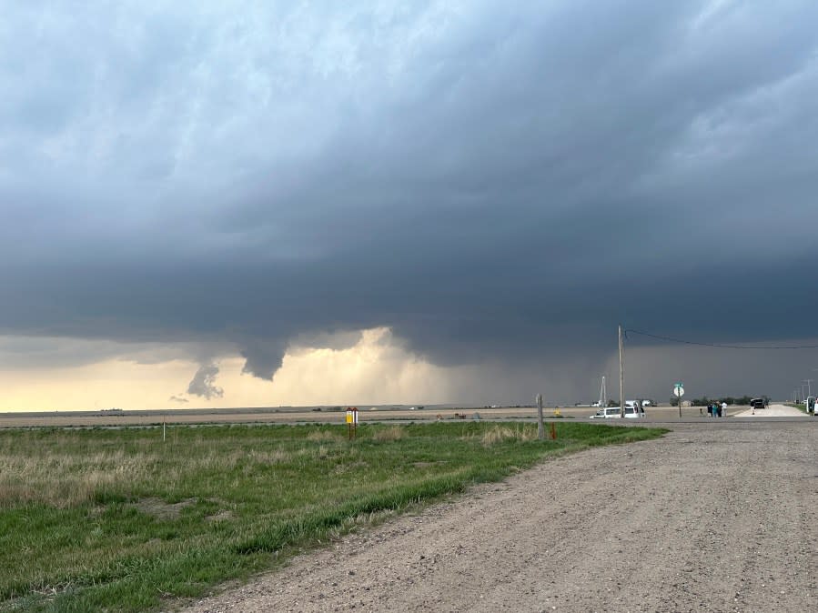
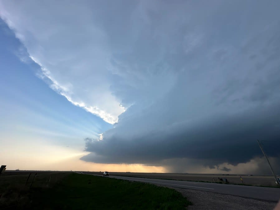
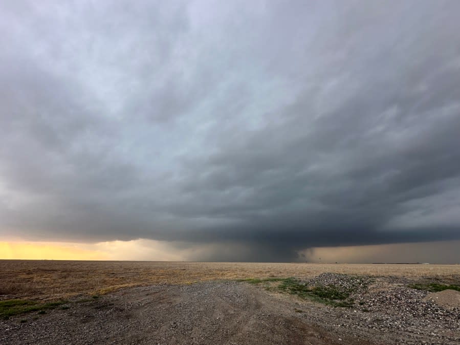
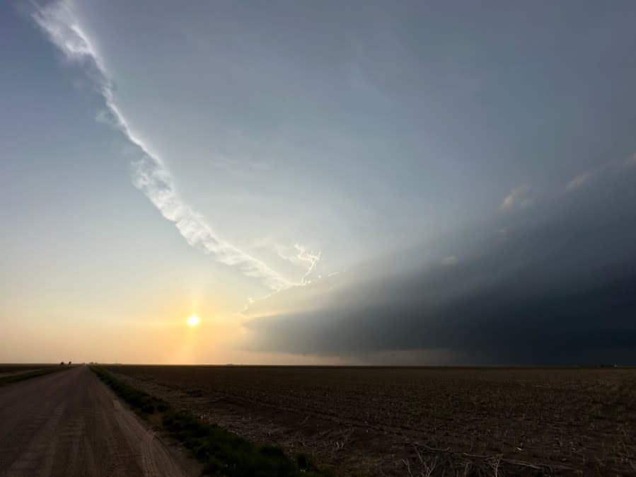
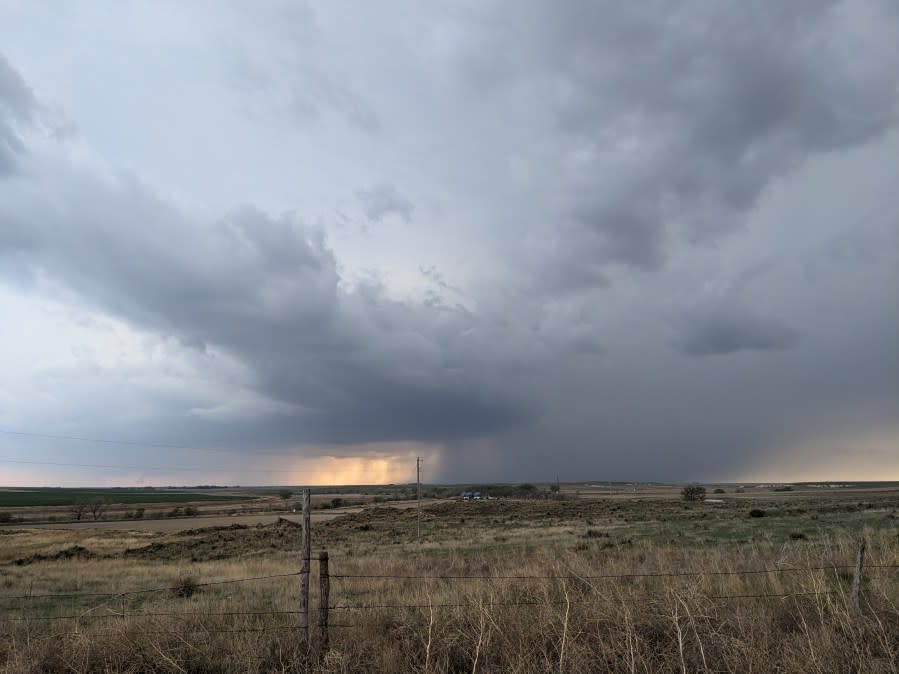
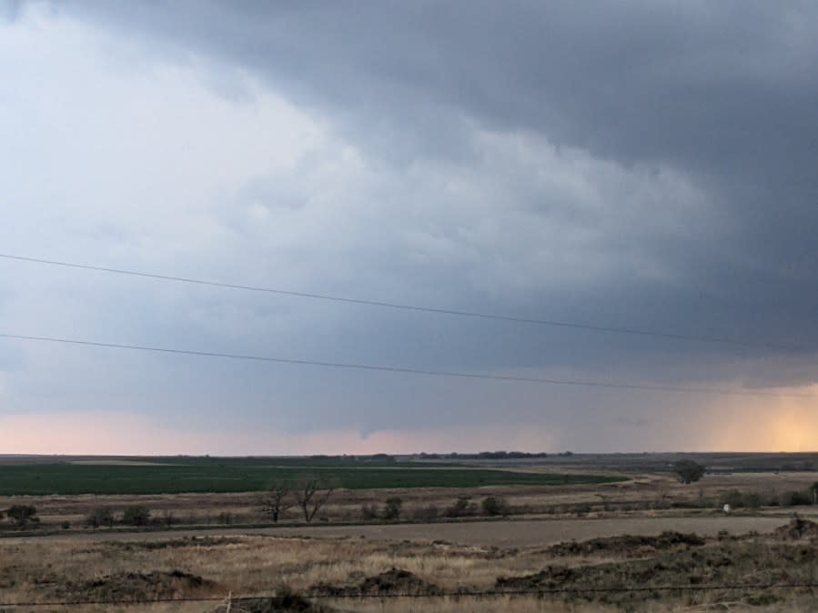
KSN Storm Trackers spot numerous wall clouds and funnels with the storms in Gove County
Weather Pictures:
Gove storm cloud on May 1, 2024 (Courtesy: Jennifer Shindley) Gove storm cloud on May 1, 2024 (Courtesy: Jennifer Shindley) Gove storm cloud on May 1, 2024 (Courtesy: Jennifer Shindley) Gove storm cloud on May 1, 2024 (Courtesy: Jennifer Shindley) Weather pictures from KSN Storm Tracker Lisa Dimmitt. Weather pictures from KSN Storm Tracker Lisa Dimmitt. Weather pictures from KSN Storm Tracker Lisa Dimmitt. Weather pictures from KSN Storm Tracker Lisa Dimmitt.
TRACKING SEVERE WEATHER
In the event of expected severe weather, KSN’s live stream replay will be shown without delay.
Severe Weather Preparedness: Interactive map shows tornado shelters in the U.S.
Interactive Radar (Control yourself)
CURRENT WEATHER WARNINGS AND WATCHES
FREE APPS
KSN STORM TRACKER 3 WEATHER APP
SOCIAL MEDIA
For the latest news, weather, sports, and streaming video, head to KSN-TV.

