Copious mountain snows and heavy rain hit B.C. into this weekend
A parade of storms will take aim at British Columbia to end this week, with periods of rain and heavy alpine snow certainly adding up. While this will be great news for ski areas that are embracing the recent hefty totals, it could also lead to slippery and dangerous travel conditions on mountain passes through the weekend.
For the northern parts of Metro Vancouver, including Coquitlam, and Howe Sound, wet snow is possible with colder temperatures in place to start, though accumulations will depend on location, and will likely remain minimal ahead of Friday's warm up.
MUST SEE: How 10 days turned the entire B.C. ski season around
Still, drivers are being urged to prepare for changing weather conditions, as snow could impact rush hour travel times during the Friday morning commute.
Thursday night into Friday morning: First low moves in with wet snow threat over Lower Mainland
The first round of the storm parade moved into B.C. late Thursday, with rain spreading over coastal Vancouver Island, and snow for the higher elevations.
For the northern parts of Metro Vancouver and Howe Sound, there could be some wet snow in mountainous areas starting Thursday night. Special weather statements are currently in effect for the wet snow threat into Friday.
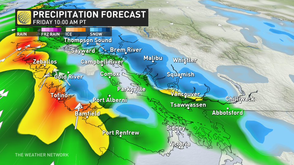
Temperatures will warm into Friday morning, however, which would melt any snow that has fallen before transitioning over to heavy rain. Still, driver's are urged to prepare for changeable weather conditions as the snow could impact rush hour Friday morning.
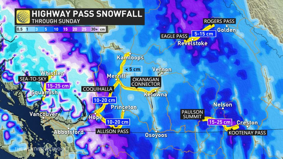
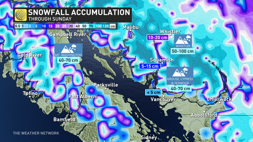
In Whistler and the Sea to Sky Highway, snow will pick up through the overnight hours on Thursday, persisting well into the weekend, with 20+ cm possible.
Friday through Sunday: Heavy rain and a hefty dose of alpine snow
Persistent and heavy rain will pick up in intensity and continue for the South Coast and Metro Vancouver, with significant totals exceeding 30-50 mm with back-to-back systems moving in through Sunday.
Even heavier amounts of rain are forecast for west Vancouver Island, with between 100-150 mm possible by the time all is said and done.
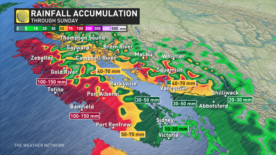
Meanwhile, freezing levels hover just under 1,000 m throughout the weekend, keeping the peaks of the North Shore Mountains as heavy snow.
Snow accumulation could vary greatly depending on the intensity of precipitation as well as the temperatures. Regardless, with the threat for 40-70+ cm in some of the harder hit areas, travel conditions will be difficult throughout the weekend. Drivers are urged to consider postponing any non-essential travel until conditions improve.
RELATED: What recent snowstorms mean for the drought and wildfire risk in Western Canada
While the rounds of rain and snow continue into the start of next week, a much milder and drier pattern is set to take shape mid-month and continuing well into the second half of March.

