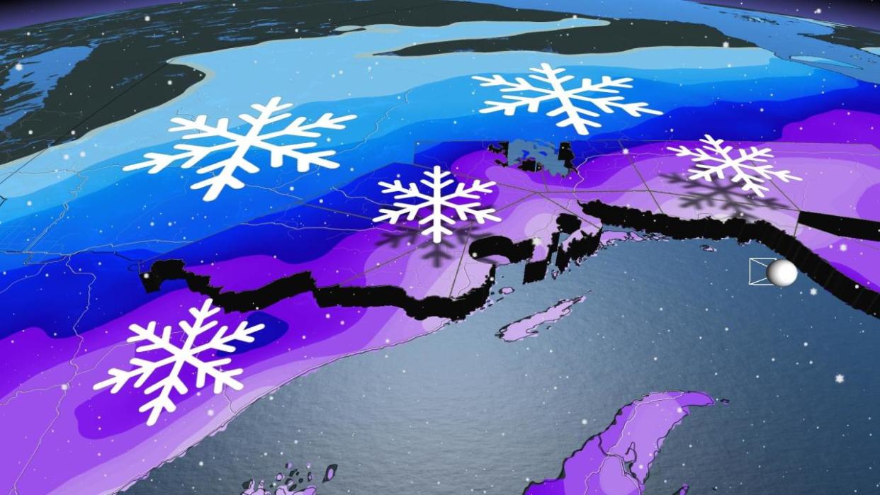
Spring storm heralds heavy, multi-day snowfall event in NW Ontario
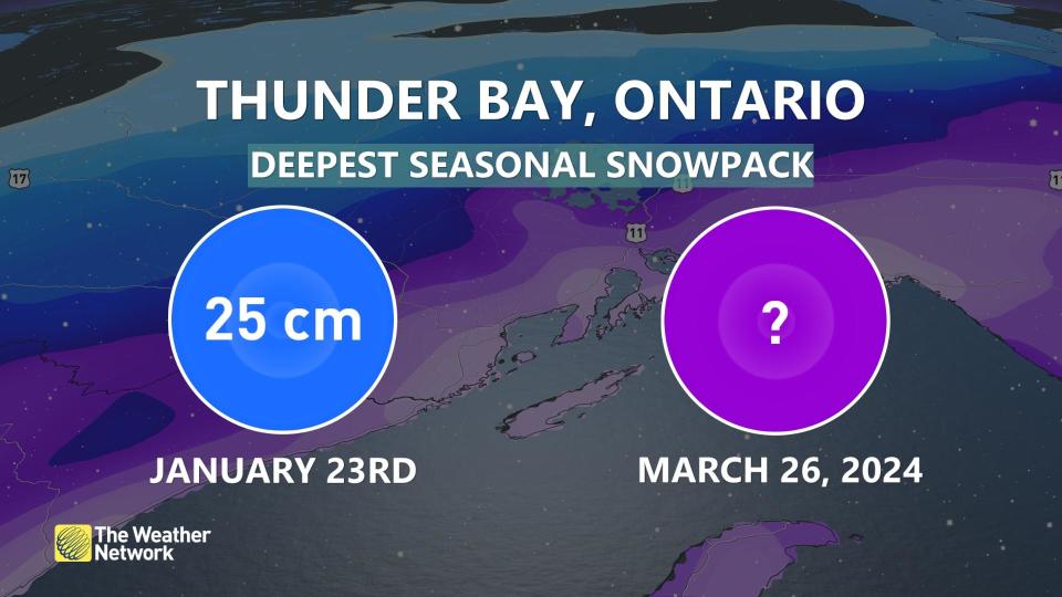
Thunder Bay, Ont., avoided a white Christmas last year and has received a lower-than-normal snowpack this past winter, but it seems like its dry luck is finally running out.
DON'T MISS: Canada’s widespread drought may fuel the upcoming wildfire season
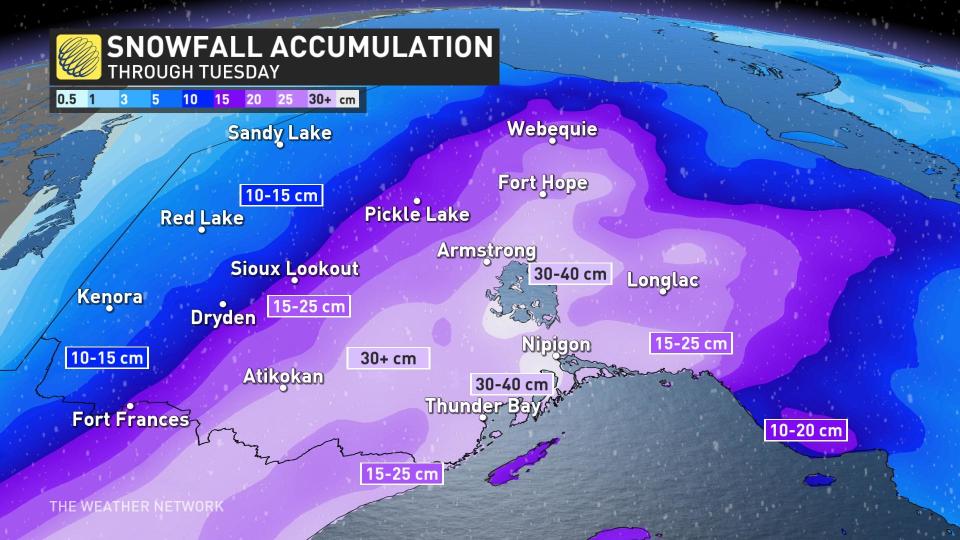
Contrary to what it normally sees, Thunder Bay's deepest snowpack has just been 25 cm since winter arrived. Now, with spring here, Mother Nature will correct that in a hurry with an incoming and slow-moving Colorado low.
Some areas could be in line for 30-40 cm, including Thunder Bay. Snowfall warnings and winter weather travel advisories are in place.
There remains some uncertainty in exact snowfall amounts through Wednesday morning as the track of this low-pressure system may shift a bit west.
Regardless of the final totals, travelling will be treacherous during the storm, especially along the Trans-Canada Highway and Highway 11. Road closures are a real possibility. Consider postponing non-essential travel until conditions improve.
Sunday to Wednesday morning: Prolonged snowfall will have major travel implications
A very slow-moving Colorado low is going to disrupt travel across northern Ontario into this week.
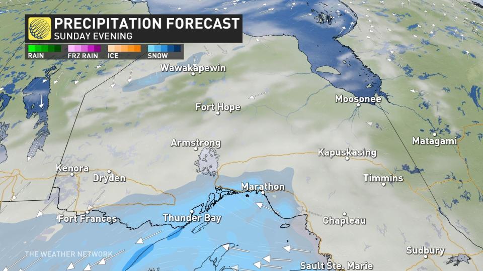
By Sunday evening, periods of snowfall will pivot across the region and fill in, with rates gradually picking up to 1 cm an hour through the overnight.
Expect slick, snow-covered roads and pockets of blowing snow by Monday morning.
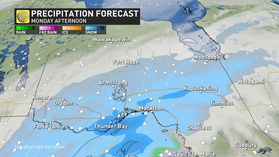
As Monday progresses, snowfall rates will hover close to 1 cm an hour through most of the day for areas near Lake Superior, with the highest risk of blowing snow along the shorelines.
The steady accumulation on roadways and blowing snow will continue to pose a moderate risk to travel. Trans-Canada Highway and Highway 11 are roadways that will need to be avoided during the storm, as the snow and winds will make driving treacherous, if not near impossible.
Come Tuesday, the heaviest snowfall rates of the event will occur, jumping to anywhere from 1-3 cm of an hour through the first half of the day.
With widespread, blowing snow still an ongoing issue, road closures and travel delays are likely during this time period. Consider postponing non-essential travel.
However, there’s still some uncertainty on the highest snowfall amounts through Wednesday morning. Some models highlight the potential for more than 40 cm of snowfall across pockets north of Lake Superior.
Be sure to check back for the latest weather updates across northern Ontario.

