Solar eclipse maps show 2024 totality path, peak times across the U.S.
A total solar eclipse crossed North America Monday with parts of 15 U.S. states within the path of totality. Maps show where and when astronomy fans could see the big event as skies darkened in the middle of the day Monday, April 8.
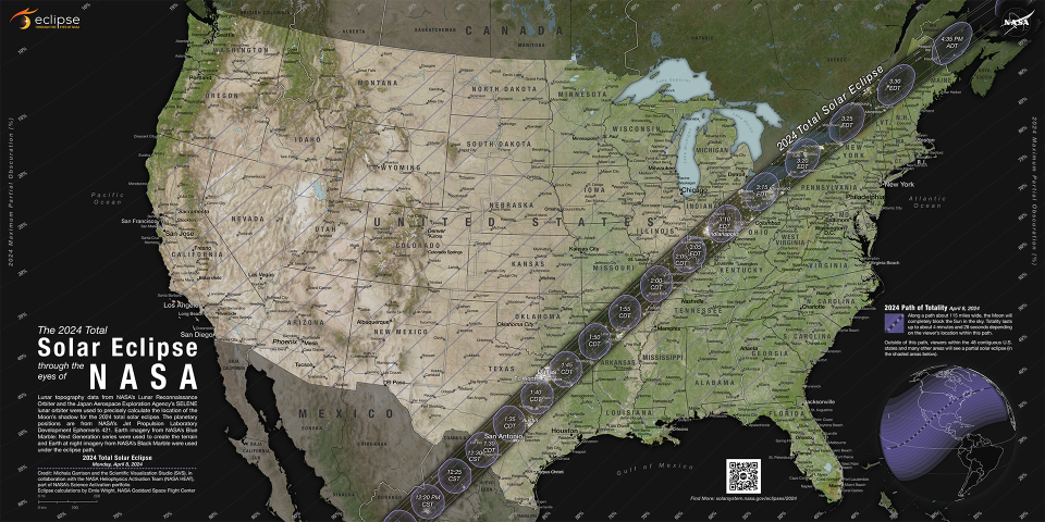
The total eclipse first appeared along Mexico's Pacific Coast at around 11:07 a.m. PDT, then traveled across a swath of the U.S., from Texas to Maine, and into Canada.
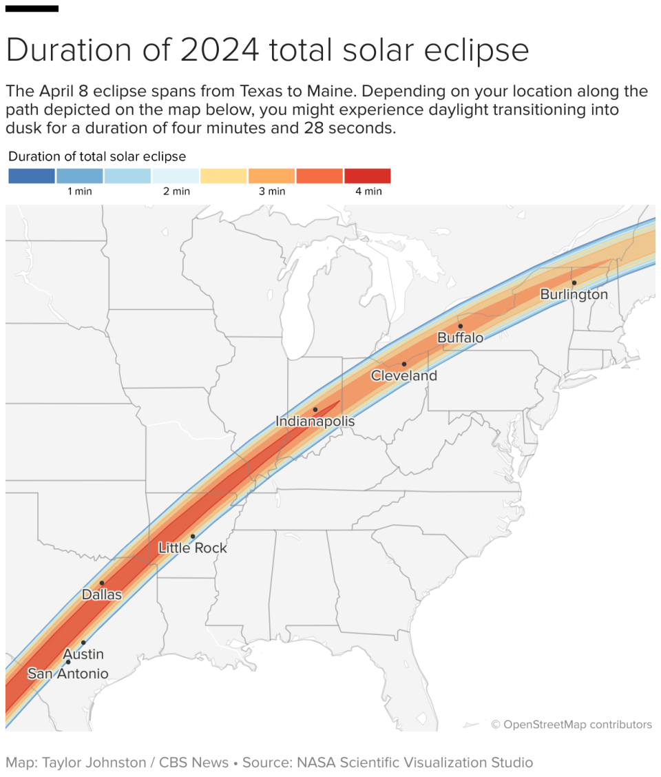
About 31.6 million people live in the path of totality, the area where the moon fully blocked out the sun, according to NASA. The path ranged between 108 and 122 miles wide. An additional 150 million people live within 200 miles of the path of totality.
Solar eclipse path of totality map for 2024
The total solar eclipse started over the Pacific Ocean, and the first location in continental North America that experienced totality was Mexico's Pacific Coast, around 11:07 a.m. PDT, according to NASA. From there, the path continued into Texas, crossing more than a dozen states before the eclipse enters Canada in southern Ontario. The eclipse exited continental North America at around 5:16 p.m. NDT from Newfoundland, Canada.
The path of totality included portions of the following states:
TexasOklahomaArkansasMissouriIllinoisKentuckyIndianaOhioPennsylvaniaNew YorkVermontNew HampshireMaine
Small parts of Tennessee and Michigan also experienced the total solar eclipse.
Several major cities across the U.S. were included in the eclipse's path of totality, while many others saw a partial eclipse. These were some of the best major cities for eclipse viewing — though the weather was a factor:
San Antonio, Texas (partially under the path)Austin, TexasWaco, TexasDallas, TexasLittle Rock, ArkansasIndianapolis, IndianaDayton, OhioCleveland, OhioBuffalo, New YorkRochester, New YorkSyracuse, New YorkBurlington, VermontMap of when the solar eclipse reached totality across its path
The eclipse began in the U.S. as a partial eclipse beginning at 12:06 p.m. CDT near Eagle Pass, Texas, before progressing to totality by about 1:27 p.m. CDT and then moving along its path to the northeast over the following few hours.
NASA shared times for several cities in the path of totality across the U.S. People could have also checked their ZIP code on NASA's map to see when the eclipse was to reach them if they were on, or near, the path of totality — or if they saw a partial eclipse instead.
!function(){"use strict";window.addEventListener("message",(function(a){if(void 0!==a.data["datawrapper-height"]){var e=document.querySelectorAll("iframe");for(var t in a.data["datawrapper-height"])for(var r=0;r
NASA to launch rockets into total solar eclipse path
Thief says he tried on, then melted down Yogi Berra World Series rings | 60 Minutes

