Severe weather threat continues into Memorial Day weekend

NASHVILLE, Tenn. (WKRN) — Stay weather aware this holiday weekend as we will have rounds of strong to severe storms. It will not be a washout, but you need to pay attention to the weather.
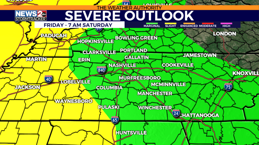
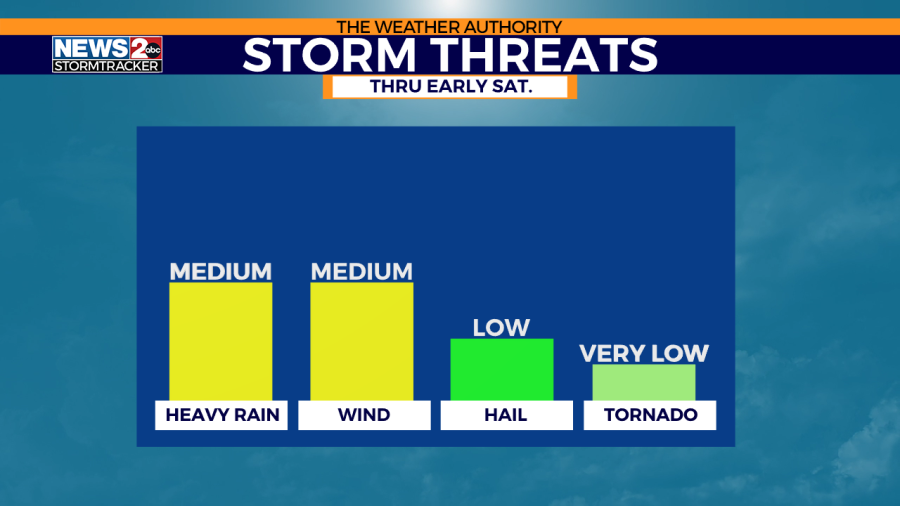
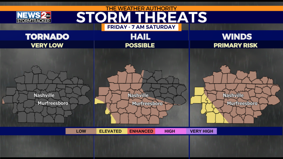
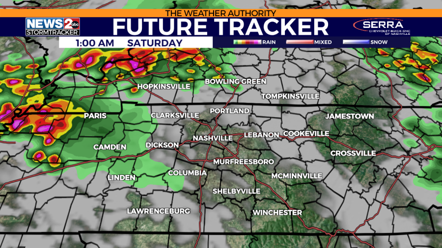
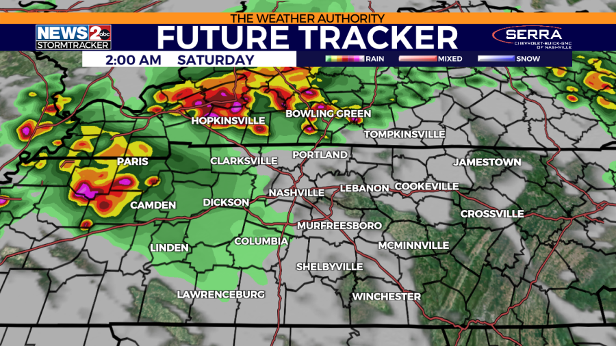
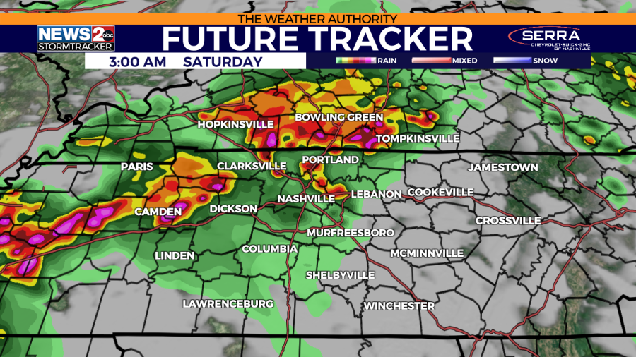
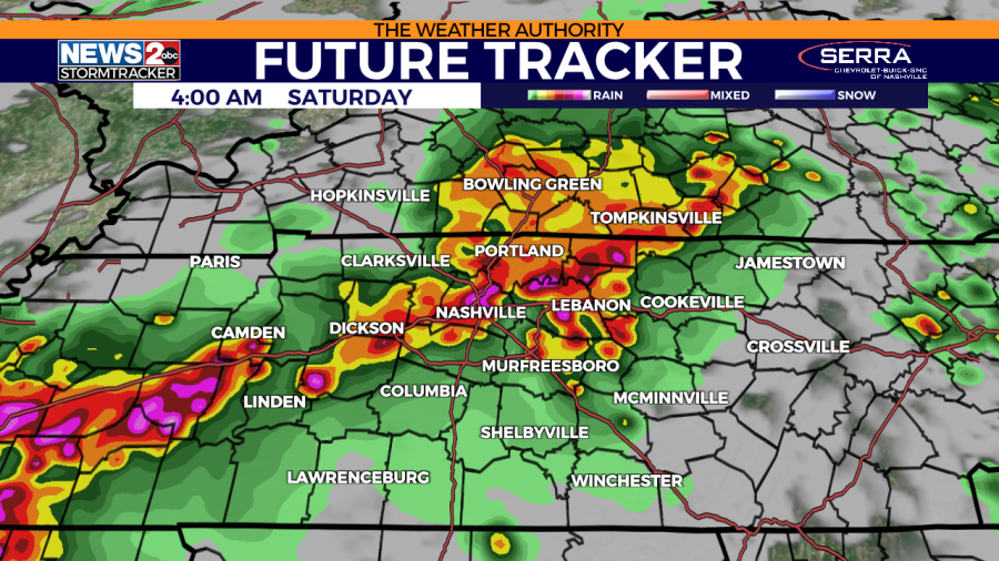
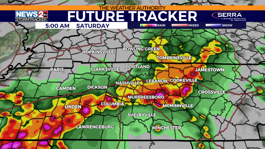
Tonight into early Saturday, there is a severe risk for all of Middle Tennessee and Southern Kentucky. There is a Slight Risk (level 2/5) for areas in western areas near the TN River into western Southern Kentucky and near the TN/AL border, and a Marginal Risk (level 1/5) the rest of our area. Wind gusts, heavy rain, lightning, and hail are the primary severe weather hazards. The tornado risk overall is very low.
RADAR | Track weather across TN live
FORECAST: Middle Tennessee & Southern Kentucky Weather
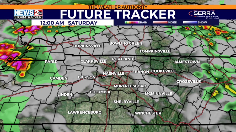
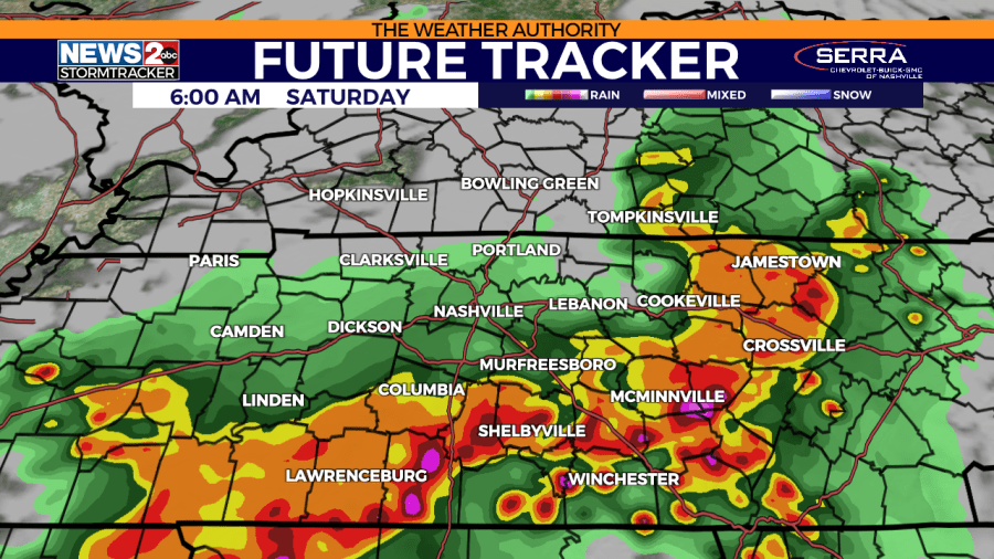
A complex of strong storms will arrive after midnight and continue into early Saturday. They should clear out by mid-morning.
ALERTS | Weather advisories in Middle Tennessee
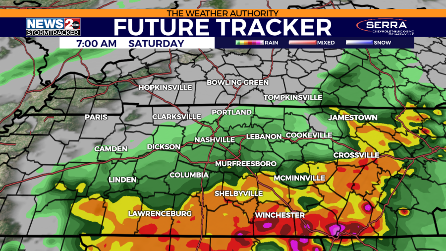
On Saturday, the prior Marginal Risk has been removed for the area, thanks to the early morning storms mentioned above. Saturday afternoon will feature a mixture of clouds and sunshine with very humid and breezy conditions. A stray shower or storm may develop in the afternoon but overall most areas will be dry.
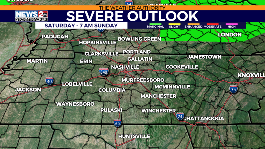
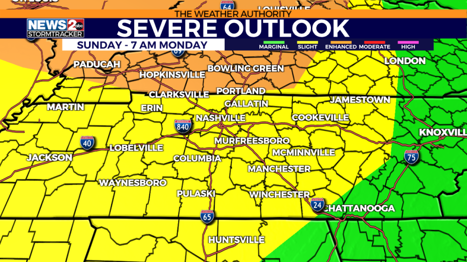
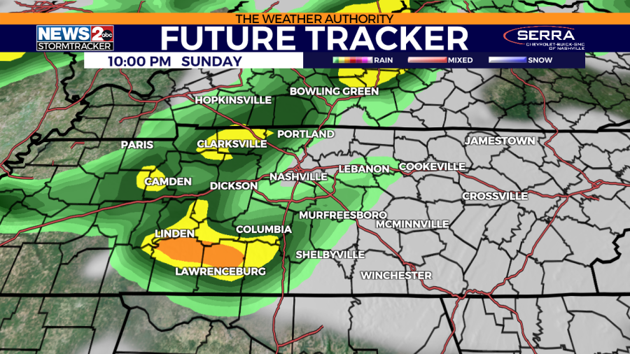
Sunday afternoon through early Monday morning is the time frame where you will need to stay weather alert as the Storm Prediction Center has put most of Middle Tennessee and all of Southern Kentucky under a Slight Risk (level 2/5), with an Enhanced Risk (level 3/5) for most of Southern Kentucky. All modes of severe weather are possible including tornadoes, wind, hail, and heavy rain.
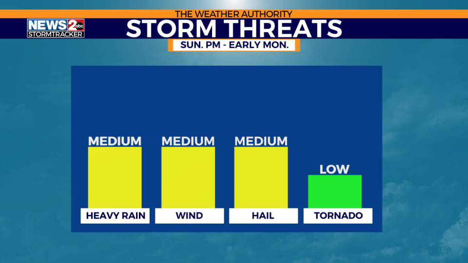
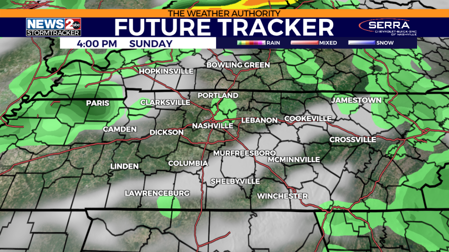
Sunday afternoon, several discrete storms are likely to form ahead of the main complex of storms. These storms will be moving into a very warm and humid environment, providing prime conditions for severe weather development. Any discrete storms that form will pose a threat for tornadoes, strong winds, and hail.
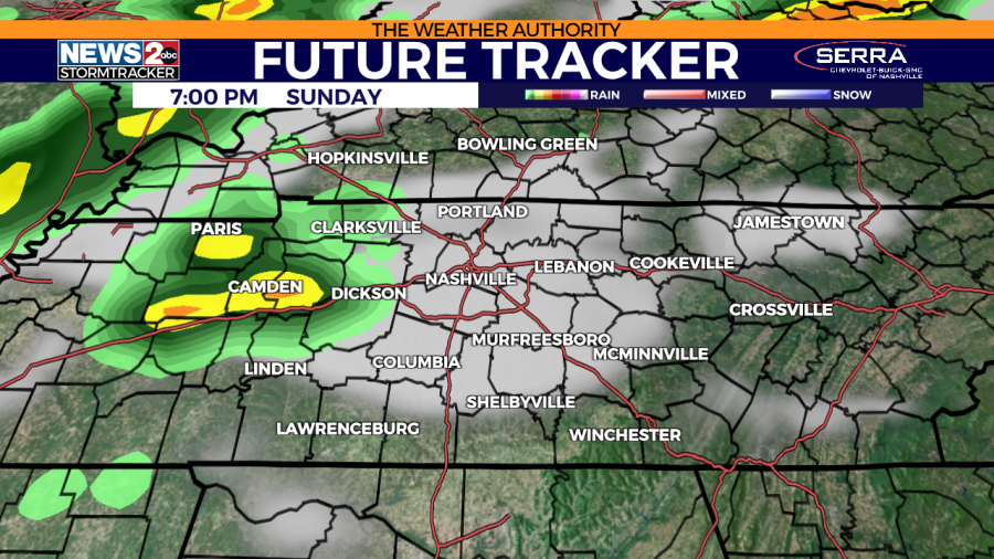
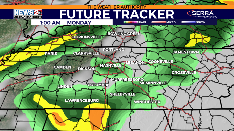
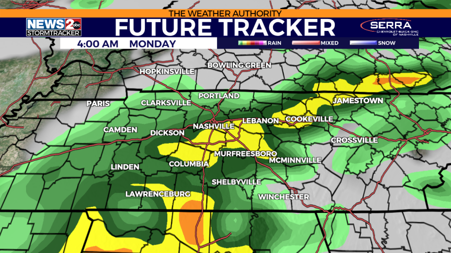
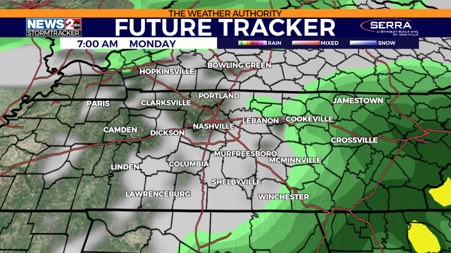
The main line of storms will move into Middle Tennessee late Sunday into the early morning hours of Monday. Severe storms will once again be likely with gusty winds being the main threat, but tornadoes and hail will also be possible. The storms will first develop and enter Southern Kentucky, then dive southward into Middle Tennessee, moving out of the area by Monday morning.
⏩ Read today’s top stories on wkrn.com
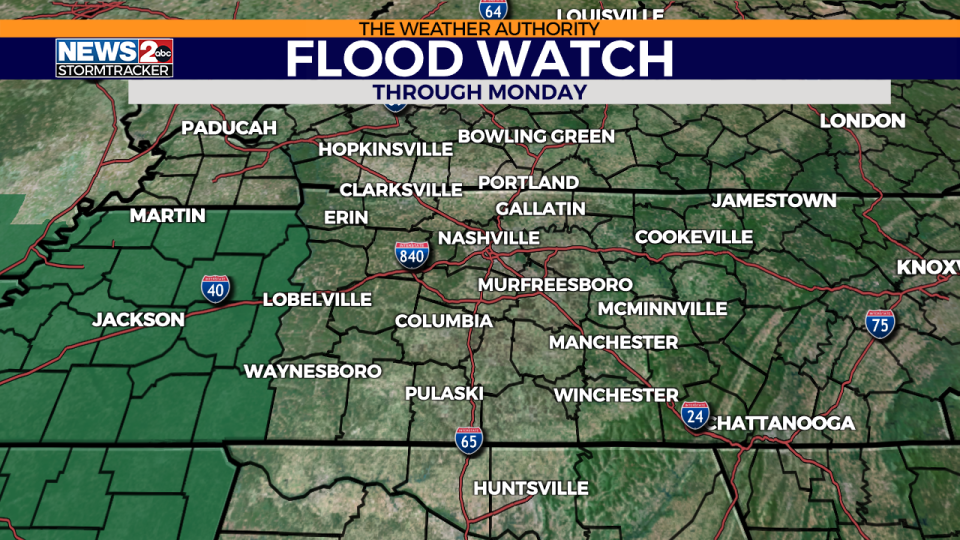
With all the rain we are anticipating, a flood watch was issued through Monday for Benton, Decatur, Carroll & Henry counties.
Don’t forget to take the power and reliability of the WKRN Weather Authority with you at all times by downloading the News 2 Storm Tracker app.
Copyright 2024 Nexstar Media, Inc. All rights reserved. This material may not be published, broadcast, rewritten, or redistributed.
For the latest news, weather, sports, and streaming video, head to WKRN News 2.

