Severe storms brewing over Brevard County
Strong storms have fired up this afternoon over Brevard County, downpours and lightning continue to develop.
▶ WATCH CHANNEL 9 EYEWITNESS NEWS
Small hail and pockets of damaging wind are possible in stronger storms through around 7pm.
Just after 4pm, a severe thunderstorm warning was issued for Brevard County until 5:15 p.m EDT.
Read: Boeing Starliner Now Targeting a June 1st Launch Attempt
At 4:02 p.m. EDT, a severe thunderstorm was located over Titusville Airport, moving southeast at 10 mph.
At 4:28 P.M. EDT, a severe thunderstorm was located over Sharpes, moving southeast at 15 mph.
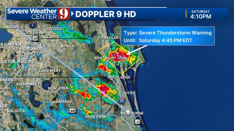
Both storms had hazardous 60 mph wind gusts and quarter-size hail.
Storms over the rest of Central Florida will be isolated, but take temporary cover if they pass through your neighborhood this afternoon. Stay lightning aware with our app!
Read: Man arrested, charged in connection to Apopka bank robberies
Follow our Severe Weather team on X for live updates:
Click here to download our free news, weather and smart TV apps. And click here to stream Channel 9 Eyewitness News live.

