Satellite imagery shows devastation left behind from EF-4 tornado in Greenfield, Iowa
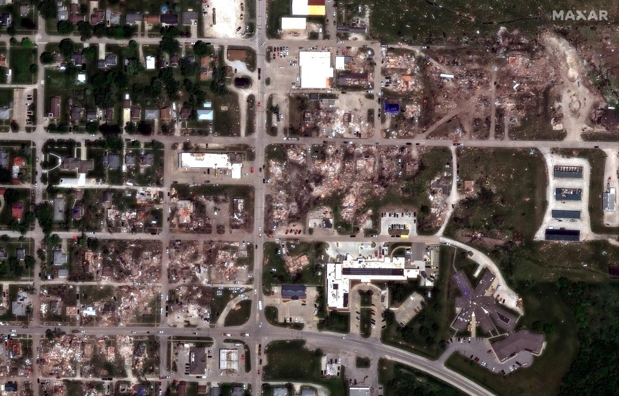
GREENFIELD, Iowa -- Satellite imagery is giving a new perspective on the damage left behind from the devastating E-4 tornado that swept through Greenfield, Iowa on Tuesday.
The storm left five dead and dozens injured as it left much of the town of 2,000 people in ruins.
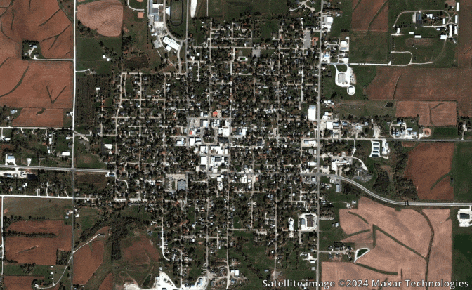
Maxar's satellite shows the path of the tornado starting its destruction in the southwestern corner of the town, leveling homes and businesses through the heart of the town and into the northeastern corner.
DEADLY GREENFIELD TORNADO RATED EF-4 WITH HIGHEST WINDS OF 2024 YET
The National Weather Service storm survey team estimated the tornado was on the ground for nearly 44 miles and was over a half-mile wide. Meteorologists estimated the peak wind speeds were at 175-185 mph, rating the tornado an EF-4 and making it the strongest measured tornado so far of the 2024 season.
Original article source: Satellite imagery shows devastation left behind from EF-4 tornado in Greenfield, Iowa

