San Marcos to use federal grant to protect Sunset Acres neighborhood from flooding
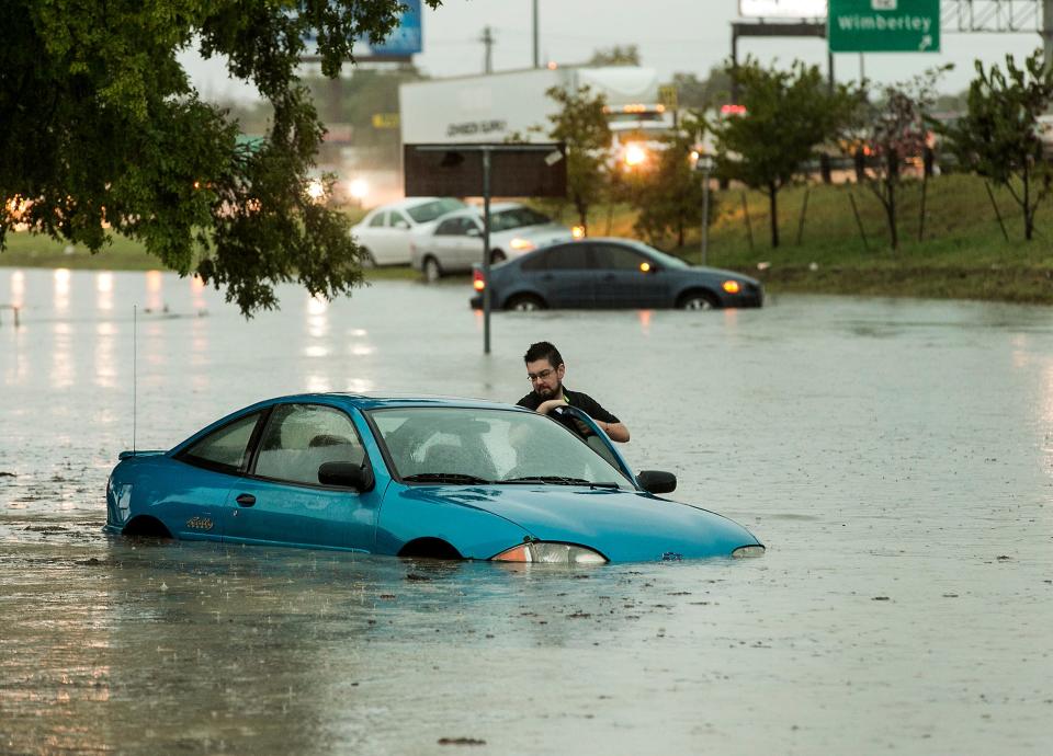
The city of San Marcos is no stranger to the intense flooding that is possible throughout Central Texas. After a series of devastating floods hit the community in 2015, residents and city officials started looking at how to prevent the worst effects of flooding.
Mayor Jane Hughson was then a City Council member, and she recalls seeing “devastation in several neighborhoods after the May flood.” After more floods hit that November, neighbors who had been in the process of rebuilding “had to start over.”
“I talked to people who had over 6 feet of water in their homes. That really means everything had to be disposed of,” Hughson said.
Over the following years, San Marcos has changed how it prepares for floods. The city requires landlords to tell renters if they are in flood-prone areas and to provide information on evacuation routes. Now, the city is receiving a boost of federal funding for an infrastructure project meant to reduce flood risk in one of the city’s vulnerable neighborhoods.
In April, the city received a $13.9 million grant from the U.S. Transportation Department. The money will support an ongoing project in Sunset Acres, a largely Hispanic neighborhood of about 300 homes, most built from the 1960s to the 1980s, bordering the east side of Interstate 35. The drainage project will allow rainwater to flow off streets more quickly.
“It's not uncommon for older neighborhoods to either have undersized drainage infrastructure or no drainage infrastructure,” said Shaun Condor, director of engineering and capital improvement projects for San Marcos. In Sunset Acres, the drains are small and clog easily.
The grant money will help the city install upgraded storm drains and pipes in the neighborhood that can handle larger quantities of water. The project also includes road improvements such as resurfacing and gutters. The new drainage system will connect with the network of pipes and water detention boxes for water runoff from I-35. Construction on the storm drain improvements will begin in 2026 and is expected to last two to three years, Condor said.
The city plans to eventually build a detention pond capable of storing a large volume of stormwater, but that phase of the project is not funded by the federal grant. Local funds also will provide improvements to the neighborhood’s wastewater system.
The Sunset Acres project will cost $42 million overall. The federal funding made possible by the passage of the 2021 Infrastructure Investment and Jobs Act will take some of the burden off the city. San Marcos puts about $50 million of its budget into capital investments split between multiple infrastructure projects each year.
Central Texas is expected to face a higher risk of flooding in the coming decades as climate change intensifies the rainy season. A report on extreme weather from the office of the state climatologist at Texas A&M University predicts a 10% increase in extreme rainfall by 2036 compared with the rainfall levels seen from 2000 to 2018.
More: Flash floods inundate Central Texas history
Increasing temperatures can raise the rate of evaporation. That will dry out landscapes faster, but it also will lead to more moisture in the atmosphere ready to be unleashed when rainstorms form. Warmer ocean temperatures can also create stronger hurricanes.
In the 2024 update of the report “Assessment of Historic and Future Trends of Extreme Weather in Texas, 1900-2036,” the authors state that “the change in frequency of extreme rainfall would translate directly to a change in the expected frequency of urban flooding.” The overall chances of intense urban flooding in 2036 will be up 50% in comparison with levels seen from 2000 to 2018.
“There’s going to be a greater likelihood of rainfall events where a lot more rain falls in a shorter period of time,” said Jeremy Mazur, a senior policy adviser for the group Texas 2036 that helped produce the report. “These flood risks are not going to go away.”
The geography of the Hill Country makes it especially vulnerable to flooding. The hills form the southern edge of the Edwards Plateau giving way to the Gulf Coast plains and making areas around San Marcos and Austin a flooding danger zone sometimes referred to as flash flood alley.
“When you have hills, you get faster water running off the land surface into the streams,” said Robert Mace, executive director of the Meadows Center for Water and the Environment and a Texas State University professor.
Mace said people often misunderstand flood likelihood. For example, with a 100-year flood, the likelihood of it occurring is not once every 100 years. Instead, Mace said, there is a 1% chance of a flood of that magnitude occurring any given year.
“You might get hit with a 100-year flood last year. And then two years later get hit with another 100-year flood and maybe five years after that get hit with a 100-year flood,” Mace said. “People tend to underestimate the risk from flooding.”
The city of San Marcos will build the Sunset Acres drainage projects to accommodate a 25-year flood, which by Mace’s logic has about a 4% chance of occurring in any given year. With climate change leading to more intense rainfall and, with it, worse urban flooding, Mace said flood plain maps tend to be out of date, and places that used to be considered safe from large floods are at an increased risk.
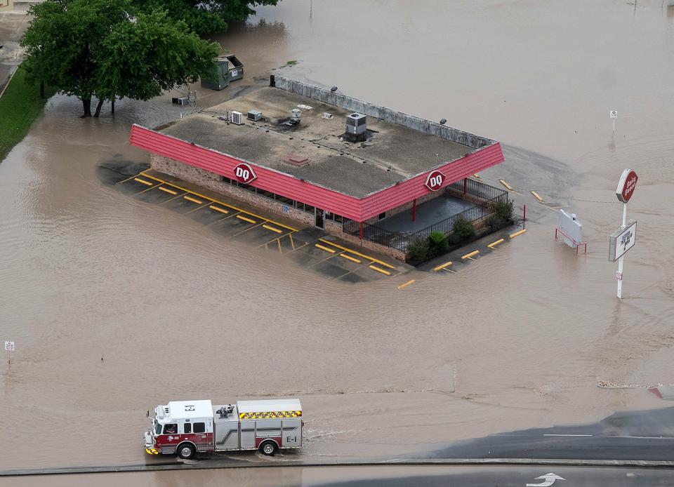
In Austin, the Watershed Protection Department handles most flood mitigation projects for the city. In 2023, the department installed or replaced more than 10,000 feet of storm drain infrastructure and cleared debris from an additional 76,000 feet, according to its annual report.
The Texas Water Development Board will complete the first statewide flood plan this year, but regional flood plans already have been developed for several years. A recent update found that completing all of the flood infrastructure projects that have been identified as priorities across the state’s 15 flood regions would cost $54 billion.
The water development board does provide state funding in the form of grants for flood infrastructure. For fiscal 2024-25, the board has $375 million available — less than 1% of the overall need. From the perspective of policy analysts such as Mazur, the state needs to continue investing in flood infrastructure to protect residents against the worst-case scenario.
“If we continue to have urban floods, that’s going to continue to increase the (insurance) premiums that some homeowners are going to have to pay,” Mazur said. “It may reach a point that it can make insurance or even home ownership out of reach for people living in flood-prone areas.”
This article originally appeared on Austin American-Statesman: San Marcos to use federal grant to protect neighborhood from flooding

