Relentless severe weather threatens central, eastern US: More than 20M at risk
Swaths of the central and eastern United States braced for another round of strong storms as a dayslong span of severe weather stretched into Wednesday.
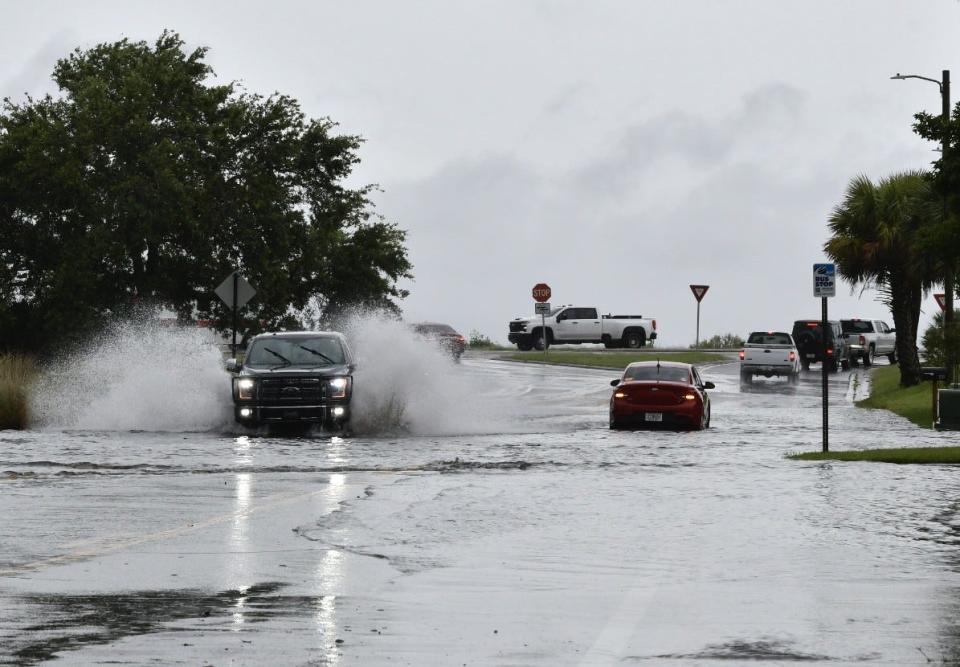
More than 20 million people were at risk of experiencing fierce storm conditions from the Florida Peninsula to the southern Plains and the Carolinas, according to the National Weather Service's Storm Prediction Center. Amarillo, Texas; Oklahoma City; Orlando; and Charlotte, North Carolina were among the cities in the path of various storms.
Florida, which faced the highest risk of twisters, "deadly lightning" and winds as high as 55 mph through the morning, dodged a bullet. A tornado watch issued for 19 counties in central and northern Florida, including in Tampa and Orlando, expired at 11 a.m., and little damage was reported. A severe thunderstorm watch remained in effect until 5 p.m.
The Federal Aviation Administration said temporary ground stops were issued at Tampa International Airport and Orlando International Airport early Wednesday. At international airports in Miami and Fort Lauderdale flights were were delayed over an hour.
More than 12,000 utility customers in Florida were without power, according to a USA TODAY outage tracker. In Louisiana, where earlier this week deadly storms inflicted widespread damage and killed at least three people, over 16,000 homes and businesses had no power.
11:32am CDT #SPC Day1 Outlook Enhanced Risk: this afternoon into early tonight from the TX Panhandle into northwest OK and southern KS https://t.co/TgJgC6cQZw pic.twitter.com/GXUnSRD7Ej
— NWS Storm Prediction Center (@NWSSPC) May 15, 2024
Storms expected in the southern Plains and Carolinas
As the poor weather dissipates in Florida on Wednesday afternoon, thunderstorms will begin ramping up in other parts of the central and eastern U.S.
To the east, storms are expected to develop and intensify during the mid-to-late afternoon throughout the southern Plains, especially in central Oklahoma, southern Kansas and the Texas Panhandle. Large hail, along with strong winds and potential tornadoes, were among the main weather threats. Meteorologists say the storms should gradually weaken overnight as they reach far eastern Kansas and northeast Oklahoma.
An area spanning the Carolinas and southern Virginia was also under severe weather advisories. Storms are forecast to develop and breakout throughout the afternoon, bringing with them a threat of "severe wind and hail," the weather service said.
Parts of eastern Ohio and western Pennsylvania also faced potential showers, though they're not expected to be as organized as those anticipated to hit the Plains and Carolinas.
New storm eyes the Southeast
While eastern Texas, Louisiana, Mississippi and most parts the Gulf Coast region experienced a respite from the fierce weather late Tuesday and Wednesday, thunderstorms are set to barrel through the Southeast starting Thursday.
A new system will push out from the southern Rockies and initiate a new surge of moisture from the Gulf of Mexico, developing powerful thunderstorms that will expand eastward on Friday and Saturday, the weather service said.
In recent weeks, the region has been lashed by rounds of thunderstorms that have unleashed deadly tornadoes and flash floods. The deluge has fostered an environment of wet soil and high waterways, only increasing the possibility of floods as more rain rolls in.
This article originally appeared on USA TODAY: Severe storms, tornadoes threaten central, eastern US on Wednesday

