Protect your plants: Nighttime freezes to chill Northeast into Friday

 |
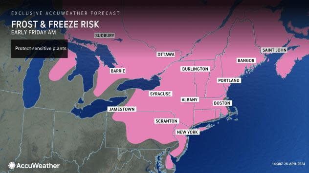
Nighttime temperatures will plunge into the 30s and 20s Fahrenheit over much of the northeastern United States into Friday with the likelihood of damaging frosts and freezes, AccuWeather meteorologists warn. The risk will extend into the major cities over the interior and could even occur in some of the major Interstate 95 urban areas.
The second of two high-pressure areas from northern Canada in less than a week will drop across the region.
 |
An active breeze, dry air and any cloud cover will negate the warming effects of strong late-April sunshine during the day, resulting in AccuWeather RealFeel® Temperatures several degrees lower than the actual temperature.
However, when the sky clears and winds drop off at night, temperatures will plummet quickly, and the air mass will take on its northern Canada characteristics.
Patchy clouds and a breeze lingered Wednesday night in parts of the central Appalachians and the mid-Atlantic. This prevented temperatures from nosediving into the low 30s and 20s. However, the bottom fell out with temperatures farther to the north across northern Michigan, upstate New York and northern New England.
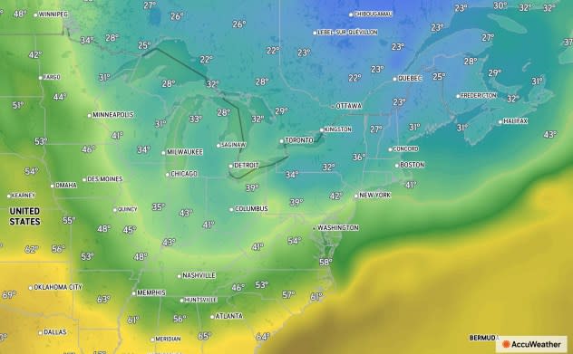
Temperatures dipped to record challenging and breaking levels from the Great Lakes to parts of the interior Northeast Thursday morning. At Saranac Lake, New York, in the Adirondack Mountains, the temperature plummeted to a frigid 12 degrees. In Alpena, Michigan, the temperature dropped to an icy 20 degrees. Meanwhile, in Ithaca, New York, the temperature dipped to a frosty 21 F on the shores of the Finger Lakes.
 |
From late Wednesday night to Thursday morning, areas of frost and a hard freeze occurred over the interior Northeast and the Upper Midwest. As of 8 a.m. EDT, from one to two hours after sunrise, temperatures were still at or below freezing (32 F) at some locations around the Great Lakes and the interior Northeast.
Not only were temperatures below the freezing mark Thursday morning, but some areas were below freezing for several hours, adding to the risk and the extent of the damage to tender leaves, flowers and breaking buds. The same conditions are anticipated in some areas late Thursday night to Friday morning.
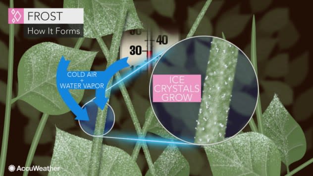
Some rooftop gardens in cities may be safe from a heavy frost, as the cold air in a pattern like this tends to collect at ground level.
When the sky is clear and winds are calm, temperatures on the turf can be 10 degrees or lower than those 4-6 feet off the ground, where official temperature readings are taken and forecasts are intended. For example, a forecast low of 35 degrees might seem like a safe temperature for your location, but temperatures may dip into the 20s at ground level during clear and calm conditions.
 |
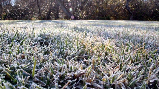
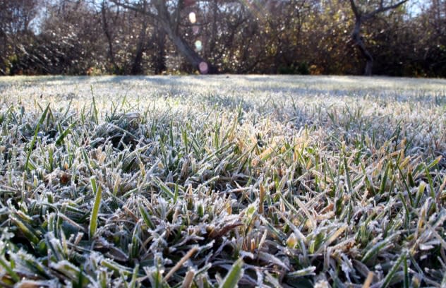
(Photo/DeniceBreaux, Getty Images) |
Golf courses may prohibit early tee times, as walking on frosty greens can damage the turf.
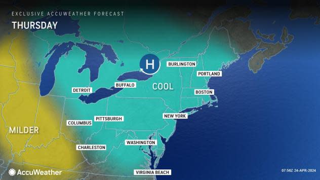
From Thursday night to Friday morning, frosts and freezes will focus mostly on New England and the mid-Atlantic. This is the time frame when there is most likely to be a frost in some coastal regions of the mid-Atlantic, as these areas will be clear and calm the entire night. This means some locations in southern and eastern New Jersey, eastern Maryland, Delaware and Long Island, New York, will be at risk.
 |
Many locations in the Midwest should be frost-free Thursday night, but there will still be some stubborn pockets with freezing temperatures in the central Appalachians.
Experts urge those who have purchased tender flower and vegetable plants to protect their investment. Some sensitive summer-blooming shrubs such as hydrangeas may need to be covered.
Orchard and vineyard operators may employ bonfires or wind machines to raise temperatures a few degrees in their fields. Garden centers may move stock indoors or under cover.
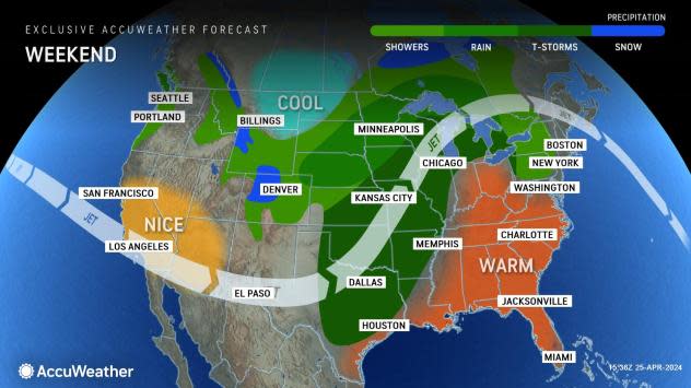
Following a cold start Friday, a significant warming trend is in store for the weekend, with widespread highs in the 70s and 80s forecast for Sunday and Monday. Temperatures may reach the 90s in parts of Virginia Monday.
 |
In the Central states, the warmup will help trigger a dangerous outbreak of severe weather that includes tornadoes over several days through the weekend.
Regarding any additional risk of frosts, the region is not quite out of the woods yet. Another chill will come next weekend, with perhaps another to follow before the middle of May. The extent and magnitude of any frosts will depend on cloud cover and wind conditions, which would be limiting factors.
Want next-level safety, ad-free? Unlock advanced, hyperlocal severe weather alerts when you subscribe to Premium+ on the AccuWeather app. AccuWeather Alerts™ are prompted by our expert meteorologists who monitor and analyze dangerous weather risks 24/7 to keep you and your family safer.
