Pinpoint Weather: June-like warmth, isolated storms
ROANOKE, Va. (WFXR) — The unseasonably warm pattern will continue across Southwest and Central Virginia for much of the week. However, isolated late-day showers and storms are possible over the next few days.
Monday will start dry and mostly clear with morning temperatures in the mild upper 50s and 60s. By the afternoon, temperatures will rise into the warmer-than-average upper 70s and 80s with breezy southwest winds blowing through.
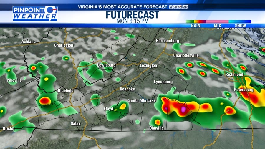
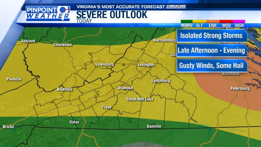
A front to the north may spark isolated showers and thunderstorms during the late afternoon and evening hours. Not everyone will see rain, but a few storms could become strong to severe. The main storm concerns are gusty winds and hail. Thunderstorms may produce heavy downpours.
The slightly unsettled pattern will continue through the middle of the week. From Tuesday through Friday, morning lows will be in the 50s and lower 60s while afternoon temperatures will reach the 70s and lower 80s. Variably cloudy skies will be overhead. Isolated showers and storms are possible each day, more so during the afternoon and early evening hours.
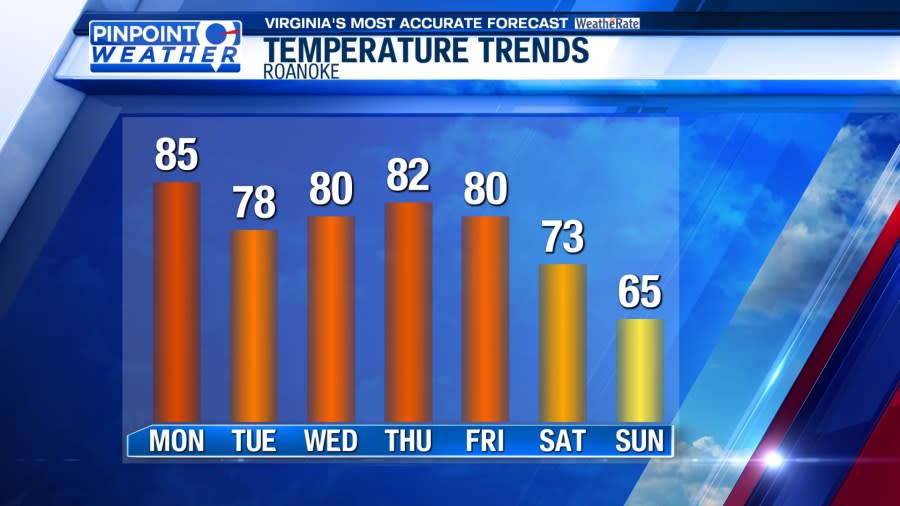
A stronger cold front will impact Southwest and Central Virginia for the weekend. Rain showers are possible on Saturday and Sunday, but it won’t be a complete washout. A cooling trend will take place. For Saturday, morning lows will be in the 50s and afternoon highs in the upper 60s and lower 70s. Sunday will be cooler with highs in the 60s.
For the latest news, weather, sports, and streaming video, head to WFXRtv.

