Nice weekend, warming trend
Columbus and Central Ohio Weather
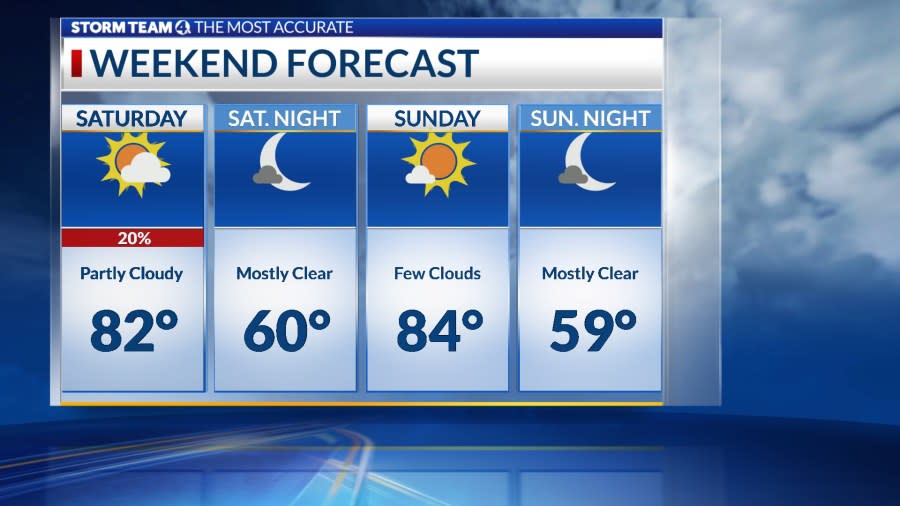
Low pressure will move east of the region, with more sunshine. Isolated showers popped up int afternoon and early evening, with a few scattered storms, but will quickly dissipated by sunset. Skies will be mostly clear overnight, and some light fog is possible.
The weather will be partly cloudy and warm Sunday through Tuesday, thanks to high pressure building down from the Great Lakes. Temperatures will rise into the mid-80s.
A weak cold front will stall across the lower Great Lakes, keeping the threat of rain north of Ohio early in the week.
The next storm system tracking from the southern Plains to the Great Lakes will bring showers and storms Tuesday night and Wednesday ahead of a cold front. Behind the front, cooler and drier air will settle in later in the week.
Forecast
Saturday: Mix clouds and sun, isolated showers east. High 79
Tonight: Few clouds. Low 60
Sunday: Sunny, warm. High 84
Monday: Sunny. High 86 (61)
Tuesday: Partly sunny, late shower. High 87 (64)
Wednesday: Showers, storms. High 83 (68)
Thursday: Mostly sunny. High 77 (61)
Friday: Partly sunny, showers, storm. High 78 (57)
Copyright 2024 Nexstar Media, Inc. All rights reserved. This material may not be published, broadcast, rewritten, or redistributed.
For the latest news, weather, sports, and streaming video, head to NBC4 WCMH-TV.

