Columbus forecast: National Weather Service says storm has weakened, severe threat remains
The National Weather Service has issued a hazardous weather warning for the Columbus area and other parts of Central Ohio.
Storms are expected to begin this afternoon and carry into the evening with damaging winds and large hail serving as the most considerable threats, the NWS in Wilmington said. Isolated tornadoes are also possible.
As the storm moved into Ohio early Thursday afternoon it weakened and will likely continue to do so, but the threat of isolated large hail, damaging wind gusts and a possible tornado remains, according to the NWS in Wilmington.
The storms are expected to move into the Columbus area beginning at 5 p.m. and continue through midnight. Heavy rains and localized flooding are expected.
Counties included in the warning are:
Wayne, Fayette, Union, Franklin, Hardin, Mercer, Auglaize, Darke, Shelby, Logan, Delaware, Miami, Champaign, Clark, Madison, Preble, Montgomery, Greene, Butler, Warren and Clinton.
[135 PM] Storm update - the line of storms has progressed into western Ohio but has weakened in the past hour. Still cannot rule out localized strong/damaging wind gust as this line passes. Remain weather aware! pic.twitter.com/jxuAAJSouB
— NWS Wilmington OH (@NWSILN) March 14, 2024
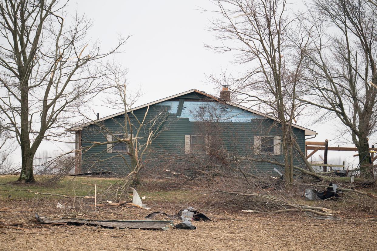
Tornado predictions come weeks after 9 struck Central Ohio
The forecast including hail and tornadoes comes weeks after the Feb. 28 storms that tore through several Central Ohio counties in the Columbus area.
The storms resulted in no deaths, but left a wake of damaged homes, vehicles and garages along with splintered and downed trees. The NWS confirmed that at least nine tornadoes struck the region.
What's the difference between tornado watches and warnings
While the NWS hasn't issued thunderstorm or tornado watches or warnings as of Thursday morning, it's important to understand the difference in urgency between the two distinctions.
A tornado watch means tornadoes are possible in areas that often include large parts of several counties or states.
If a tornado watch is issued, it's a good time to review emergency plans, check supplies and decide the safest place for you to go in the event that the storm gets worse. Ensure your phones are charged and have a plan to act quickly should the watch become a warning.
A tornado warning means a tornado has been sighted or is indicated by weather radar.
A warning means there’s imminent danger to life and property in the warning area, and you should immediately move to an interior room on the lowest floor of a sturdy building and avoid windows.
More: Severe weather: What are the differences between a tornado watch and a tornado warning?
What to do if your power goes out
You can check local outage maps for AEP or the Columbus Division of Power online. Also, Ready.gov, a website run by the U.S. Department of Homeland Security, has a few tips:
Keep freezers and refrigerators closed.
Use a generator, but only outdoors and away from windows.
Do not use a gas stove or oven to heat your home.
Disconnect appliances and electronics to avoid damage from electrical surges.
Have alternate plans for refrigerating medicines or using power-dependent medical devices.
Charge devices beforehand
More: Thursday storms: how to check AEP outage map in central Ohio during high wind, hailstorm
This article originally appeared on The Columbus Dispatch: Columbus forecast: Storm weakens but severe weather threat remains

