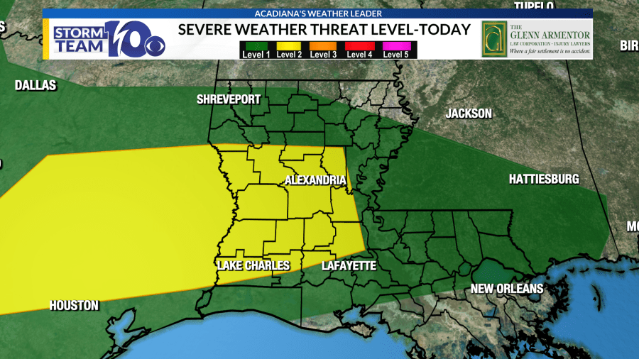
Nasty storms possible for Mother’s Day, heavy rain threat through Monday
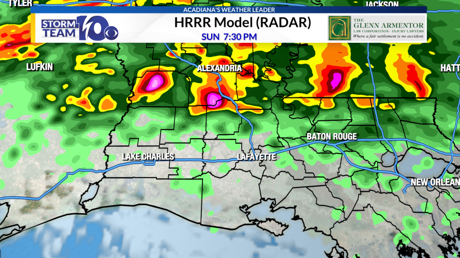
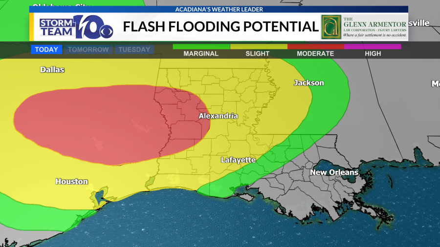
A warm front will lift northward across the region today, stalling somewhere across northern Acadiana/central Louisiana. Storms will form along this boundary during the afternoon and evening, moving from west to east along the frontal zone. Some of these storms could be strong-to-severe, containing large hail and gusty winds. Our latest HRRR model shows the possibility of supercellular thunderstorms across northern Acadiana this afternoon and evening. A heavy rainfall threat could shape up as well, as storms develop and re-develop along the front. High-resolution models show the possibility of 3-6 inches of rainfall in a narrow swath across central Louisiana/northern Acadiana through Monday morning.
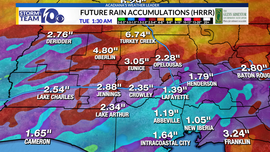
Additional heavy rainfall could be possible Monday afternoon and Monday evening as a front approaches the area. A severe weather threat will also be there on Monday with a level two risk of severe storms containing gusty winds and large hail. Also, a slight risk of excessive rainfall on Monday with the possibility of additional storms across the region.
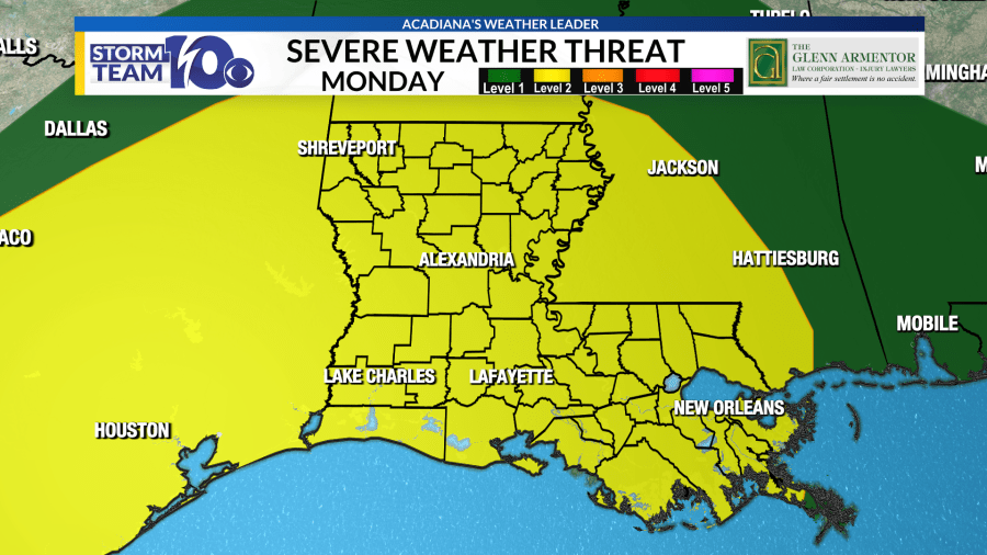
The heavy rainfall and severe threats should end on Tuesday as we transition to a quieter weather pattern on Tuesday and Wednesday.
It will be short-lived, however, as more storms are anticipated on Thursday and Friday.
For the latest news, weather, sports, and streaming video, head to KLFY.com.

