Nashville area faces severe weather risk through Memorial Day weekend
Strong to severe thunderstorms are possible for the Middle Tennessee region on Wednesday ahead of an active Memorial Day weekend. The National Weather Service is warning primarily of damaging winds and heavy rain, including the possibility of hail.
According to the weather service, storms are expected from 5 p.m. until about 11 p.m on Wednesday. Although the tornado threat remains low, it is not completely zero. The tornado threat will begin to increase on Friday and may last until Monday, said the weather service.
Strong to severe thunderstorms are possible across Middle TN this afternoon/evening. Primary threats will be damaging winds and heavy rain. Hail will also be possible. Timing is roughly 5 PM to 11 PM. pic.twitter.com/72I7igrTgF
— NWS Nashville (@NWSNashville) May 22, 2024
"Areas along and west of I-65 have a higher chance of seeing strong to severe storms, but ALL of Middle Tennessee will be very unstable with a threat for strong storms to develop, so remain weather aware and ready to act just in case a warning be issued," said the weather service.
National Weather Service issues severe thunderstorm watch for Middle Tennessee
A severe thunderstorm watch for Nashville and Davidson County was canceled Wednesday after a round of early evening storms, the National Weather Service said.
Counties in the watch area included: Bedford; Cannon; Cheatham; Clay; Coffee; Cumberland; Davidson; DeKalb; Fentress; Giles; Grundy; Jackson; Lawrence; Macon; Marshall; Maury; Overton; Pickett; Putnam; Robertson; Rutherford; Smith; Sumner; Trousdale; Van Buren; Warren; White; Williamson; and Wilson.
A flash flood warning was also canceled for Montgomery, Stewart, Dickson, Houston and Humphreys Counties.
Radar indicated between three to five inches of rain had fallen in parts of Middle Tennessee Wednesday and emergency management agencies have reported water rescues, the weather service said.
Houston County Emergency Management Agency Director Bill Hall confirmed the rescue of nine children and four adults trapped inside Ms. Katies Kids daycare, 57 Store Front Drive in Erin as several inches of rain fell in the area Wednesday.
Owner Katie Hudson said children were crying as they called Erin Police to remove them from the building. The children and adults were taken to city hall.
Hudson said the water has subsided some and she expects to open Thursday.
"It was definitely really scary," Hudson said. "I have my kids at the daycare as well as other kids. A lot of the kids were crying, but thankfully, we knew what to do, how to get out."
Middle Tennessee could see stormy weather through holiday weekend
Overnight headed into Thursday, showers and thunderstorms are expected however the severe weather threat for the storms is low, said the weather service. On Thursday, another round of showers and thunderstorms will push through the afternoon. The weather service is warning of damaging wind, hail and heavy rain.
The weather service is predicting multiple days of potentially strong to severe thunderstorms later in the week, specifically Friday, Sunday and Memorial Day. All three days pose the threat of damaging winds, hail, tornadoes and flooding. The cumulative rainfall over the next several days could cause flooding issues by the end of the weekend, said the weather service.
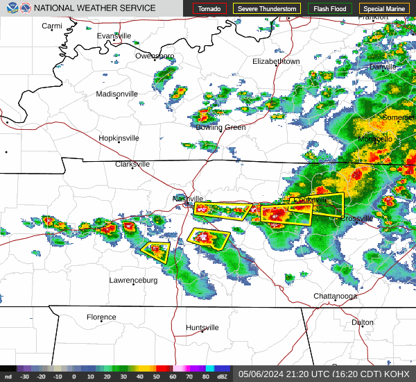
Nashville weather radar
Nashville 7-day weather forecast
Wednesday: High near 85. A chance of showers and thunderstorms before 3 p.m. then showers and possibly a thunderstorm likely between 3 p.m. and 4 p.m. The chance of precipitation is 80%. New rainfall amounts between a tenth and quarter of an inch, except higher amounts possible in thunderstorms.
Mostly cloudy, with a low around 66 at night. Showers and thunderstorms likely before 10 p.m. Chance of precipitation is 70%.
Thursday: High near 80, showers and thunderstorms mainly before 4 p.m. The chance of precipitation is 90%. New rainfall amounts between a quarter and half of an inch possible.
Mostly cloudy, with a low around 66 at night. showers likely and possibly a thunderstorm after 1 a.m. The chance of precipitation is 60%.
Friday: High near 81, showers likely and possibly a thunderstorm. The chance of precipitation is 80%. Mostly cloudy, with a low around 67 at night. Showers likely and possibly a thunderstorm after 1 a.m. The chance of precipitation is 60%.
Saturday: Partly sunny, with a high near 86. Showers likely and possibly a thunderstorm after 1 p.m. The chance of precipitation is 60%.Mostly cloudy, with a low around 68 at night. Showers likely and possibly a thunderstorm after 1 a.m. The chance of precipitation is 60%.
Sunday: Partly sunny, with a high near 88. Showers likely and possibly a thunderstorm. The chance of precipitation is 70%. Low around 69 at night, showers likely and possibly a thunderstorm. The chance of precipitation is 80%.
Memorial Day: Mostly sunny, with a high near 86. A 50% chance of showers and thunderstorms. Partly cloudy, with a low around 61 at night. A 40% chance of showers and thunderstorms, some of the storms could produce heavy rainfall.
Tuesday: Mostly sunny, with a high near 79. A 30% chance of showers and thunderstorms.
Diana Leyva covers trending news and service journalism for The Tennessean. Contact her at Dleyva@gannett.com or follow her on X, the platform formerly known as Twitter, at @_leyvadiana
This article originally appeared on Nashville Tennessean: Nashville severe weather: Storms in forecast tonight and thru weekend
