Low tides reveal Bronze Age fortress that likely defended against Irish mainland
Low tides on Ireland's western coast have revealed the remains of defensive walls that are likely Bronze Age ramparts.
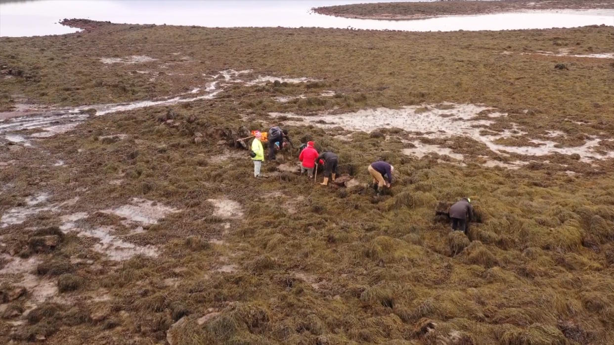
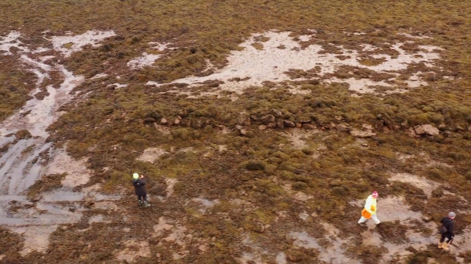
Archaeologist Michael Gibbons discovered the ramparts, which are made of large limestone blocks, on a partially submerged isthmus, a narrow strip of land between two parts of the sea. But he's only recently obtained photographs of the site, which has enabled him to publicize the ramparts for the first time.
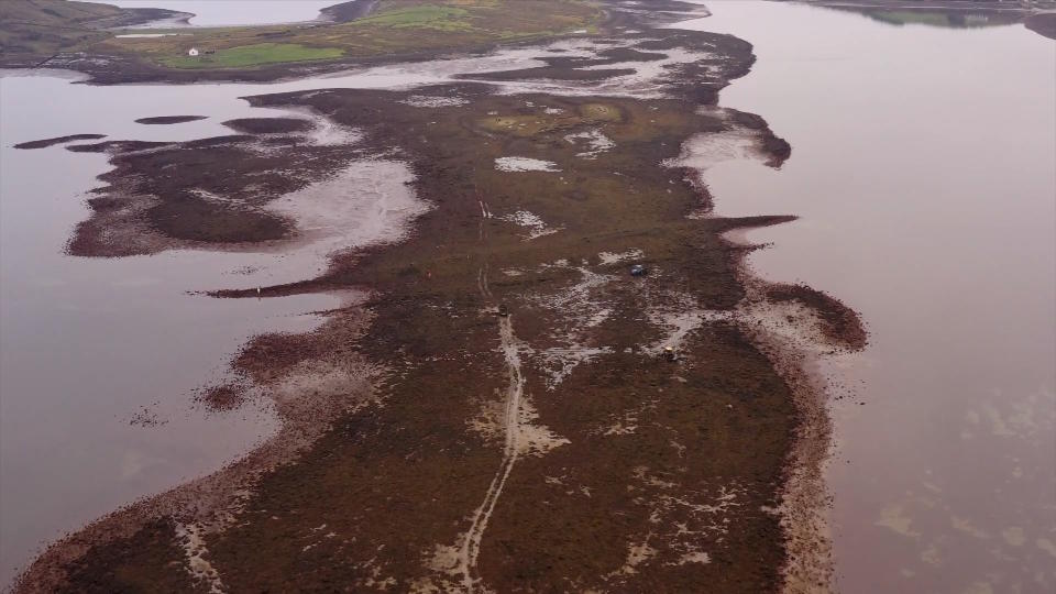
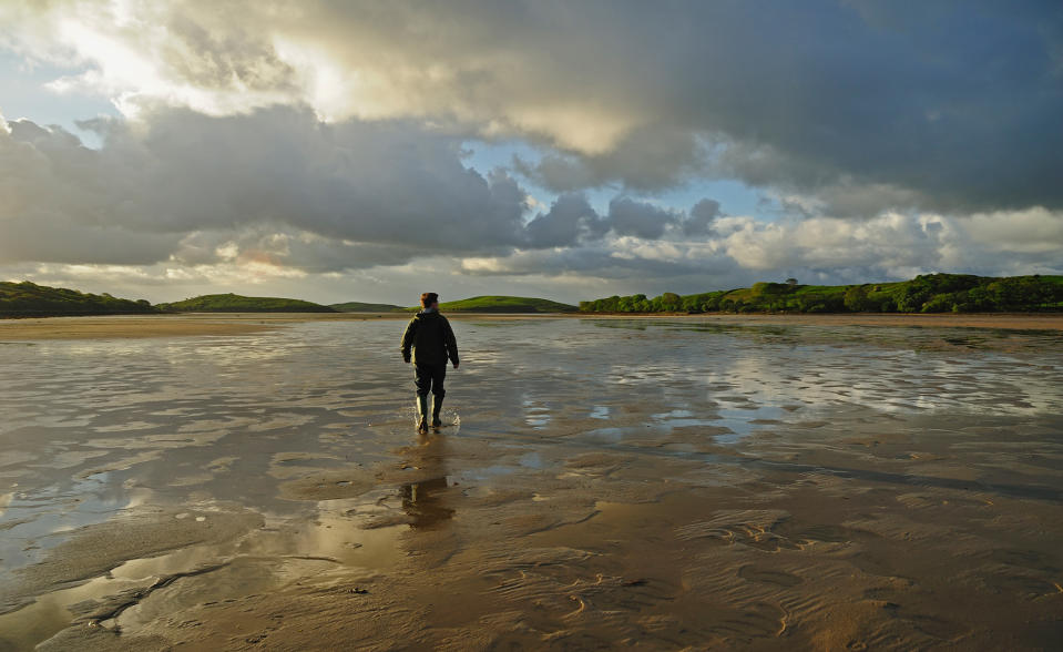
The isthmus, located in County Mayo's Clew Bay between Collanmore Island and the mainland near the village of Roscahill, is usually flooded by seawater, Gibbons told Live Science. However, a road across it can be used at very low tides.
The ramparts are about halfway across the roughly 1-mile-long (1.6 kilometer) isthmus; the remains of a wall nearest the mainland are about 590 feet (180 meters) long, while the remains of a larger wall nearest the island are about 820 feet (250 m) long, he said.
Related: 2,000-year-old 'bog body' of teenager with missing skull discovered in Northern Ireland
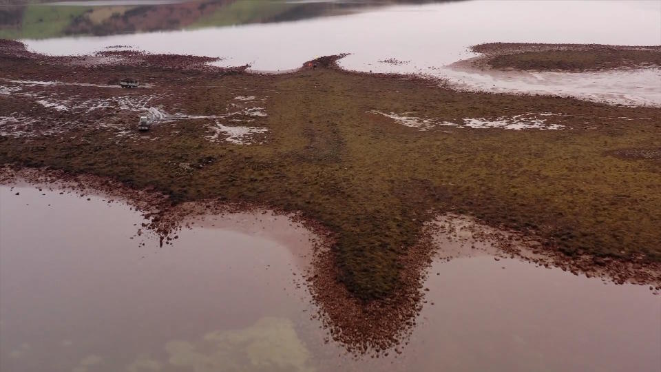
Both ramparts cut across the isthmus and seem to have served to protect the isthmus and island from attacks from the mainland.
"They are providing a defensive wall, at a time when sea levels were considerably lower than they are now," Gibbons said.
Ancient landscape
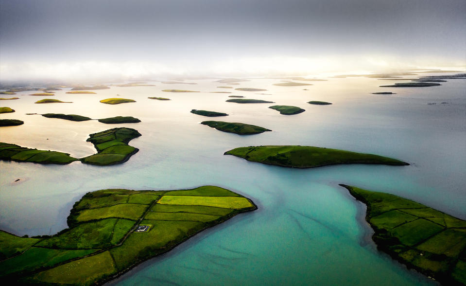
Clew Bay features more than 300 small islands that were created when the sea flooded the coastal landscape thousands of years ago.
The walls suggest the region's sea level was much lower when the walls were built than it is today, he said.
Gibbons thinks the walls were built during Ireland's Bronze Age, probably between 1100 B.C. and 900 B.C., because of their similarity to ramparts built around a Bronze Age fortress at Lough Fee (or Feeagh), about 6 miles (10 kilometers) to the north. In both cases, the walls are made of local stone and covered with large blocks from limestone deposits in the area, he said.
The size and scale of the Collanmore ramparts suggest the island was of major strategic importance when they were built, although the island is mostly deserted today. It may have been the site of a large Bronze Age hillfort, as such settlements were common throughout Ireland at the time.
"I've mapped several of these big hillforts before, and sites on this scale tend to be Late Bronze Age in date," Gibbons said. "This was probably a coastal version of those."
Local legend
Gibbons said local people knew about the smaller wall near the mainland, but they didn't know how old it was. The very low level of the isthmus today means it's almost never traversed, and the ramparts themselves are usually completely flooded, he said.
RELATED STORIES
—Remains of 4,000-year-old 'lost' tomb discovered in Ireland
—'Untouched' Bronze Age tomb containing human remains and a mysterious stone found in Ireland
—More than 140 graves found by medieval abbey in Northern Ireland, including executed criminals
But Gibbons and a team of Irish archaeologists were able to investigate the walls during extraordinarily low tides in recent weeks. Some local men were also harvesting seaweed on the isthmus at the time, and the walls are so covered with seaweed that it's easy to see why they were discovered only recently, he said.
Gibbons also recently found a possible Bronze Age "cist," or stone-lined grave, at Omey Island, about 25 miles (40 km) southwest of Clew Bay. The grave seems to have been built at about the same time, he said, and it was revealed after powerful swells swept sand from the coastline.
"We're finding a lot of sites now in the intertidal zone," Gibbons said. "It's our new frontier, if you like."

