Long-distance footpaths in the UK

Hikers can enjoy some of Europe's best long-distance footpaths here in the UK, but you don't have to walk each entire trail in one go.
You can cover the section that most appeals, or that's closest, or work your way along the path over several trips, known as section-hiking. Or you can opt for a shorter distance with our pick of Britain's most scenic walking routes.
Long-distance paths in England and Wales are recognised as National Trails, and these 16 routes are waymarked with the yellow acorn symbol and include some of Britain's best-known routes.
Scotland has its own version, called the Great Trails – 29 routes marked by a thistle symbol.
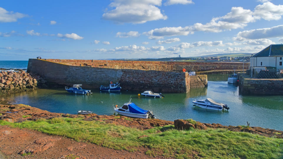
Pennine Way
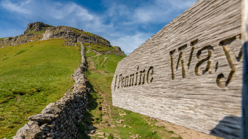
This trail is "the oldest of England's National Trails", said BBC Countryfile. First proposed by "journalist and hiker Tom Stephenson in an article for the Daily Herald in 1935", its final section opened in 1965. At 268 miles, it's "not the longest route but arguably the toughest", starting in the Peak District before heading north along the backbone of England – the Pennines – passing though the Yorkshire Dales and Northumberland National Park before reaching the Scottish Borders". It's a walk "for those who love wide empty spaces", said The Telegraph, as although it "threads between some of the most populated parts of the country, such as Manchester and South Yorkshire, you will often feel incredibly isolated and alone".
Find out more: www.nationaltrail.co.uk
Hadrian's Wall Path
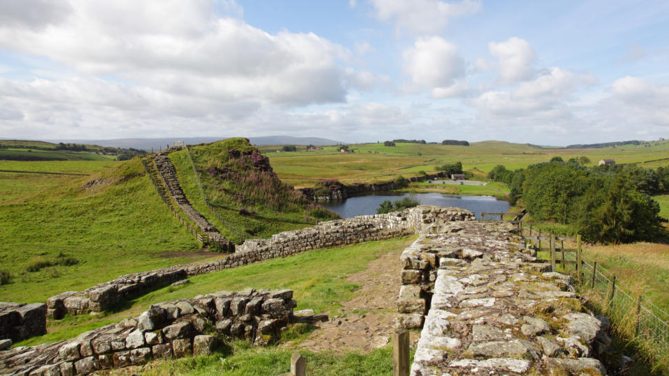
"Of all the National Trails, Hadrian's Wall follows an idea as much as a path," said The Guardian: "the thousands of hands that formed the wall remind us that while empires wax and wane, they leave persistent traces in our landscape and culture". Spanning 84 miles from Wallsend on the River Tyne to Bowness-on-Solway in Cumbria, past the now infamous Sycamore Gap, it's a "substantial walk", said The Telegraph, but "achievable by the reasonably fit". Its "unfolding landscapes" revealed a "rocky escarpment with cliffs dropping sheer to water", then a "light-dappled copse" or "cattle grazing nonchalantly" with "the hazy-blue horizon to the northwest" that will have you "wondering where England stopped and Scotland began". Only remnants of the wall remain "at scattered intervals", appearing as "solid (reconstructed) chunks, foundations and grassy bumps", but archaeologists have mapped its route. And thanks to the path's creation in 2003 "we can, literally, patrol in those Romans' footsteps".
Find out more: www.nationaltrail.co.uk
King Charles III England coast path
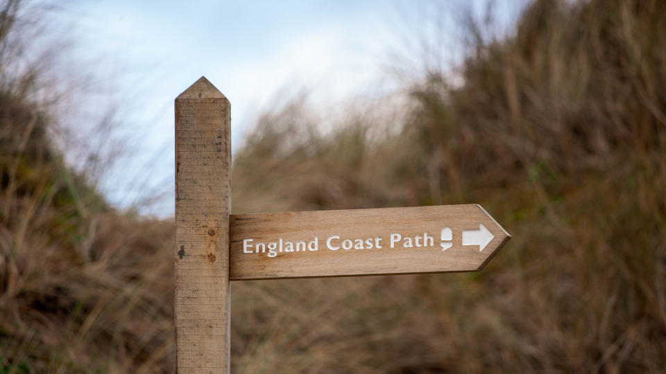
"Like the coronation of our new monarch, the King Charles III England Coast Path has been a long time coming," said The Times. A trail around the entirety of England's coastline was "announced back in 2008 as one of Gordon Brown's big ideas as prime minister", said The Guardian. However, a "managed route allowing an ambitious walker to enjoy the delights of Scarborough Castle and Robin Hood's Bay, and the Amble to Bamburgh stretch in the north-east, and then hike on to take in Land's End and the Penhale Sands between Newquay and Penzance" has been a goal for "recreation and countryside groups since 1949". Originally known as the England Coast Path, with the first stretch at Weymouth opening in 2012, it was renamed by the government in May 2023 "to commemorate the Coronation of His Majesty King Charles III and in recognition of his regard for the natural world", said Natural England. At the end of 2023 "just 26 miles" of the route were "yet to be submitted to the government for approval", said The Guardian, while "2,295 miles have been signed off".
Find out more: www.nationaltrail.co.uk
Wexford-Pembrokeshire Pilgrim Way
This "epic Wales-Ireland walking trail" will "link up the two Celtic nations", said TimeOut, and run for "100 on-land miles – with an Irish Sea crossing, from Rosslare to Fishguard, in the middle", said the i news site. The two-country trail, first winding through County Wexford from the historic town of Ferns to the port of Rosslare, "aims to mirror a journey taken by Irish monk St Aidan to visit his mentor, St David, the patron saint of Wales". The "Welsh leg" follows "the wonderful Pembrokeshire coast via hermit cells, Neolithic tombs and St Patrick's Chapel". Signage and waymarking on the Irish side is yet to be completed, but the Welsh route is open using digital waymarking.
Find out more: wexfordpembrokeshirepilgrimway.org
John Muir Way
Celebrating its 10th anniversary in April 2024, the John Muir Way runs for 134 miles across Scotland, and is "named after the Dunbar-born father of America's national parks," said The Scotsman. The route "mixes cultural history with natural beauty from the get-go", said The Guardian. Highlights range from Charles Rennie Mackintosh's Hill House in Helensburgh to "vistas over Loch Lomond and the Trossachs national park" with Campsie Fells as a "backdrop" before passing the Falkirk Wheel, "the world's only rotating boat lift", and the "19th-century Avon aqueduct" before reaching Edinburgh and heading along the coast to Dunbar, home to John Muir Country Park.
Find out more: johnmuirway.org
Thames Path
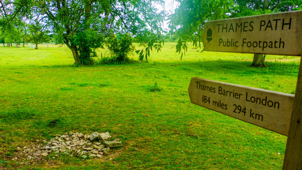
Winding alongside "England's longest river", this 184-mile path "starts from the source of the Thames, in an unassuming meadow in the Cotswolds", said The Telegraph. It then moves between "medieval towns and tiny villages" in Wiltshire, Gloucestershire and Oxfordshire, passes "through the clay and chalk of the Chilterns in Buckinghamshire" and finally, "after a brief meander through Surrey, spools out beyond the city of London past the flood barrier, ending as the river joins the sea". In its London section, you can walk on both banks "from the lost floodplains of Richmond, to the Dickensian stretches of the eastern marshes", said Secret London. And the sightseeing "showstoppers" along the way include "Tower Bridge, Hampton Court Palace, Albert Bridge, The Royal Docks, Battersea Park and Kew Gardens".
Find out more: www.nationaltrail.co.uk

