El Niño fading fast, when La Niña could begin
AUSTIN (KXAN) — El Niño, at times considered very strong, is on its way out.
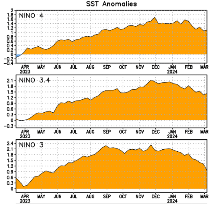
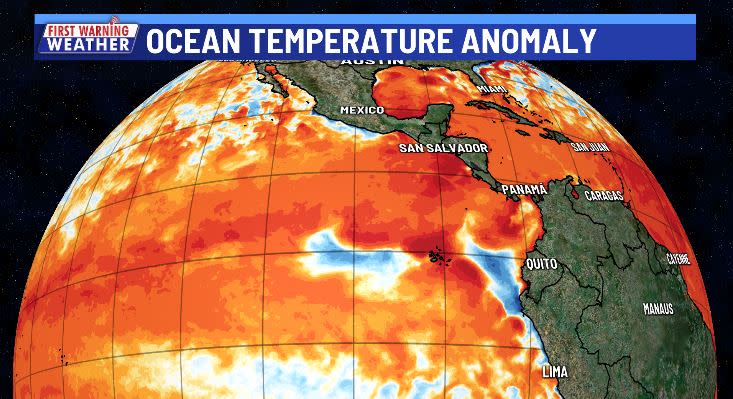
Sea surface temperature anomalies in critical areas of the eastern equatorial Pacific Ocean have dropped since peaking in November-December 2023. Some areas are already showing up as cooler than normal as the upwelling of colder waters shows up on the surface.
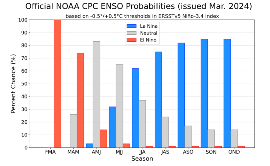
The Climate Prediction Center recently updated its ENSO (El Niño-Southern Oscillation) forecast and pointed toward a rapid transition from El Niño to ENSO-Neutral and then quickly to La Niña.
ENSO-Neutral could briefly mean no weather pattern connections associated with the water temperatures in the eastern Pacific. ENSO Neutral conditions are expected during the April-May-June and May-June-July three-month periods.
Soon after, La Niña is expected to take over as the expected phase of ENSO beginning June-July-August and into next winter.
What would a summer La Niña mean?
If La Niña develops in time for summer, it could have the highest impact, initially, on 2024 hurricane season.
Typically, during La Niña hurricane seasons, the Atlantic Basin sees a more active season due to less wind shear and trade winds and more instability.
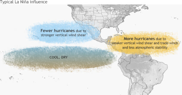
This doesn’t guarantee more storms than normal in the Atlantic, or a Texas impact, but it does tilt the scales toward more storms in the Atlantic, some of which could enter the Gulf.
La Niña’s main impact: Winter
Summer hasn’t even started yet, but La Niña’s inevitable return would have notable impacts to winter weather across the United States.
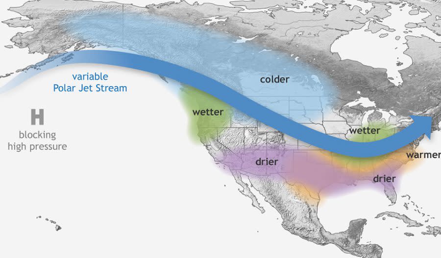
This typically means cold weather enters the northern states thanks to dips in the Polar Jet Stream. Wetter weather is common in the Pacific Northwest and near the Great Lakes States, but warmer and drier weather is common in the southwest, south and southeast.
This would not be good news for Central Texas if our ongoing drought hasn’t improved by next winter.
In the meantime, we are about to enter our wet season with our wettest month of the year, May, right around the corner.
For the latest news, weather, sports, and streaming video, head to KXAN Austin.

