After a last round of showers this morning, some sunshine gradually returns
AVERAGE HIGH FOR MAY 23rd: 73°
AVERAGE LOW FOR MAY 23rd: 47°
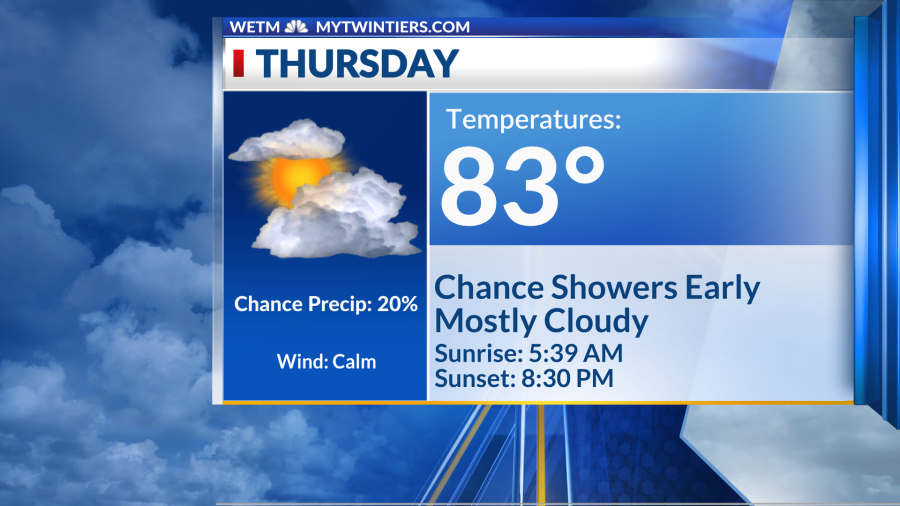
THURSDAY’S SUNRISE: 5:39 AM
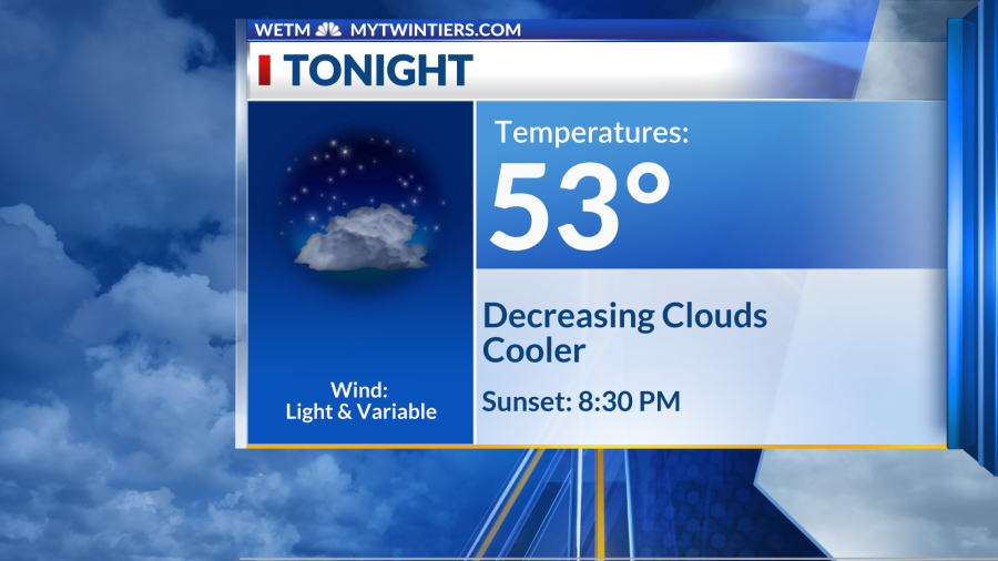
THURSDAY’S SUNSET: 8:30 PM
Elmira, N.Y. (WETM)- One last batch of showers moves through this morning before we dry off for the next few days. How will things pan out? Details below:
TODAY:
A few more showers roll through early this morning, but by late morning we are drying off as high pressure moves in behind yesterday’s system. We’ll be mostly cloudy through the rest of our afternoon, but cloud cover is decreasing heading into this evening. Temperatures today are cooler behind the cold front, but still warm in the low 80s.
TONIGHT:
By tonight we are mostly clear and we’ll remain mostly clear overnight into a beautiful sunny day for Friday. Lows tonight are in the low 50s thanks to clearing skies.
REST OF THE WEEK:
Our Friday will be sunny and warm, and we will start the weekend off dry. However, showers and storms return late Saturday night, and although Sunday looks drier, we can’t rule out a stray shower or two. By Monday, our next system will roll through likely bringing widespread showers and storms for the first half of the work week.
THURSDAY: AM SHOWERS. MOSTLY CLOUDY
HIGH: 83 LOW: 53
FRIDAY: SUNNY
HIGH: 84 LOW: 53
SATURDAY: EVENING SHOWERS/STORMS
HIGH: 85 LOW: 59
SUNDAY: PARTLY CLOUDY. STRAY SHOWERS
HIGH: 84 LOW: 60
MONDAY: CHANCE SHOWERS/STORMS
HIGH: 79 LOW: 56
TUESDAY: CHANCE SHOWERS
HIGH: 74 LOW: 53
WEDNESDAY: CHANCE SHOWERS/STORMS
HIGH: 72 LOW: 49
Chief Meteorologist Rhonda Lee: Facebook I Instagram
Meteorologist Alivia Colón: Facebook I Twitter I Instagram
Meteorologist Anthony Codispoti: Facebook I Twitter
Have a wonderful day!
Copyright 2024 Nexstar Media, Inc. All rights reserved. This material may not be published, broadcast, rewritten, or redistributed.
For the latest news, weather, sports, and streaming video, head to WETM - MyTwinTiers.com.

