June-like warmth, scattered weekend storms
Columbus and Central Ohio Weather
Skies will be partly sunny with weak high pressure over the area, and it will be another warm and humid day, with temperatures reaching the mid-80s,
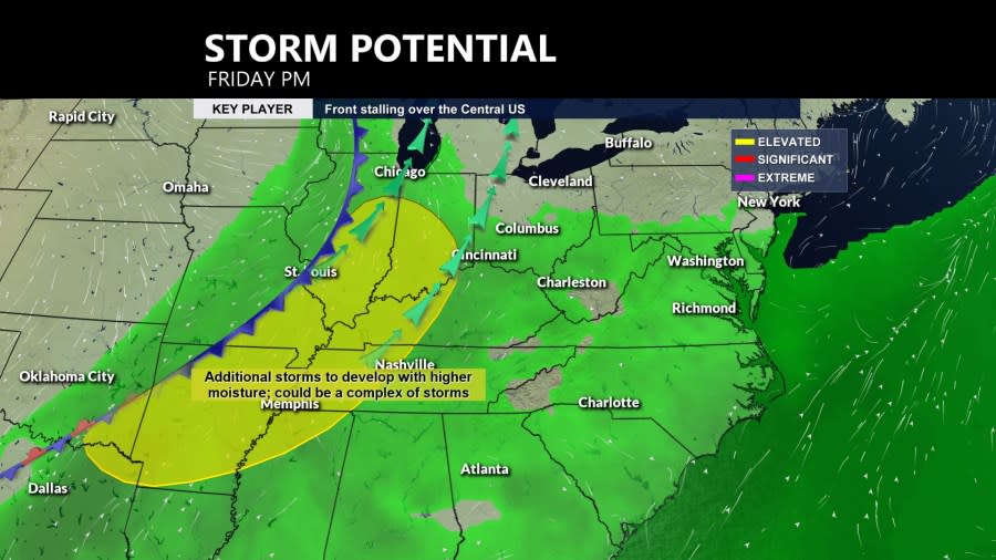
A complex of showers and storms will approach from the west this evening, with an increasing chance for storms to develop and linter into the overnight hours ahead of a cold front.
Saturday will get off to a cloudy start as showers diminish, followed by some sunshine. A few showers could develop later in the day and move quickly off the east before sunset. Temperatures will reach the low 80s.
The next likelihood for more widespread rain and storms will arrive late on Sunday ahead of low pressure in the middle of the country tracking from the central Plains to the Upper Midwest.
Rain and thunderstorms will become more likely Sunday night and linger into Memorial Day. Temperatures on Monday will cool down into the mid-70s with cloud cover behind a cold front.
Next week will be noticeably cooler, with scattered showers lingering through midweek, and highs only reaching the low 70s.
Forecast
Friday: Partly sunny, evening storm. High 84
Tonight: Scattered showers, storm. Low 65
Saturday: Early showers, some sun, late-day shower/storm. High 82
Sunday: Clouds increase, storms late. High 84 (59)
Memorial Day: Mostly cloudy, few showers. High 78 (66)
Tuesday: Mostly cloudy, cooler, showers. High 74 (58)
Wednesday: Mostly cloudy, shower possible. High 70 (54)
Thursday: Mostly sunny. High 73 (50)
Copyright 2024 Nexstar Media, Inc. All rights reserved. This material may not be published, broadcast, rewritten, or redistributed.
For the latest news, weather, sports, and streaming video, head to NBC4 WCMH-TV.

