How Hwy. 1 was carved into one of the most treacherous parts of the Big Sur coast
There aren’t many wild places left that are also accessible by car.
The extreme environment of Big Sur is an exception, and though there is a road, nature still holds the advantage.
For example: Cone Peak at an elevation 5,155 feet is taller than the tallest peak in 28 other states and has views of the Pacific Ocean.
Sea level is less than three miles away from a mountaintop that is almost a mile tall and has an average 33% slope to the ocean.
The wild isolation of Big Sur was there to provide refuge for the surviving few dozen sea otters after they were thought to have been hunted to extinction in the early 20th Century.
Writers, artists and mystics have found the isolation and untamed beauty on the edge of the world to be a powerful attraction.
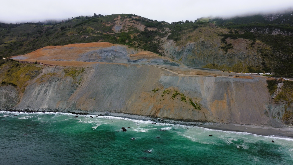
Scenic Highway 1 has been hit hard by recent atmospheric river events, washing portions of the road into the ocean at several points over the last few years.
And critics say the cost of repairs on this unlikeliest of roads is too high.
But California has seen several roads hit hard and closed by the storms of the last few years.
As the state makes decisions on how to allocate resources, I tend to hear the voice of late President John F. Kennedy ring in my mind.
He delivered a speech explaining why he was committing the U.S. to the astronomical challenges of putting an astronaut on the moon, “not because they are easy, but because they are hard, because that goal will serve to organize and measure the best of our energies and skills.”
The wild magic of Big Sur is a wonder of the world, and we have the gateway in our backyard.
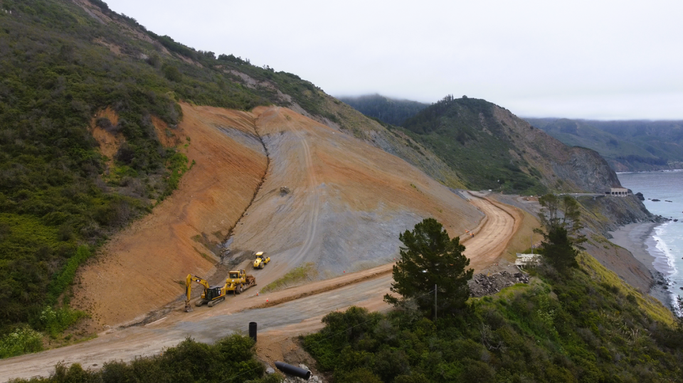
The Tribune recently covered efforts to repair the damaged road near Lime Kiln canyon.
It was named for a limestone mining operation from the late 19th century that felled ancient redwoods to fuel furnaces.
In the era before cheap fuel oil, the 24-hour kiln fires converted the stone into a key ingredient for concrete.
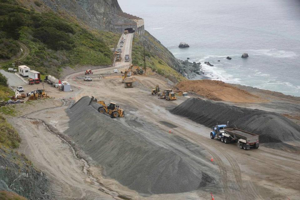
Today, the construction materials arrive at the site not from up the canyon but by truck. Boulders, rock base and asphalt will all be driven in to the job site.
The road that we now know as Highway 1 was built with the assistance of prison labor from San Quentin over the course of several years during the Great Depression.
One of the difficult construction points took place near Lime Kiln Point.
And though the story talks about cutting the road through solid rock, large swaths of the landscape is Franciscan melange, a chaotic stew of loose rocks, formerly scrambled in an ocean trench and now thrust up out of the water by tectonic forces as slopes of mountains.
Solid is not a word geologists associate with this confused conglomeration.
The Daily Telegram documented construction on a difficult piece of the highway on March 22, 1933. The road would open in 1937.
It was an eventful time, and other stories on the front page documented Hitler assuming dictatorship of Germany with support of the reichstag and President Franklin Roosevelt signing bills to end Prohibition.
Crews Begin Work on Final San Simeon-Carmel Link
Blasts Break Rock Bluffs Along Coast
Human Flies Cling to Cliffs, Carve Footpath
The boom of exploding dynamite and the rumble of blasted rock is reverberating through the virgin country of Lime Kiln canyon this week as convict crews attack the most formidable project of the entire San Simeon-Carmel highway.
Lime Kiln Point — a mass of vertical rock bluffs, one-fourth of a mile in length — must be hewn away to permit the building of a road that will cling to the side of the sheer precipice and in places swing out over the ocean by means of side bridges.
It is estimated that approximately 316,000 years of solid rock will be excavated to make way for the first road to wind its way along California’s untouched coast line as the beginning of the final link in the new Roosevelt highway.
Six months time will be consumed in constructing this quarter of a mile of highway alone, engineers estimate.
Lime Kiln Point, which has taxed the skill and ingenuity of highway engineers and which is acknowledged as the most difficult piece of work on the coast project, is located about 85 miles north of San Luis Obispo.
HANG ABOVE THE OCEAN.
Its wall-like sides have been scaled by surveyors and for more than two months, the treacherous work of carving a narrow footpath around the rock bluffs has been slowly accomplished by two men who have clung precariously to the side of the hill 300 feet above the ocean.
It will take 120 tons of powder to break down the rock wall and permit crews of men to force slowly ahead with the work of clearing away the debris.

Three blasts of dynamite, the first of which was put off last week, will tear away age-old rocks and create the ledge along which the road is to be constructed.
Four months time will be consumed in merely creating this temporary ledge in order that men and equipment can get by and begin actual construction.
The present convict camp borders on Lime Kiln Point and the new San Simeon-Carmel highway is traversable for the 85 miles north of San Luis Obispo.
Farther up in Monterey county, where the northern convict camp is working south, a similar problem of rock bluffs is faced and until these two obstacles are surmounted, progress will be slow.
GREATER SPEED.
After that time, it is expected that the two camps will begin to shorten the distance between them with great speed.
To date there have been no heavy rains or slides to contend with at the San Luis Obispo camp and the road has been open for its completed length every day this year.

