Gorgeous start to weekend after weak disturbance Friday night

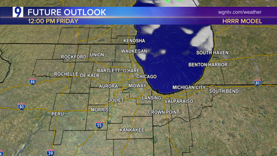
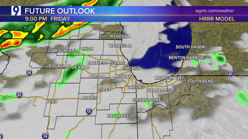
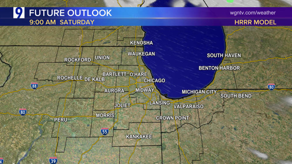
Weak disturbance to bring a period of showers Friday night, but they will quickly exit making for a gorgeous start to the weekend
Simulated radar snapshot at various times


Stunning Chicago day-to-day temperature change—as if we flipped the calendar back to late March or April within 24 hours
Wednesday afternoon temperatures surged well into the 70s, even some inland 80s, but temps were much cooler on Thursday
Thursday late afternoon temperatures: How much cooler than the same period on Wednesday?


Temperatures over the next week are expected to average near or slightly below normal across the Chicago area with a modest warming trend beginning in mid-May
Forecast temperature anomaly through May 15

Forecast temperature anomaly May 16-22

What a Climatological Spring it has been!
Since March 1, it’s been the 3rd-warmest on record dating back 154 years to 1871, averaging 6 degrees above normal. Only 2012 and 1977 have been any warmer than this year!

May-2024 off to a wet start!
More than 1.5 times the normal amount of rain at both airports
11 of the past 14 days have seen rain
Thursday saw another soaking rain for many areas. Here are the rainfall totals for the past 24 hours:


For the latest news, weather, sports, and streaming video, head to WGN-TV.

