Live updates: Tornadoes possible, Hwy. 1 closed as ‘vigorous storm’ slams SLO County
The National Weather Service issued a flood advisory for a huge swath of San Luis Obispo County on Friday night, followed by a special weather statement warning of heavy rain, strong winds and possible tornadoes along the coast.
National Weather Service warns of ‘strong storms’ along coast
Update, 8:15 p.m.:
Just after 8 p.m., the National Weather Service issued a special weather statement for western San Luis Obispo County “as lines of strong storms were coming ashore between Cayucos and Pismo Beach.”
The agency said on X that threats included “strong wind gusts to 55 mph, small hail, heavy downpours and possible brief tornadoes.”
A second weather statement was issued soon after for southern San Luis Obispo County and northern Santa Barbara County.
Highway 1 closed at SLO County line
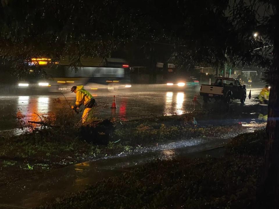
Meanwhile, Highway 1 was closed Friday evening at the San Luis Obispo-Monterey counties line near Ragged Point due to slide activity, Caltrans said.
“The current perimeter of the Hwy. 1 closure is from Lime Creek to the north and Ragged Point to the south,” Caltrans said in a tweet on X.
There was no estimate for when it would reopen.
Highway 1 is closed at the San Luis Obispo/Monterey County line at Ragged Point due to slide activity north of this location. The current perimeter of the Hwy. 1 closure is from Lime Creek to the north and Ragged Point to the south. No estimate for re-opening.@CaltransHQ pic.twitter.com/v2MtVshBFs
— Caltrans District 5 (@CaltransD5) March 30, 2024
Flood advisory issued for SLO County
Original story:
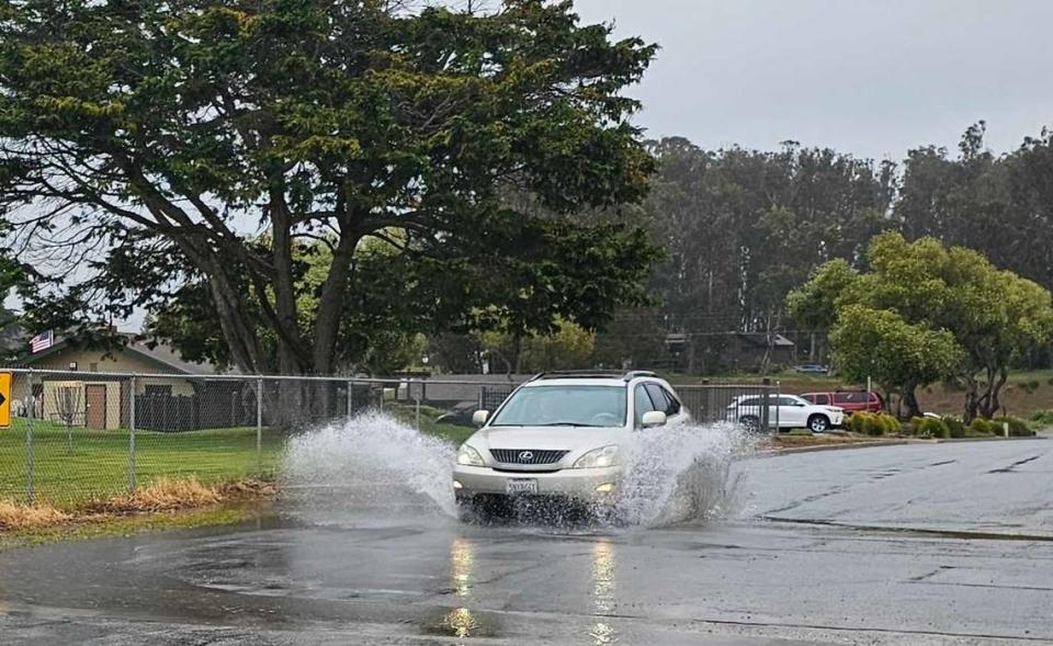
According to the flood advisory, Doppler radar detected moderate-to-heavy rainfall moving into western San Luis Obispo County around 5:12 p.m., with additional heavy rain offshore.
Rainfall rates were expected to continue to increase through the evening hours, the Weather Service said, reaching between 0.25 and 0.5 inches per hour, with local rates of up to 0.75 inches in some places.
Locations that could experience flooding include Arroyo Grande, Atascadero, Cambria, Grover Beach, Lopez Lake, Morro Bay, Nipomo, Oceano, Paso Robles, Pismo Beach, San Luis Obispo, Shandon and Templeton, according to the advisory.
Flood Advisory issued for San Luis Obispo County until 1215 am Sat. Rain rates/coverage will continue to increase across county thru evening hours, resulting in urban roadway/small stream flooding. Increased threat of mudslides, especially near canyon roadways. #SLOWeather#cawx
— NWS Los Angeles (@NWSLosAngeles) March 30, 2024
The National Weather Service warned of the potential for “urban roadway and small stream flooding ... especially in low-lying areas.”
In addition, there’s an increased chance of mud or rock slides, the agency said.
The advisory was expected to remain in effect until 12:15 a.m.
Two flood watches for most of San Luis Obispo County were also expected to remain in effect for the region through Sunday evening. The National Weather Service also warned of up to 15-foot waves through the storm.
The agency also issued a special marine warning for waters off the San Luis Obispo County coast, advising of wind greater than 49 knots, pea-sized hail and possible waterspouts.
What’s in the Easter weekend weather forecast?
An “unseasonably cold and vigorous storm system” was expected to linger over San Luis Obispo County and Southern California through much of the Easter holiday weekend, according to the National Weather Service’s forecast discussion.
Locally, the heaviest rain was expected Friday evening from 6 p.m. to midnight, with the possibility of thunderstorms stretching from then through Sunday evening, according to the National Weather Service.
Mostly light rain was forecast for Saturday, followed by a moderate burst Sunday morning through 6 p.m.
Parts of the region were likely to see up to 3 inches of rain across the stormy weekend, though up to 6 inches could fall on some mountains and foothill areas, according to the Weather Service.
The rainy weather is expected to dry up Monday morning, according to the forecast discussion.
“Monday will see clearing skies and warming temperatures as early April sunshine shines on the area,” the agency said.
Strong cold front will bring heavy rain to SW Calif tonight-early Sat. AM. 20% chance of tstms with front will bring potential for strong-locally severe wind gusts to 60 mph, small hail, and heavy downpours. Remote risk of waterspouts/brief tornado. #LARain #LAWeather pic.twitter.com/ZMF6EBnTFp
— NWS Los Angeles (@NWSLosAngeles) March 29, 2024

