Five Oklahoma tornado tracks identified by National Weather Service, so far
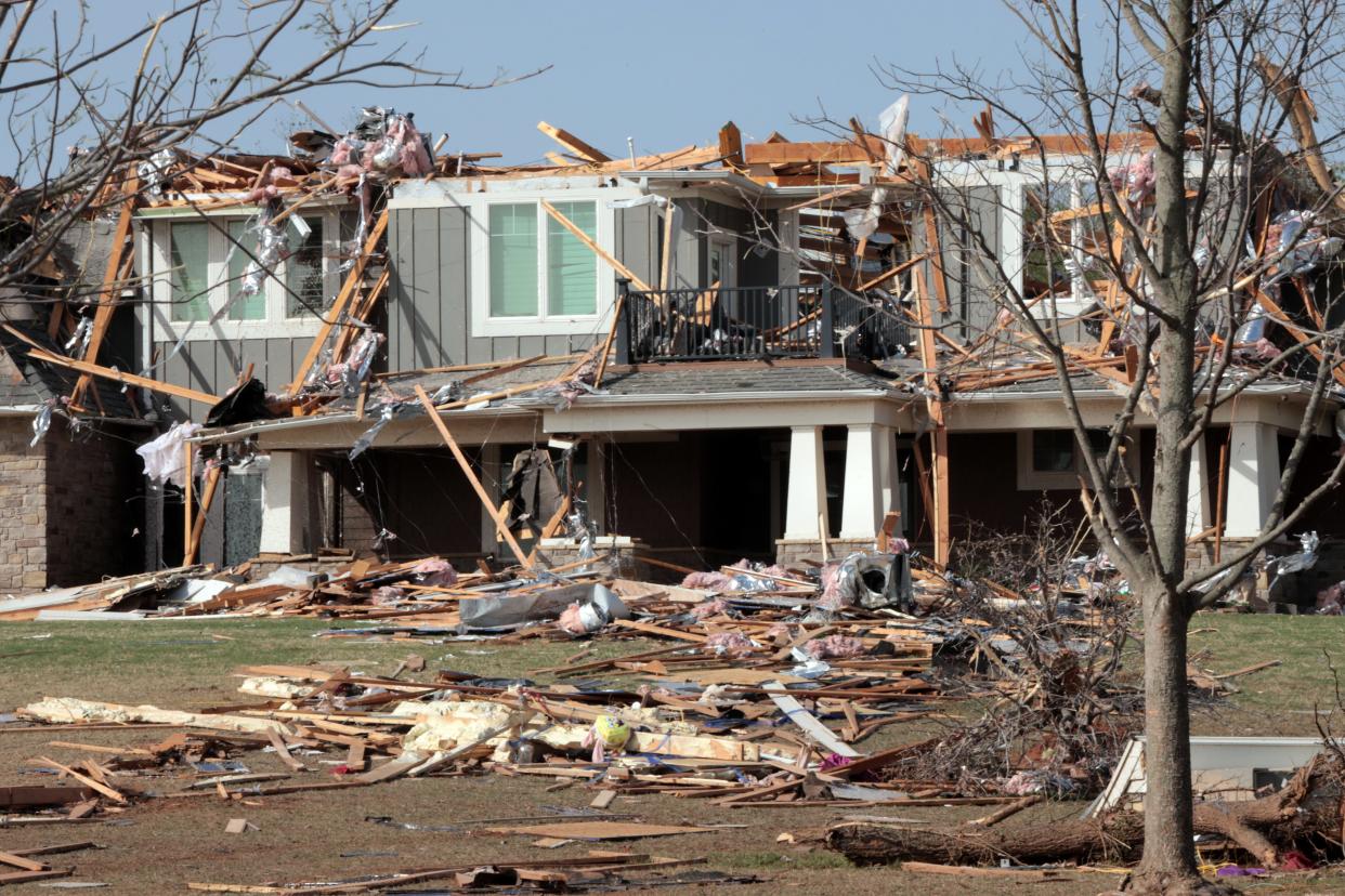
The National Weather Service in Norman continues to survey damage caused by multiple tornadoes that touched down Wednesday night south and southeast of Oklahoma City.
So far, tracks for five tornadoes have been identified. Here is what we know:
We will continue to survey areas of tornado damage tomorrow from Wednesday evening's storms, but this is a map of what our survey teams found so far. The tornado that hit Cole OK has been rated EF3, and EF2 ratings have been assigned so far for the Shawnee & Etowah tornadoes. pic.twitter.com/D8wXSqe2oj
— NWS Norman (@NWSNorman) April 21, 2023
A tornado rated as an EF0 started northeast of Moore at 7:03 p.m. then tracked north and northwest across Interstate 240 before it dissipated just five minutes later on the west side of Tinker Air Force Base.
A tornado rated as an EF3 started south of Blanchard at 7:30 p.m., tracked northeast and then north before dissipating in the vicinity of Cole at 8:05 p.m.
A tornado rated as an EF2 started just northwest of Slaughterville at 8:32 p.m., tracked northeast then east for about five miles before turning north just southeast of Etowah and continuing on for about 3.5 miles before dissipating at 8:54 p.m.
A tornado rated as an EF1 started just north of the Citizen Potawatomie Nation tribal complex southwest of Shawnee at 9:04 p.m. and tracked north and then northwest past the town of Pink before dissipating 20 minutes later in a rural area about 3 miles south of Interstate 40.
A tornado rated as an EF2 started 3 miles west of Tecumseh at 9:39 p.m. and tracked northeast and then north across Shawnee's west side before dissipating about 3 miles southwest of Meeker at 10:16 p.m.
More: Shawnee and Cole residents clean up after tornadoes hit
More: See before, after satellite photos of tornado damage in Cole
This article originally appeared on Oklahoman: Five tornadoes touched down in Oklahoma Wednesday, one rated EF3

